What it's like to live in Matlock
Matlock is a small market town of around 15,500 people in the Derbyshire Dales, set among steep wooded hills on the edge of the Peak District. It feels busy in the centre and quiet a few streets up the slope. It suits people who want town shops and services with proper countryside close by, with Hall Leys Park and the River Derwent right in the middle of it.
"I'd move here" adds Matlock to the areas on your listing, so homes here are matched to you first.
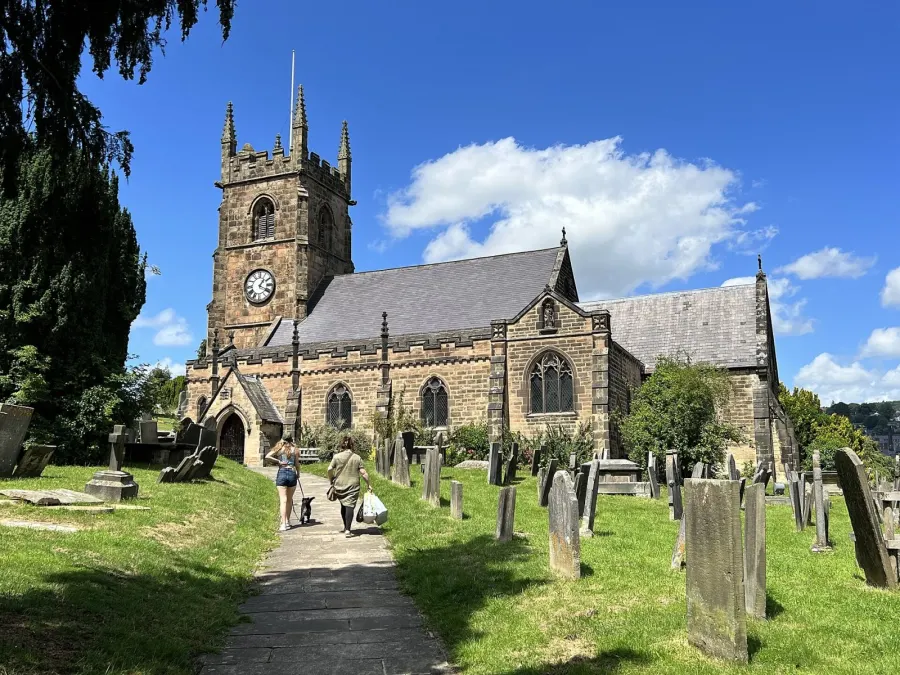
Matlock sits in the Derbyshire Dales, in the East Midlands, on the southern edge of the Peak District National Park. It is the administrative centre for the district, with a population of about 15,500. Bakewell lies to the north west, Cromford and Matlock Bath to the south, and the bigger centres of Derby, Chesterfield and Sheffield are all reachable for work, shopping or hospital appointments.
People move here for the setting as much as the town. The Derwent valley runs through it, the hills rise straight from the main street, and the national park starts almost at the door. For a town of this size it holds on to a good spread of shops, a hospital nearby, a railway station and a bus interchange.
It is worth being honest about the trade-offs. This is a rural district, so some journeys take longer than they would from a city, and social housing makes up a smaller share of homes here than in England as a whole. If you want a tenancy in a small Peak District town rather than a big urban area, Matlock is one of the few places that offers it with town services attached.
Swapping to Matlock: key facts
Can I swap my council or housing association home to Matlock?
Yes, if you are already a council or housing association tenant. Mutual exchange means swapping homes with another social tenant, so it does not depend on the council waiting list: you need a tenant in or near Matlock who wants your area, and both landlords must agree. Landlords have 42 days to decide and can only refuse on set legal grounds.
How long is the council housing waiting list in Matlock?
1,186 households were on the Derbyshire Dales housing register on 31 March 2025, up 7% on a year earlier. 366 social homes were let through the council in 2024 to 2025, roughly 3.2 households for every home let. Source: Local Authority Housing Statistics, Ministry of Housing, Communities and Local Government.
How much is social rent in Matlock?
Average weekly social rents in the Derbyshire Dales council area in 2024/25: 1 bed £98 council, £101 housing association; 2 bed £118 council, £117 housing association; 3 bed £135 council, £123 housing association. Affordable rent homes cost more, typically 60 to 80% of market rent. Source: Regulator of Social Housing.
How much social housing is there in Matlock and who owns it?
12.6% of homes in the Derbyshire Dales council area are social housing (council 2.9%, housing association 9.7%), against 17.1% across England, according to the 2021 Census. The biggest social landlords there are Platform Housing Limited (3,391 homes), Nottingham Community Housing Association Limited (392 homes) and Places for People Living+ Limited (248 homes).
How Busy Is The Swap Market In Matlock?
Figures as of 23 October 2026, updated every night. The waiting list figure is from 2024 to 2025 government data.
Which homes are available to swap near Matlock?
Homes are shown near their address, not on it. Contains OS data © Crown copyright and database right. Source: Office for National Statistics, Open Government Licence.
No homes listed within 5 miles at the moment. New homes are listed every week: see homes across Derbyshire, use the alert form below, or list your own home so tenants here can find you.
What is housing like in Matlock and who lives there?
Home ownership dominates in the Derbyshire Dales: 72% of homes are owned, 14.4% are privately rented and 12.6% are social rented. That social share is below the England figure of 17.1%, and only 2.9% is council-owned, with 9.7% held by housing associations. In practice, most social tenants here have a housing association landlord.
Platform Housing Limited is by far the biggest, with around 3,391 homes in the district. Nottingham Community Housing Association has 392, Places for People Living+ 248, The Guinness Partnership 163 and Peak District Rural Housing Association 99.
Average weekly social rents in the district for 2024/25 were about £101 for a one bed, £117 for two beds and £123 for three. The council's housing register held 1,186 households at the end of March 2025, with 366 social homes let through the council during 2024-25, which gives a sense of how tight supply is. The area also skews older, with 31.5% aged 45 to 64 and fewer young adults than the England average.
Council waiting list and lettings
Households on the register by the size of home they need.
That is roughly 3.2 households waiting for every social home let in a year. Mutual exchange doesn't use the waiting list: if you already have a council or housing association home, swapping with another tenant can be a quicker way to move to Matlock.
A register counts households who have applied, so it isn't a simple queue: some are already social tenants hoping to transfer, and people can be on more than one council's list.
Typical weekly social rents in the Derbyshire Dales council area
| Size | Council | Housing association |
|---|---|---|
| Bedsit | £0 | £83 |
| 1 bed | £98 | £101 |
| 2 bed | £118 | £117 |
| 3 bed | £135 | £123 |
| 4 bed | £159 | £133 |
Social rent averages for 2024/25. Affordable rent homes cost more, typically 60 to 80% of market rent.
Biggest social landlords in the council area
- Platform Housing Limited3,391 homes
- Nottingham Community Housing Association Limited392 homes
- Places for People Living+ Limited248 homes
- The Guinness Partnership Limited163 homes
- Peak District Rural Housing Association Limited99 homes
- Ashbourne Almshouse Charity46 homes
- Derbyshire Dales District Council44 homes
- Housing 2126 homes
What is it like to live in Matlock?
Day to day, most things sit within a short walk of the centre. There is an M&S Foodhall, a Co-op and a Sainsbury's all within a couple of hundred metres of each other, plus Boots and Peak Pharmacy in the town. Whitworth Hospital is just over a mile away at Darley Dale.
The town climbs away from the river, so expect hills on the walk home from almost any direction. Neighbourhoods like Hurst Farm and Starkholmes have their own community centre or village hall, and there are more at Tansley and Bonsall nearby. Hall Leys Park, Allenhill Park and Sparrow Park are all within a few minutes of the centre, and Asker Lane Fields and The Ship Loads give you open ground a little further out.
What are the schools and family life like in Matlock?
There is a decent choice of primary schools within walking distance of the centre. All Saints CofE Infant School is around a third of a mile away, with Castle View Primary School, St Joseph's Catholic Voluntary Academy, Highfields School (Lower School) and St Giles Church of England Primary and Nursery School all within about half a mile. St Giles also has a nursery attached, which helps if you need early years places close to home.
For time outside, families are well served. Hall Leys Park sits beside the river in the middle of town and is the obvious everyday spot, with Allenhill Park and Sparrow Park also within a few minutes' walk. Asker Lane Fields and The Ship Loads give you more open space a short way out.
Community buildings matter in a town this size. Hurst Farm Community Centre is around half a mile from the centre, and there are halls at Starkholmes, Tansley and Bonsall within a couple of miles. Worth noting that the wider Derbyshire Dales has a smaller share of under 16s than England as a whole, at 14.6% against 18.6%, so this is an older area overall.
Primary schools
- All Saints CofE Infant School0.3 mi
- Castle View Primary School0.4 mi
- St Joseph's Catholic Voluntary Academy0.5 mi
- Highfields School (Lower School)0.6 mi
- St Giles Church of England Primary and Nursery School0.6 mi
Parks
- Hall Leys Parknearby
- Allenhill Parknearby
- Sparrow Park0.3 mi
- The Ship Loads0.3 mi
- Asker Lane Fields0.7 mi
What shops and everyday essentials are in Matlock?
Supermarkets
- M&S Foodhallnearby
- Co-op Foodnearby
- Sainsbury'snearby
Pharmacies
- Bootsnearby
- Peak Pharmacynearby
Hospitals
- Whitworth Hospital1.2 mi
How do you get around Matlock?
Matlock station is about a five minute walk from the centre and is the end of the line from Derby, with stops including Cromford and Matlock Bath on the way. Matlock Riverside and Darley Dale are heritage line stations nearby. For many trips the train is the easy option, though you will often change at Derby for places further afield.
Buses run from Matlock Interchange and the Bakewell Road stops, both right in the centre, which makes connecting between bus and train straightforward. Services link the town with surrounding Dales villages and larger towns, so it is possible to manage here without a car, though rural timetables mean planning ahead for evenings and Sundays.
On foot, the town centre, the parks, the supermarkets and the pharmacies are all close together, so a car-free day is realistic. The catch is the gradient: homes on the hillsides above the centre involve a steady climb, which is worth thinking about if anyone in the household struggles with slopes or pushes a buggy. Drivers get main roads out towards Bakewell, Derby and Chesterfield.
Train stations
- Matlocknearby
- Matlock Riverside0.5 mi
- Matlock Bath1.1 mi
- Cromford1.8 mi
- Darley Dale2.2 mi
Bus stations
- Matlock Interchangenearby
- Bakewell Roadnearby
What is there to do in Matlock?
The parks are the heart of it. Hall Leys Park runs along the Derwent in the town centre and is the place most people head for a walk, a sit or time with the children. Allenhill Park and Sparrow Park are both nearby, and The Ship Loads and Asker Lane Fields give you rougher, more open ground within a short walk.
For going out, the centre has a cluster of pubs and bars within a few minutes of each other, including Twenty Ten, Tipsy Toad, Rabona, Bradmans and the Edgefold Club. That gives you a reasonable choice for a small town without having to travel.
The bigger draw is what sits on the doorstep. Matlock Bath is just over a mile down the valley with its own station, and the Peak District begins where the town ends, so walks start from home rather than needing a trip out first. Village halls at Tansley, Bonsall and Starkholmes host the kind of local groups and events that keep a rural area ticking over.
Pubs and bars
- Twenty Tennearby
- Edgefold Clubnearby
- Tipsy Toadnearby
- Rabonanearby
- Bradmansnearby
Community centres
- Hurst Farm Community Centre0.5 mi
- Starkholmes Village Hall0.8 mi
- Tansley Community Hall1.5 mi
- Tansley Village Hall1.5 mi
- Bonsall Village Hall1.9 mi
What is work and the local economy like in Matlock?
Figures for the wider Derbyshire Dales show 54.4% of adults in work, a little below the England figure of 57.4%. That partly reflects the age profile: 28% of residents here are 65 or over, well above the 18.4% England average, so a larger share of people are retired rather than out of work.
Unemployment is low. The census recorded 1.9% unemployed against 3.5% for England, and in September 2026 just 1.9% of 16 to 64 year olds in the district were claiming unemployment-related benefits, compared with 4% nationally.
Matlock is the administrative centre of the Derbyshire Dales, and Whitworth Hospital is a little over a mile away, so public services, health and care are part of the local picture alongside tourism and the trades you would expect in a Peak District town. Many households also commute, and the rail line to Derby plus road links towards Chesterfield and Sheffield widen the options if your work is not in town.
Figures are for the Derbyshire Dales council area, Census 2021 and ONS claimant count.
How safe is Matlock?
Like every town centre, Matlock has police incidents logged each month. In August 2026 there were 91 within about a mile of the centre, made up of:
- Anti-social behaviour reports16
- Vehicle crime2
- Shoplifting4
- Other theft2
- Theft from the person1
- Criminal damage12
Source: data.police.uk street-level crime. Counts cover a fixed one-mile radius around the centre, so busy high streets and stations always record far more than the residential streets around them, and most incidents are minor. Compare like with like: a similar-sized town centre, not a village.
Is Matlock a good place for social housing tenants?
If Matlock appeals, a mutual exchange is often the most realistic route in. Social homes here are a smaller share of the housing stock than in most of England, so swapping gives you a way to move without waiting on allocations.
Start by listing your own home properly. Clear photos of every room, honest notes on the number of bedrooms, heating, parking, any stairs or garden, and what the street is like. Tenants looking at Matlock are often moving from towns and cities, so spell out what your area offers. Then set Matlock, or the DE4 postcode district, as a desired area so your listing shows up for people there.
It is worth being flexible. Adding Matlock Bath, Darley Dale, Tansley or Cromford to your preferences widens the pool and keeps you within reach of the same station, shops and schools. Check back regularly, message tenants whose homes suit you rather than waiting to be contacted, and always visit before you commit so you can judge the hills, the parking and the walk to town for yourself.
Tell me when a home appears near Matlock
One email, the first time a council or housing association home is listed within your chosen distance. No newsletter, no spam.
Live in Matlock? Add a photo
Tenants' own photos help other people picture the place. Approved photos are credited to you. Submit a photo.
Nearby place guides
Thinking of moving a little further? Compare homes to swap, rents and local landlords in places near Matlock.
All place guides in Derbyshire → · All place guides in the East Midlands → · All regions →