What it's like to live in Ripley
Ripley is a working market town of around 20,600 people in Amber Valley, Derbyshire, with a plain-spoken, former coalfield character and the Peak District countryside not far to the west. It suits families and anyone who wants a proper town centre with its own hospital, leisure centre and green space like Crossley Park right on the doorstep.
"I'd move here" adds Ripley to the areas on your listing, so homes here are matched to you first.
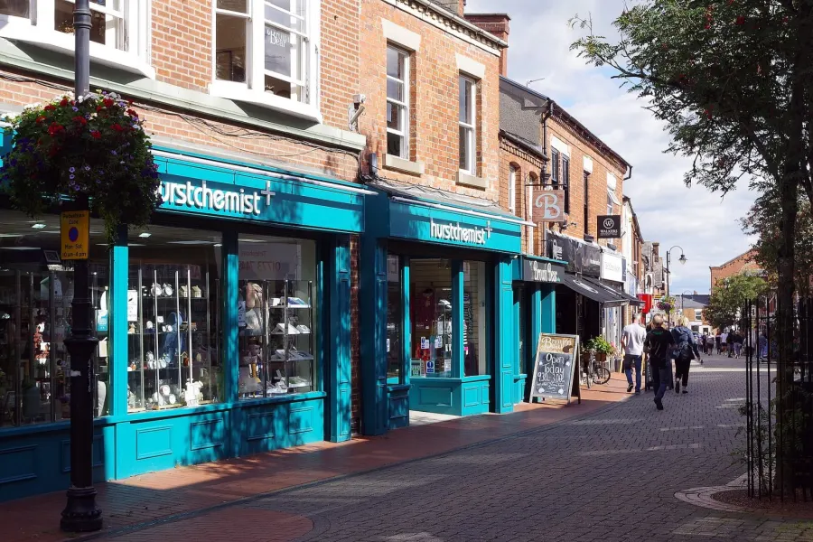
Ripley sits in the Amber Valley district of Derbyshire, in the East Midlands, between the Erewash Valley and the edge of the Peak District. Belper lies a few miles to the west, Swanwick and Codnor are close neighbours, and Derby and Nottingham are the nearest cities.
People move here for the balance. It is a town big enough to have its own shops, schools, hospital and leisure centre, but small enough that you are among fields and old colliery land within a mile or two. The DE5 postcode covers Ripley and the villages around it.
For social housing tenants, the draw is usually practical: lower social rents than many parts of England, a compact town where most things are reachable without a long journey, and a location that keeps the bigger job markets of Derby and Nottingham within commuting distance. It is not a showy place, and that is rather the point. People who settle in Ripley tend to stay.
Swapping to Ripley: key facts
Can I swap my council or housing association home to Ripley?
Yes, if you are already a council or housing association tenant. Mutual exchange means swapping homes with another social tenant, so it does not depend on the council waiting list: you need a tenant in or near Ripley who wants your area, and both landlords must agree. Landlords have 42 days to decide and can only refuse on set legal grounds.
How long is the council housing waiting list in Ripley?
2,273 households were on the Amber Valley housing register on 31 March 2025, up 10% on a year earlier. 385 social homes were let through the council in 2024 to 2025, roughly 5.9 households for every home let. Source: Local Authority Housing Statistics, Ministry of Housing, Communities and Local Government.
How much is social rent in Ripley?
Average weekly social rents in the Amber Valley council area in 2024/25: 1 bed £0 council, £93 housing association; 2 bed £0 council, £107 housing association; 3 bed £0 council, £115 housing association. Affordable rent homes cost more, typically 60 to 80% of market rent. Source: Regulator of Social Housing.
How much social housing is there in Ripley and who owns it?
12.7% of homes in the Amber Valley council area are social housing (council 4.1%, housing association 8.6%), against 17.1% across England, according to the 2021 Census. The biggest social landlords there are Futures Homescape Limited (5,983 homes), Places for People Living+ Limited (589 homes) and The Guinness Partnership Limited (425 homes).
How Busy Is The Swap Market In Ripley?
Figures as of 23 October 2026, updated every night. The waiting list figure is from 2024 to 2025 government data.
Which homes are available to swap near Ripley?
Homes are shown near their address, not on it. Contains OS data © Crown copyright and database right. Source: Office for National Statistics, Open Government Licence.
No homes listed within 5 miles at the moment. New homes are listed every week: see homes across Derbyshire, use the alert form below, or list your own home so tenants here can find you.
What is housing like in Ripley and who lives there?
Amber Valley is a district where most people own their home. Census 2021 put owner occupation at 72%, private renting at 14.6% and social renting at 12.7%, made up of 4.1% council and 8.6% housing association. That social rented share is below the England figure of 17.1%, so swaps come up less often than in bigger cities and it pays to be patient and flexible.
Social rents across the council area averaged £93 a week for a one bed, £107 for a two bed and £115 for a three bed in 2024/25. The largest social landlord by far is Futures Homescape Limited with close to 6,000 homes, followed by Places for People Living+, The Guinness Partnership, Nottingham Community Housing Association and EMH Housing and Regeneration.
The age profile skews older than England as a whole: 22.6% of residents in the council area are 65 or over against 18.4% nationally, and 29% are aged 45 to 64. Amber Valley's housing register held 2,273 households at March 2025, which is a reminder that mutual exchange is often the quicker route.
Council waiting list and lettings
Households on the register by the size of home they need.
That is roughly 5.9 households waiting for every social home let in a year. Mutual exchange doesn't use the waiting list: if you already have a council or housing association home, swapping with another tenant can be a quicker way to move to Ripley.
A register counts households who have applied, so it isn't a simple queue: some are already social tenants hoping to transfer, and people can be on more than one council's list.
Typical weekly social rents in the Amber Valley council area
| Size | Council | Housing association |
|---|---|---|
| Bedsit | £0 | £79 |
| 1 bed | £0 | £93 |
| 2 bed | £0 | £107 |
| 3 bed | £0 | £115 |
| 4 bed | £0 | £125 |
Social rent averages for 2024/25. Affordable rent homes cost more, typically 60 to 80% of market rent.
Biggest social landlords in the council area
- Futures Homescape Limited5,983 homes
- Places for People Living+ Limited589 homes
- The Guinness Partnership Limited425 homes
- Nottingham Community Housing Association Limited403 homes
- EMH Housing and Regeneration Limited147 homes
- Metropolitan Housing Trust Limited126 homes
- Platform Housing Limited75 homes
- Anchor Hanover Group48 homes
What is it like to live in Ripley?
Day to day, life revolves around the town centre and its market square. There is a Co-op in the middle of town, a Lidl a few minutes away and a Sainsbury's about half a mile out, so a weekly shop does not mean a long trip. Pharmacies are easy to reach too, with Peak Pharmacy, Hurst and Boots all in or beside the centre.
Green space is close by rather than grand. Crossley Park sits a couple of minutes from the middle of town, with Pit Top and Charnwood Drive Park within half a mile. A little further out, Waingroves Community Woodland and Strelley Wood give you woodland paths, and Codnor Park is about a mile and a half away. Ripley Hospital is a short walk from the centre, which matters more than people expect.
What are the schools and family life like in Ripley?
Ripley is well served for primary schools, and most are close enough to walk. Lons Infant School is about a third of a mile from the centre, with Ripley Infant School and Ripley Junior School both around four tenths of a mile, and Ripley St John's Church of England Primary School and Nursery half a mile away with nursery provision attached. Waingroves Primary School is roughly a mile out.
For older children, The Ripley Academy is the local secondary at just over half a mile. Swanwick Hall School and Swanwick School and Sports College are both under two miles, John Flamsteed Community School is a little over two miles, and Belper School and Sixth Form Centre is around two and a half miles away, which gives families some genuine choice.
Outside school, there is Ripley Leisure Centre in the town centre, parks at Crossley Park, Pit Top and Charnwood Drive, and woodland walks at Waingroves and Strelley Wood. The Blend Youth Project is close to the centre, and St Joseph's Ripley Parish Community Hall and village halls at Pentrich and Heage host community activity nearby.
Primary schools
- Lons Infant School0.3 mi
- Ripley Infant School0.4 mi
- Ripley Junior School0.4 mi
- Ripley St John's Church of England Primary School and Nursery0.5 mi
- Waingroves Primary School1 mi
Secondary schools
- The Ripley Academy0.6 mi
- Swanwick Hall School1.6 mi
- Swanwick School & Sports College1.7 mi
- John Flamsteed Community School2.3 mi
- Belper School and Sixth Form Centre2.6 mi
Parks
- Crossley Parknearby
- Pit Top0.4 mi
- Charnwood Drive Park0.5 mi
- Waingroves Community Woodland & Strelley Wood1.2 mi
- Codnor Park1.5 mi
What shops and everyday essentials are in Ripley?
Supermarkets
- The Co-operative Foodnearby
- Lidlnearby
- Sainsbury's0.5 mi
- Nisa Extra2.2 mi
- Aldi2.9 mi
Pharmacies
- Peak Pharmacynearby
- Hurstnearby
- Bootsnearby
- Holmfield Chemist1.4 mi
- Tambers1.8 mi
Hospitals
- Ripley Hospitalnearby
How do you get around Ripley?
Ripley is a walkable town. The centre, the Co-op, Lidl, the pharmacies, the leisure centre and Ripley Hospital all sit within about half a mile of each other, so plenty of everyday errands can be done on foot. Crossley Park is barely a couple of minutes from the shops.
There is no mainline station in the town itself. The nearest stations listed within three miles are Hammersmith and Butterley, both about a mile away, and Swanwick Junction at around a mile and a half. Check what services actually run from each before you plan a commute around them, as they are small stops rather than big interchanges.
That makes buses and the roads the mainstays. Ripley sits on the A38 and A610 corridor, which links it towards Derby, Alfreton and the M1, and the town centre is a hub for local bus services across Amber Valley. If you drive, journeys to Derby, Nottingham or Chesterfield are straightforward. If you do not, it is worth testing the bus routes you would need on a real weekday before you commit to a swap.
Train stations
- Hammersmith1 mi
- Butterley1 mi
- Swanwick Junction1.4 mi
What is there to do in Ripley?
Most of Ripley's leisure sits within a short walk of the market place. Ripley Leisure Centre, GymFit and Fusion Yoga Studios and Wellbeing Centre are all within a few minutes of the centre, so getting active does not need a car. Group Fitness and Amber Valley Fitness Centre are a little under three miles out.
The pub scene is decent for a town this size. The Pear Tree, Tom Said, The Crompton Arms and The Keys are all in or beside the centre, and Ripley's Little Ale House offers something smaller and quieter. The Association Nightclub is the one late-night venue nearby if that matters to you.
For fresh air, Crossley Park is the handiest green space, with Pit Top and Charnwood Drive Park close behind. Waingroves Community Woodland and Strelley Wood, just over a mile away, is the better choice for a proper walk, and Codnor Park sits about a mile and a half out. Community centres and village halls at Pentrich, Heage and Riddings Park round out local groups and events.
Gyms
- Fusion Yoga Studios & Wellbeing Centrenearby
- Ripley Leisure Centrenearby
- GymFitnearby
- Group Fitness2.7 mi
- Amber Valley Fitness Centre2.9 mi
Pubs and bars
- Pear Treenearby
- Tom Saidnearby
- The Crompton Armsnearby
- Ripley's Little Ale Housenearby
- The Keysnearby
Nightlife
- The Association Nightclubnearby
Community centres
- Blend Youth Projectnearby
- St Joseph's Ripley Parish Community Hall0.5 mi
- Pentrich Village Hall1.6 mi
- Heage Village Hall1.8 mi
- Riddings Park Community Centre2.2 mi
What is work and the local economy like in Ripley?
Figures here are for the wider Amber Valley council area rather than Ripley alone. At the 2021 Census, 57.3% of adults were in work, almost exactly the England figure of 57.4%, while unemployment was 2.3% against 3.5% nationally. More recently, 2.7% of working-age residents were claiming unemployment-related benefits in September 2026, below the England figure of 4%.
So the local labour market holds up reasonably well. Amber Valley has a history rooted in coal and engineering, and today work is spread across the district's towns and industrial estates rather than concentrated in one place.
Many people here commute. Ripley's position near the A38 and A610 puts Derby, Alfreton, Heanor and the M1 within reach, and Nottingham is a realistic journey by road. If you rely on buses, map out the route to any job offer carefully, because travel times vary a lot depending on where in the county you are heading.
Figures are for the Amber Valley council area, Census 2021 and ONS claimant count.
How safe is Ripley?
Like every town centre, Ripley has police incidents logged each month. In August 2026 there were 144 within about a mile of the centre, made up of:
- Anti-social behaviour reports16
- Vehicle crime3
- Shoplifting9
- Other theft9
- Theft from the person1
- Criminal damage6
Source: data.police.uk street-level crime. Counts cover a fixed one-mile radius around the centre, so busy high streets and stations always record far more than the residential streets around them, and most incidents are minor. Compare like with like: a similar-sized town centre, not a village.
Is Ripley a good place for social housing tenants?
If Ripley looks like the right fit, the first step is simple: list your own home on Mutual Home Exchange and set Ripley, or the wider DE5 area, as somewhere you want to move to. Swaps happen when someone in Ripley sees your home and wants what you have, so a clear, honest listing with good photos does most of the work.
Say plainly what your home offers, including the number of bedrooms, any garden, parking, floor level and whether it is adapted. Mention the schools and transport near you, because the tenant in Ripley is weighing up exactly the things you are.
It is worth setting a few nearby areas as well as Ripley itself, such as Swanwick, Codnor, Waingroves or Heage, since they share the same schools, parks and roads. Then keep your listing active and reply quickly to messages. Before you agree anything, visit on a weekday, walk the route to work or school, and check your landlord's permission process. A swap you have thought through properly is one you will be happy with years later.
Tell me when a home appears near Ripley
One email, the first time a council or housing association home is listed within your chosen distance. No newsletter, no spam.
Live in Ripley? Add a photo
Tenants' own photos help other people picture the place. Approved photos are credited to you. Submit a photo.
Nearby place guides
Thinking of moving a little further? Compare homes to swap, rents and local landlords in places near Ripley.
All place guides in Derbyshire → · All place guides in the East Midlands → · All regions →