What it's like to live in Tonypandy
Tonypandy is a small valley town in Rhondda Cynon Taf, home to around 3,560 people, with terraced streets climbing the hillsides and the open moorland never far from view. It suits people who want a close-knit South Wales community rather than city bustle. Cwm Clydach Countryside Park and the green space at Garth Park are both close by.
"I'd move here" adds Tonypandy to the areas on your listing, so homes here are matched to you first.
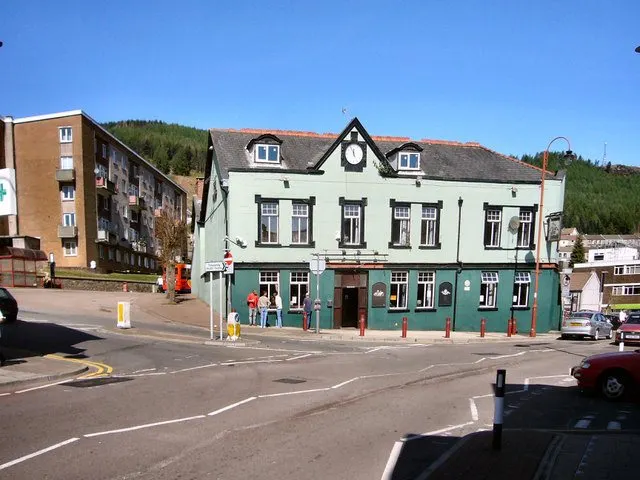
Tonypandy sits in the Rhondda valley, part of the Rhondda Cynon Taf council area in south Wales. Porth is about a mile and a half down the valley, Tonyrefail a little under three miles away, and Cardiff is reachable by train along the Rhondda line. It is a town of roughly 3,560 people in a wider borough of 237,651.
People move here for a few plain reasons. Housing costs in the valleys are generally lower than in Cardiff and the coastal belt, and you get a proper town with its own station, bus station, hospital and secondary school rather than a commuter dormitory.
It also appeals to anyone who wants countryside on the doorstep without giving up services. The valley sides rise straight from the streets, and Cwm Clydach Countryside Park is barely over a mile away. If you want a settled community with strong local identity, good rail links down the valley and a slower pace than a city, Tonypandy is worth a serious look.
Homes to swap near Tonypandy
Homes are shown near their address, not on it. Contains OS data © Crown copyright and database right. Source: Office for National Statistics, Open Government Licence.
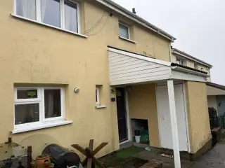 3-Bed House in Merthyr Tydfil £550 p/m Wants to move to Llanelli or Swansea
- 1-bed flat in Pencoed Wants to move to Wild Mill
No homes listed within 5 miles at the moment. New homes are listed every week: see homes across Rhondda Cynon Taf, use the alert form below, or list your own home so tenants here can find you.
Swapping to Tonypandy: key facts
Can I swap my council or housing association home to Tonypandy?
Yes, if you are already a council or housing association tenant. Mutual exchange means swapping homes with another social tenant, so it does not depend on the council waiting list: you need a tenant in or near Tonypandy who wants your area, and both landlords must agree. Landlords have 42 days to decide and can only refuse on set legal grounds.
How much social housing is there in Tonypandy and who owns it?
13.7% of homes in the Rhondda Cynon Taf council area are social housing (council 5.6%, housing association 8.2%), against 17.1% across England, according to the 2021 Census. The biggest social landlords there are Trivallis Limited (10,023 homes), Beacon Cymru Group Ltd (2,204 homes) and Cynon Taf Community Housing (2007) Limited (1,985 homes).
How much is Council Tax in Tonypandy?
In 2026 to 2027, Council Tax in the Rhondda Cynon Taf council area is £1,526 a year for Band A, £1,781 for Band B, £2,035 for Band C and £2,289 for Band D, for two adults, including police and the average community council charge. The Wales average for Band D is £2,283. Someone living alone gets 25% off. Source: Welsh Government.
What is the average salary in Tonypandy?
The typical (median) full-time salary for people living in the Rhondda Cynon Taf council area was £34,837 a year before tax in 2025, against £36,354 across Wales. For jobs based in the area, including people who travel in, it was £33,976. Source: Office for National Statistics, Annual Survey of Hours and Earnings.
Who is the MP for Tonypandy?
Chris Bryant (Labour) is the MP for Rhondda and Ogmore, the constituency that covers Tonypandy. Correct on 19 November 2026. Source: UK Parliament.
How Busy Is The Swap Market In Tonypandy?
Figures as of 19 November 2026, updated every night.
Housing in Tonypandy
Housing in the Rhondda Cynon Taf council area leans heavily towards ownership: 68.3% of homes are owned, 17.6% are privately rented and 13.7% are socially rented, split between 5.6% council and 8.2% housing association. That social rented share is below the England figure of 17.1%, so social homes are less common here than in many areas, and a mutual exchange can be a realistic route in.
The largest social landlord by far is Trivallis Limited with 10,023 homes across the borough. Beacon Cymru Group has 2,204, Cynon Taf Community Housing 1,985, Newydd Housing Association 963 and Hafod Housing Association 823.
The age profile across the borough is close to the England average: 18.4% under 16, 25.1% aged 25 to 44, 26.3% aged 45 to 64 and 19.6% aged 65 and over. In short, a settled mix of families, working-age adults and older residents rather than a young transient population.
Who owns the homes
Share of homes in the Rhondda Cynon Taf council area, Census 2021.
Ages
Share of people in each age group, Census 2021.
Biggest social landlords in the council area
- Trivallis Limited10,023 homes
- Beacon Cymru Group Ltd2,204 homes
- Cynon Taf Community Housing (2007) Limited1,985 homes
- Newydd Housing Association (1974) Limited963 homes
- Hafod Housing Association Limited823 homes
- Codi Group Ltd166 homes
- United Welsh Housing Association Limited99 homes
- Aelwyd Housing Association Limited85 homes
Compare these landlords against every other on tenant satisfaction, repairs and complaints.
Living in Tonypandy
Day to day, life here is walkable in the valley-floor sense: the main street, the library at under a mile, pharmacies within a short stroll and Tonypandy Bus Station all sit within easy reach. For the bigger shop there is an Asda about a mile away, with Lidl, Aldi and Morrisons within a couple of miles, so you are not stuck for choice.
The hills mean some streets are steep, and that is worth thinking about if you have mobility needs or a pushchair. In return you get views, quick access to Belle Vue Park and Ynyscynon Park, and Ysbyty Cwm Rhondda just over a mile away for local health services. It is an unshowy town where people tend to know their neighbours.
Schools in Tonypandy
There is a good cluster of primary schools within half a mile or so: Trealaw Primary and Alaw Primary both around 0.3 miles, Penygraig Infants at 0.4 miles, Tonypandy Primary at 0.5 miles and St Gabriel & Raphael R.C.P. School, a Catholic school, also about 0.5 miles away. That choice is handy if you are moving with children of different ages.
For older children, Tonypandy Community College is roughly 0.7 miles away, with Porth Community School about a mile and Tonyrefail Community School around 2.6 miles. We don't have details on nursery places, so it is worth ringing the council and individual schools about availability before you swap.
For family time outside school, Garth Park and Belle Vue Park are both about 0.3 miles away, and Tonypandy Library is under a mile. Valleys Kids, a community organisation, is around 1.7 miles away, and there are community centres including Waun-wen Community Recreation Centre within a couple of miles.
Primary schools
- Trealaw Primary School0.3 mi
- Alaw Primary School0.3 mi
- Penygraig Infants School0.4 mi
- Tonypandy Primary School0.5 mi
- St Gabriel & Raphael R.C.P. School0.5 mi
Secondary schools
- Tonypandy Community College0.7 mi
- Porth Community School1 mi
- Tonyrefail Community School2.6 mi
Parks
- Garth Park0.3 mi
- Belle Vue Park0.3 mi
- Ynyscynon Park1 mi
- Pontygwaith Park1.2 mi
- Cwm Clydach Countryside Park1.3 mi
Libraries
- Tonypandy Library0.8 mi
- Porth Library1.7 mi
Shops in Tonypandy
Supermarkets
- Asda1 mi
- Lidl1.1 mi
- ALDI1.3 mi
- Morrisons1.7 mi
- Co-Op2.3 mi
Pharmacies
- Well Pharmacy0.4 mi
- Boots0.6 mi
- Allied Pharmacy1.3 mi
- Sheppards Pharmacy1.4 mi
- Knights Pharmacy2 mi
Hospitals
- Ysbyty Cwm Rhondda1.3 mi
- Priory Hospital Ty Cwm Rhondda1.8 mi
Getting around Tonypandy
Tonypandy is unusually well served by rail for a town its size. Dinas Rhondda station is about 0.2 miles away and Tonypandy station around 0.3 miles, with Llwynypia, Porth and Ystrad Rhondda all within a couple of miles. That gives you several options on the Rhondda line without needing a car.
Buses matter here too. Tonypandy Bus Station is under a mile from the centre, and Porth Bus Interchange, about a mile and a half away, links routes across the wider valleys. Between the two you can reach neighbouring communities, the hospital and the main supermarkets without driving.
By car, the valley road runs the length of the Rhondda and connects south towards Pontypridd and the wider road network. On foot, the valley floor is manageable and most everyday things, from the library to pharmacies to the parks, sit within a mile. The side streets are another matter: gradients are steep in places, so check the walk from any home you are considering before you commit.
Train stations
- Dinas Rhonddanearby
- Tonypandy0.3 mi
- Llwynypia1.1 mi
- Porth1.5 mi
- Ystrad Rhondda2 mi
Bus stations
- Tonypandy Bus Station0.8 mi
- Porth Bus Interchange1.5 mi
Things to do in Tonypandy
Green space is the big draw. Garth Park and Belle Vue Park are right on the doorstep, Ynyscynon Park is about a mile away, Pontygwaith Park a little further, and Cwm Clydach Countryside Park at 1.3 miles gives you proper walking country without a drive.
For indoor options, Tonypandy Library is under a mile, and there is a choice of gyms: JN Fitness at around half a mile, TJ11 Fitness at 1.4 miles and Ystrad Rhondda Leisure Centre just under two miles. The Phoenix cinema is about 2.8 miles away if you fancy a film.
Socially, this is traditional valleys territory. The White Rock Hotel, Turberville Arms and The Welcome Inn are all within half a mile, with the Labour Club and the White Hart Hotel close behind, and Squares at about 1.5 miles for a later night. Community centres such as Tylorstown Welfare Hall and Capel Farm Community Centre host local activity within a few miles.
Gyms
- JN Fitness0.5 mi
- TJ11 Fitness1.4 mi
- Ystrad Rhondda Leisure Centre1.9 mi
Cinemas
- The Phoenix2.8 mi
Pubs and bars
- White Rock Hotel0.3 mi
- Turberville Arms0.4 mi
- The Welcome Inn0.4 mi
- Labour Club0.5 mi
- White Hart Hotel0.6 mi
Nightlife
- Squares1.5 mi
Community centres
- Waun-wen Community Recreation Centre1.6 mi
- Valleys Kids1.7 mi
- Ystrad Old Age Pensioners Association1.9 mi
- Tylorstown Welfare Hall2.1 mi
- Capel Farm Community Centre2.4 mi
Jobs in Tonypandy
Across the Rhondda Cynon Taf council area, 53.3% of adults are in work, below the England figure of 57.4%. Unemployment stands at 3.2%, slightly under England's 3.5%, and unemployment-related benefit claims were 3.3% of 16 to 64 year olds in September 2026, against 4% in England. So the picture is mixed: fewer people in work overall, but not a high jobless rate.
What that means in practice is that plenty of people here look beyond the town for work. The rail links down the valley matter a lot if you are job-hunting, since they widen the area you can realistically travel to.
Locally, Ysbyty Cwm Rhondda at 1.3 miles and Priory Hospital Ty Cwm Rhondda at 1.8 miles are nearby employers, along with schools, shops and the supermarkets within a couple of miles. Jobcentre Plus is about 1.6 miles away if you want face-to-face help with searching or claims.
Figures are for the Rhondda Cynon Taf council area, Census 2021 and ONS claimant count.
Typical Pay
Median yearly pay before tax for full-time workers, 2025. Half earn more than this and half earn less.
Where The Jobs Are
The five biggest industries by share of employee jobs, 2024. "Health" includes hospitals, GP surgeries and care homes.
Jobcentres And Recruitment Agencies
- Jobcentre Plus1.6 mi
From OpenStreetMap, which doesn't list every agency. Find more on Find a job (GOV.UK).
Council tax & MP in Tonypandy
Council Tax 2026 to 2027
Yearly bill for two adults, including police and the average community council charge. Most council and housing association homes are in Bands A to C. Living alone takes 25% off, and you may get Council Tax Reduction on a low income.
Your MP
Chris Bryant (Labour) is the MP for Rhondda and Ogmore, which covers Tonypandy. Near the edges, find the MP for your postcode.
An MP can help with problems involving government departments and, sometimes, your landlord or council.
Broadband in Tonypandy
Share of homes that can get each speed, Ofcom, January 2026. Check an address on Ofcom's broadband checker.
Is Tonypandy safe?
Like every town centre, Tonypandy has police incidents logged each month. In September 2026 there were 118 within about a mile of the centre, made up of:
Source: data.police.uk street-level crime. Counts cover a fixed one-mile radius around the centre, so busy high streets and stations always record far more than the residential streets around them, and most incidents are minor. Compare like with like: a similar-sized town centre, not a village.
Swapping to Tonypandy
If Tonypandy sounds like the right fit, the practical next step is to list your own home on Mutual Home Exchange and add Tonypandy, or the CF40 postcode district, to your desired areas. Swaps only happen when both sides can see each other, so a live listing does most of the work for you.
Write your advert honestly. Say how many bedrooms you have, which floor you are on, whether there is a garden or parking, and who your landlord is. Tenants here are often matching with Trivallis or one of the other local associations, and clear details save everyone time.
It is worth widening your desired areas to nearby places along the valley such as Porth, Llwynypia or Ystrad Rhondda, since they share the same train line and schools. Keep an eye on new listings, message people whose homes look close to what you need, and check with both landlords before agreeing anything. Patience pays off with mutual exchanges.
Home alerts for Tonypandy
One email, the first time a council or housing association home is listed within your chosen distance. No newsletter, no spam.
Nearby place guides
Thinking of moving a little further? Compare homes to swap, rents and local landlords in places near Tonypandy.
All place guides in Rhondda Cynon Taf → · All place guides in Wales → · All regions →