What it's like to live in Worsbrough
Worsbrough is a town of around 13,700 people on the southern edge of Barnsley, in South Yorkshire. It has the feel of a string of former mining communities that grew together: rows of houses, steep lanes, local pubs and plenty of green space. It suits families and anyone who wants Barnsley town centre close by, with Worsbrough Country Park and Dearne Valley Park on the doorstep.
"I'd move here" adds Worsbrough to the areas on your listing, so homes here are matched to you first.
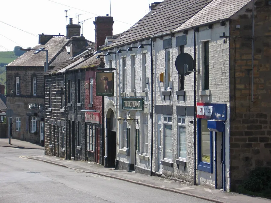
Worsbrough sits in the Barnsley council area in South Yorkshire, just south of Barnsley town centre and north of Hoyland and Wombwell. Sheffield lies further south and Leeds to the north, both reachable by road or rail through Barnsley, so the town works well for people whose lives are spread across the region.
People move here for a mix of reasons. You get a smaller, settled town of about 13,700 people with country park land close by, yet the shops, cinema and hospital of a decent-sized town are only a mile or two away. Barnsley Hospital is around 2.3 miles off, and Kendray Hospital is nearer still.
For tenants thinking about a swap, the appeal is usually practicality. Prices and pressures differ from the big cities, schools and parks cluster within a mile, and the motorway and rail links through Barnsley open up work across Yorkshire. If you want a Yorkshire town with grounded, everyday character rather than a showpiece, Worsbrough is worth a serious look.
Homes to swap near Worsbrough
Homes are shown near their address, not on it. Contains OS data © Crown copyright and database right. Source: Office for National Statistics, Open Government Licence.
No homes listed within 5 miles at the moment. New homes are listed every week: see homes across South Yorkshire, use the alert form below, or list your own home so tenants here can find you.
Swapping to Worsbrough: key facts
Can I swap my council or housing association home to Worsbrough?
Yes, if you are already a council or housing association tenant. Mutual exchange means swapping homes with another social tenant, so it does not depend on the council waiting list: you need a tenant in or near Worsbrough who wants your area, and both landlords must agree. Landlords have 42 days to decide and can only refuse on set legal grounds. In 2024 to 2025, 104 council homes in Barnsley changed tenants by mutual exchange.
How long is the council housing waiting list in Worsbrough?
4,138 households were on the Barnsley housing register on 31 March 2025, down 47% on a year earlier. 1,143 social homes were let through the council in 2024 to 2025, roughly 3.6 households for every home let. Source: Local Authority Housing Statistics, Ministry of Housing, Communities and Local Government.
How much social housing is there in Worsbrough and who owns it?
19.7% of homes in the Barnsley council area are social housing (council 15.5%, housing association 4.2%), against 17.1% across England, according to the 2021 Census. The biggest social landlord there is Reside Housing Association Limited (7 homes).
What is the average salary in Worsbrough?
The typical (median) full-time salary for people living in the Barnsley council area was £36,652 a year before tax in 2025, against £39,243 across England. For jobs based in the area, including people who travel in, it was £35,629. Source: Office for National Statistics, Annual Survey of Hours and Earnings.
Who is the MP for Worsbrough?
Worsbrough is split between more than one constituency. Stephanie Peacock (Labour) is the MP for Barnsley South, which covers the centre; the area also includes Barnsley North and Penistone and Stocksbridge. Correct on 20 November 2026. Source: UK Parliament.
How Busy Is The Swap Market In Worsbrough?
Figures as of 20 November 2026, updated every night. The waiting list figure is from 2024 to 2025 government data.
Housing in Worsbrough
In the Barnsley council area, 19.7% of homes are socially rented, a touch above the England figure of 17.1%. Most of that is council housing at 15.5%, with housing associations making up 4.2%. Around 62.3% of homes are owned and 17.2% privately rented, so Worsbrough and its neighbours are mostly owner-occupied streets with a solid social housing presence mixed in.
The council is by far the main social landlord here; among housing associations, Reside Housing Association Limited holds only a very small number of homes in the borough. In 2024-25 the council let 1,143 social homes and 104 council homes changed hands through mutual exchange, with 4,138 households on the housing register at 31 March 2025. The register is not a simple queue, which is one reason many tenants look at swapping instead.
The age profile for the borough is close to the national picture, with slightly more people aged 45 to 64 (27.7%) and 65 and over (19.5%) than England average, and 18.2% under 16. It is a settled area with plenty of families and older residents.
Who owns the homes
Share of homes in the Barnsley council area, Census 2021.
Ages
Share of people in each age group, Census 2021.
Council waiting list and lettings
Households on the register by the size of home they need.
That is roughly 3.6 households waiting for every social home let in a year. Mutual exchange doesn't use the waiting list: if you already have a council or housing association home, swapping with another tenant can be a quicker way to move to Worsbrough.
A register counts households who have applied, so it isn't a simple queue: some are already social tenants hoping to transfer, and people can be on more than one council's list.
Biggest social landlords in the council area
Compare these landlords against every other on tenant satisfaction, repairs and complaints.
Living in Worsbrough
Day to day, most of what you need is near. There is an Asda right in Worsbrough, with Morrisons, Tesco Extra, Aldi and a Co-op all within about a mile and a half. Lo's Pharmacy and Ward Green Pharmacy are a short walk, and a Boots sits just under half a mile away. Worsbrough Library is a few minutes from the middle of the town.
Community life is still visible here. Elm Court Community Centre is barely a few streets away, with Lew Whitehead, Farm Road and Worsbrough Common centres nearby too. Traditional pubs like the Ship Inn, the Dale Tavern, The Darley and the Miners Welfare keep that local, familiar feel, and there are parks at Worsbrough Dale and Ward Green for a walk with the kids.
Schools in Worsbrough
Families are well served for schools. The Mill Academy is just 0.2 miles away, with Ward Green Primary at 0.3 miles, Worsbrough Common Primary and Bank End Primary Academy both around 0.6 miles, and The Forest Academy at 0.8 miles. That is five primaries inside a mile, which gives real choice when you apply.
For older children, Barnsley Academy is 0.6 miles from Worsbrough. Greenacre School and Trinity Academy St Edward's are about 1.6 miles, Horizon Community College 1.8 miles and Kirk Balk Academy 2.2 miles, so secondary options are spread around the area and reachable by bus.
Outside school, there is plenty of outdoor space: Worsbrough Dale Park, Ward Green Community Park, Worsbrough Country Park and Dearne Valley Park are all within a mile, with Birk Avenue Park about a mile off. Worsbrough Library is close enough for a regular visit, and the community centres at Elm Court, Lew Whitehead and Farm Road are the sort of places where local groups and activities tend to be based. Barnsley Hospital is 2.3 miles away.
Primary schools
- The Mill Academy Good 2022nearby
- Ward Green Primary School Inspected 20240.3 mi
- Worsbrough Common Primary School Good 20240.6 mi
- Bank End Primary Academy Report card 20260.6 mi
- The Forest Academy Outstanding 20230.8 mi
Secondary schools
- Barnsley Academy Good 20250.6 mi
- Greenacre School Outstanding 20231.6 mi
- Trinity Academy St Edward's School Outstanding 20241.6 mi
- Horizon Community College Good 20231.8 mi
- Kirk Balk Academy Good 20252.2 mi
Parks
- Worsbrough Dale Park0.3 mi
- Ward Green Community Park0.5 mi
- Worsbrough Country Park0.5 mi
- Dearne Valley Park0.7 mi
- Birk Avenue Park1 mi
Libraries
- Worsbrough Librarynearby
- Polish Library1.4 mi
- Library@The Lightbox1.6 mi
- Dodworth Library2.5 mi
- Hoyland Library2.5 mi
Green good or better (on report cards, the expected standard or better), amber requires improvement or an area needs attention, red inadequate or an area needs urgent improvement, with the year of the inspection. Since September 2024 Ofsted no longer gives one overall grade, so newer results ("Report card", "Inspected") are coloured by their weakest area. Click a school for its full report. Ofsted data at 31 October 2026.
Shops in Worsbrough
Supermarkets
- Asdanearby
- Morrisons1.4 mi
- The Co-operative Food1.4 mi
- Tesco Extra1.5 mi
- Aldi1.5 mi
Pharmacies
- Lo's Pharmacy0.3 mi
- Ward Green Pharmacy0.4 mi
- Boots0.4 mi
- Cohens Chemist1.1 mi
- Elliott's Pharmacy1.3 mi
Hospitals
- Cygnet Oaks and Pindar House0.8 mi
- Kendray Hospital1.1 mi
- Barnsley Hospital2.3 mi
Shopping centres
- Alhambra Shopping Centre1.4 mi
- The Glass Works1.5 mi
Getting around Worsbrough
Barnsley Interchange, about 1.6 miles away, is the hub for both trains and buses. From there you can pick up rail services, and the bus station connects Worsbrough with the town centre and the wider borough. Wombwell station is roughly 2.3 miles away, with Elsecar and Dodworth both around 2.8 miles, which gives you more than one option if you commute.
By car, Worsbrough's position south of Barnsley makes it easy to head towards Hoyland, Wombwell and on to Sheffield, or north through town. Many households here run a car, but it is not the only way to get about, and bus links into Barnsley are the backbone of local travel.
On foot, the town is manageable but hilly in places. Schools, the library, pharmacies and the Asda are all within a short walk of much of Worsbrough, and the parks link up green routes nearby. For the Alhambra Shopping Centre or The Glass Works, both about a mile and a half away, most people take the bus or drive rather than walk, especially with shopping bags or small children in tow.
Train stations
- Barnsley Interchange1.6 mi
- Wombwell2.3 mi
- Elsecar2.8 mi
- Dodworth2.8 mi
Bus stations
- Barnsley Transport Interchange1.6 mi
Things to do in Worsbrough
Green space is Worsbrough's strongest card. Worsbrough Country Park and Dearne Valley Park are both within a mile, good for long walks, bikes and letting children run about, with smaller parks at Worsbrough Dale, Ward Green and Birk Avenue for a quick trip out. These are the kind of places you use week in, week out rather than once a year.
For a night out or a quiet pint, the Ship Inn, Dale Tavern, The Darley, The Greyhound and the Miners Welfare are all within half a mile. Head into Barnsley, roughly a mile and a half away, and you have Cineworld and the Parkway cinema, plus bars and clubs such as Digital, Volt, Bar Boujie, CoCo Che and Obsession.
Shopping and leisure are mostly a short hop too. The Glass Works and the Alhambra Shopping Centre cover the bigger stores, and gyms include PureGym, Motiv fitness, The Gym and Everlast, with a yoga and Pilates studio nearby. Library@The Lightbox and the Polish Library add to the local Worsbrough branch.
Gyms
- PureGym1.5 mi
- Motiv fitness1.6 mi
- The Gym1.6 mi
- Everlast Gyms1.8 mi
- Mind Body and Spirit Yoga & Pilates Studio1.8 mi
Cinemas
- Cineworld1.5 mi
- Parkway1.6 mi
Pubs and bars
- Ship Innnearby
- The Miners Welfare0.4 mi
- Dale Tavern0.4 mi
- The Darley0.4 mi
- The Greyhound0.5 mi
Nightlife
- Digital1.5 mi
- Volt1.5 mi
- Bar Boujie1.6 mi
- CoCo Che Bar1.6 mi
- Obsession Club1.6 mi
Community centres
- Elm Court Community Centrenearby
- Lew Whitehead Community Centre0.5 mi
- Farm Road Community Centre0.8 mi
- Worsbrough Common Community Centre1 mi
- St Peters Church Hall1.2 mi
Jobs in Worsbrough
Across the Barnsley council area, 55.9% of adults are in work, a little below the England figure of 57.4%. Unemployment sits at 2.9%, lower than the 3.5% recorded for England, and unemployment-related benefit claims in September 2026 ran at 3.3% of 16 to 64 year olds against 4% nationally. These are figures for the whole borough rather than Worsbrough alone, but they suggest a working area without unusually high joblessness.
Locally, Barnsley town centre is the nearest big source of jobs, from retail at The Glass Works and the Alhambra to services and the hospital. Barnsley Hospital, around 2.3 miles away, is a large employer in its own right, and Kendray Hospital is closer still.
If you are job hunting, Jobcentre Plus is about 1.6 miles away near the town centre, with Gi Group at 1.4 miles and ECS Gas Training around 2.4 miles. Rail and bus links through Barnsley Interchange also put Sheffield, Leeds and Doncaster within commuting reach, which widens your options well beyond the borough.
Figures are for the Barnsley council area, Census 2021 and ONS claimant count.
Typical Pay
Median yearly pay before tax for full-time workers, 2025. Half earn more than this and half earn less.
Where The Jobs Are
The five biggest industries by share of employee jobs, 2024. "Health" includes hospitals, GP surgeries and care homes.
Jobcentres And Recruitment Agencies
- Gi Group1.4 mi
- Jobcentre Plus1.6 mi
- ECS Gas Training2.4 mi
- jobcentreplus3 mi
From OpenStreetMap, which doesn't list every agency. Find more on Find a job (GOV.UK).
Council tax & MP in Worsbrough
Your MP
Worsbrough has more than one MP. Stephanie Peacock (Labour) is the MP for Barnsley South, which covers the centre; the area also includes Barnsley North and Penistone and Stocksbridge. Find the MP for your postcode.
An MP can help with problems involving government departments and, sometimes, your landlord or council.
Deprivation in Worsbrough
The Barnsley council area ranks 40th of 296 council areas in England on the Index of Multiple Deprivation 2025, where 1st is the most deprived. 21.6% of its neighbourhoods are among the most deprived 10% in England.
The index combines seven measures, including income, work, health, education and housing. It describes areas, not the people who live in them.
Is Worsbrough safe?
Like every town centre, Worsbrough has police incidents logged each month. In September 2026 there were 176 within about a mile of the centre, made up of:
Source: data.police.uk street-level crime. Counts cover a fixed one-mile radius around the centre, so busy high streets and stations always record far more than the residential streets around them, and most incidents are minor. Compare like with like: a similar-sized town centre, not a village.
Swapping to Worsbrough
If Worsbrough looks like the right fit, the next step is simple. List your own home on Mutual Home Exchange with clear photos, an honest description of the rooms, garden and parking, and anything a swapper would want to know before travelling to view.
Then set Worsbrough, or the S70 postcode district, as one of your desired areas. It is worth adding nearby parts of Barnsley too, such as the town centre, Wombwell or Hoyland, because a good swap often turns up a street or two from the one you had in mind. Being a little flexible on area usually speeds things up.
When enquiries come in, reply quickly and be straight about what your home offers and what it does not. Most successful exchanges come from a run of friendly messages rather than one perfect match appearing. Check both landlords' rules on mutual exchange early, keep notes of what you agree, and view in person before you commit. Take your time, ask questions, and only move when the home and the area genuinely suit your household.
Home alerts for Worsbrough
One email, the first time a council or housing association home is listed within your chosen distance. No newsletter, no spam.
Nearby place guides
Thinking of moving a little further? Compare homes to swap, rents and local landlords in places near Worsbrough.
All place guides in South Yorkshire → · All place guides in Yorkshire & Humber → · All regions →
Latest On X
Home to swap: 2-bed house in Burton-on-Trent. Looking to move to Swadlincote.
#BurtonOnTrent #Swadlincote #SouthDerbyshireDistrictCouncil