What it's like to live in Bannockburn
Bannockburn is a village of around 6,840 people just south of Stirling, in central Scotland. It feels like a settled, working community with its own high street life rather than a commuter estate, and it suits families and anyone who wants village scale with a city close by. Stirling's shops, station and hospital sit a couple of miles away.
"I'd move here" adds Bannockburn to the areas on your listing, so homes here are matched to you first.
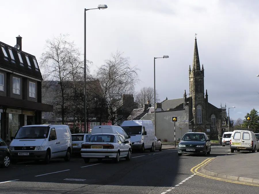
Bannockburn sits in the Stirling council area, a couple of miles south of Stirling itself and within easy reach of the central belt. Falkirk, Alloa and Grangemouth are all a short drive east, and Glasgow and Edinburgh are both reachable for work or a day out.
People move here for the balance. You get a village of roughly 6,840 people with its own schools, library and community centre, but Stirling's railway station, bus station, shopping centres and health services are only around two miles away. That combination is hard to find at this price point, and it is the main reason tenants look at FK7 when they are planning a swap.
The wider Stirling area is a mix of city, village and countryside, with a population of about 94,040. Bannockburn is firmly at the busier, better-connected end of that mix, close to the motorway network and the Stirling job market without being in the middle of town.
Homes to swap near Bannockburn
Homes are shown near their address, not on it. Contains OS data © Crown copyright and database right. Source: Office for National Statistics, Open Government Licence.
No homes listed within 5 miles at the moment. New homes are listed every week: see homes across Stirling, use the alert form below, or list your own home so tenants here can find you.
Swapping to Bannockburn: key facts
Can I swap my council or housing association home to Bannockburn?
Yes, if you are already a council or housing association tenant. Mutual exchange means swapping homes with another social tenant, so it does not depend on the council waiting list: you need a tenant in or near Bannockburn who wants your area, and both landlords must agree. Landlords have 42 days to decide and can only refuse on set legal grounds.
How much social housing is there in Bannockburn and who owns it?
16.5% of homes in the Stirling council area are social housing (council %, housing association %), against 23.1% across England, according to the 2021 Census. The biggest social landlords there are Stirling Council (6,188 homes), Forth Housing Association Ltd (1,023 homes) and Rural Stirling Housing Association Ltd (696 homes).
How much is Council Tax in Bannockburn?
In 2026 to 2027, Council Tax in the Stirling council area is £1,169 a year for Band A, £1,363 for Band B, £1,558 for Band C and £1,753 for Band D, for two adults, not counting water and sewerage charges. The Scotland average for Band D is £1,653. Someone living alone gets 25% off. Source: Scottish Government.
What is the average salary in Bannockburn?
The typical (median) full-time salary for people living in the Stirling council area was £43,559 a year before tax in 2025, against £39,905 across Scotland. For jobs based in the area, including people who travel in, it was £39,220. Source: Office for National Statistics, Annual Survey of Hours and Earnings.
Who is the MP for Bannockburn?
Chris Kane (Labour) is the MP for Stirling and Strathallan, the constituency that covers Bannockburn. Correct on 17 November 2026. Source: UK Parliament.
How Busy Is The Swap Market In Bannockburn?
Figures as of 17 November 2026, updated every night.
Housing in Bannockburn
Housing in the Stirling council area is weighted towards owner occupation: 67.8% of homes are owned, 15.5% privately rented and 16.5% socially rented. That social rented share is below the Scottish figure of 23.1%, so social homes are in demand and a mutual exchange can be a realistic route in.
Stirling Council is by far the biggest social landlord locally with around 6,188 homes, followed by Forth Housing Association with 1,023 and Rural Stirling Housing Association with 696. Castle Rock Edinvar and Paragon Housing Association also hold smaller numbers of homes in the area.
The age profile across the council area is close to the national picture, with 15.3% under 16 and 21.6% aged 65 and over, though there is a slightly larger 16 to 24 group, reflecting the student population in Stirling. Bannockburn itself, at around 6,840 people, reads as a mixed village with plenty of families alongside long-settled older households.
Who owns the homes
Share of homes in the Stirling council area, Census 2021.
Ages
Share of people in each age group, National Records of Scotland estimates.
Biggest social landlords in the council area
- Stirling Council6,188 homes
- Forth Housing Association Ltd1,023 homes
- Rural Stirling Housing Association Ltd696 homes
- Castle Rock Edinvar Housing Association Ltd227 homes
- Paragon Housing Association Ltd159 homes
- Link Group Ltd135 homes
- Bield Housing & Care105 homes
- Hanover (Scotland) Housing Association Ltd93 homes
Compare these landlords against every other on tenant satisfaction, repairs and complaints.
Living in Bannockburn
Day to day, most of what you need is close. There's a Scotmid in the village itself and a pharmacy on the doorstep, with Lidl, Morrisons, Aldi and a Waitrose all within a couple of miles for a bigger shop. Bannockburn Library is a short walk for most households, and Bannockburn Community Centre is the hub for local groups and classes.
Green space is nearby rather than on every corner. Thistle Park, swans water park and Beechwood Park are all within a mile and a half, and Wester Moss and Polmaise Colliery gives you something wilder a little further out. The pubs are properly local: the Tartan Arms and The Empire are in the village, with 1314 and the Pirnhall Inn on the edges.
Schools in Bannockburn
Families are well served for schools. Bannockburn Primary School is about 0.2 miles away and St Mary's RC Primary is 0.3 miles, with Braehead, Borestone and St Ninian's primaries all within a mile and a half. For older children, Bannockburn High School is roughly half a mile from the village centre, and Stirling High School and St Modan's High School are within two miles.
For days out and after school, Thistle Park, swans water park and Beechwood Park are the closest green spaces, and Victoria Square is a little further into Stirling. Bannockburn Library is a short walk and Stirling Library is around two miles away.
Bannockburn Community Centre sits right in the village, with Mayfield and Cowie community centres nearby, and these are usually the best places to find local children's and family groups. For health, Stirling Health and Care Village is 1.3 miles away. Check nursery places directly with Stirling Council, as availability changes.
Primary schools
- Bannockburn Primary Schoolnearby
- St Mary's RC Primary School0.3 mi
- Braehead Primary School1.1 mi
- Borestone Primary School1.1 mi
- St Ninian's Primary School1.5 mi
Secondary schools
- Bannockburn High School0.5 mi
- Stirling High School1.5 mi
- St Modan's High School2 mi
Parks
- Thistle Park1.2 mi
- swans water park1.3 mi
- Beechwood Park1.5 mi
- Wester Moss and Polmaise Colliery1.8 mi
- Victoria Square2.2 mi
Libraries
- Bannockburn Librarynearby
- Cowie Library1.9 mi
- Stirling Library2.1 mi
- Plean Library2.3 mi
Shops in Bannockburn
Supermarkets
- Scotmidnearby
- Lidl1.3 mi
- Morrisons1.7 mi
- Aldi1.7 mi
- Waitrose1.8 mi
Pharmacies
- rightmedicine Pharmacynearby
- St Minivans Pharmacy1 mi
- Plean Pharmacy2.3 mi
Hospitals
- Stirling Health and Care Village1.3 mi
- BMI Kings Park Hospital1.9 mi
Shopping centres
- The Thistles Shopping Centre2 mi
- Stirling Arcade2.1 mi
Getting around Bannockburn
Stirling Bus Station is about two miles away and acts as the hub for services across the area, with local routes running between Bannockburn and the city. For short trips, the village itself is walkable: the primary school, library, Scotmid and pharmacy are all within a quarter of a mile of the centre, so plenty of errands can be done on foot.
Stirling station, roughly 2.1 miles away, is the nearest rail link and opens up travel towards Glasgow, Edinburgh, Perth and beyond. You would usually bus, drive or get a lift to the station rather than walk it with shopping or small children.
By car, Bannockburn is well placed for the main roads heading south and east, which is why so many households here commute out to work. If you do not drive, it is worth checking the bus timetable for your own street and the times you would travel, as frequency varies across the village and surrounding estates.
Train stations
- Stirling2.1 mi
Bus stations
- Stirling Bus Station2 mi
Things to do in Bannockburn
For a village, Bannockburn is well set up. There are pubs in walking distance for most people, including the Tartan Arms and The Empire, with 1314 and the Pirnhall Inn close by and Scots Wha Hae a little further towards Stirling.
Outdoors, Thistle Park and swans water park are the nearest places for a walk or a kickabout, with Beechwood Park and the Wester Moss and Polmaise Colliery site within a couple of miles for something quieter and greener.
Stirling covers the bigger days out. The Thistles Shopping Centre and Stirling Arcade are around two miles away, and the Vue cinema is a similar distance. For fitness, Limitless Fitness is 1.6 miles away, with PureGym and The Yoga Tree Stirling just under and just over two miles respectively. Four libraries sit within three miles, which is generous, and Cowie Miners Welfare and Charitable Society and Cambuskenneth Village Hall add to the local events scene.
Gyms
- Limitless Fitness1.6 mi
- PureGym1.9 mi
- The Yoga Tree Stirling2.1 mi
Cinemas
- Vue2 mi
Pubs and bars
- Tartan Armsnearby
- The Empirenearby
- 13140.7 mi
- Pirnhall Inn0.8 mi
- Scots Wha Hae1.3 mi
Community centres
- Bannockburn Community Centrenearby
- Mayfield Community Centre1 mi
- Cowie Community Centre1.9 mi
- Cowie Miners Welfare & Charitable Society2 mi
- Cambuskenneth Village Hall2.3 mi
Jobs in Bannockburn
Across the Stirling council area, 73.9% of working-age people are in employment, almost exactly in line with the Scottish figure of 74.6%. That suggests a steady local labour market rather than a boom or a slump.
Unemployment-related benefit claims in the council area stood at 2.3% of 16 to 64 year olds in September 2026, below the Scottish figure of 3.2%. Again, these numbers cover the whole Stirling area, not Bannockburn alone, but they point to a reasonably healthy jobs picture.
Practically, most people here look to Stirling for work, and the city is close enough to reach by bus, train or car. The station and bus station are both around two miles away, which also makes commuting further afield realistic. Large local employers include the public sector, retail and health services based in and around Stirling, including the Stirling Health and Care Village and the city's shopping centres.
Figures are for the Stirling council area, Annual Population Survey (Jul 2025-Jun 2026) and claimant count.
Typical Pay
Median yearly pay before tax for full-time workers, 2025. Half earn more than this and half earn less.
Where The Jobs Are
The five biggest industries by share of employee jobs, 2024. "Health" includes hospitals, GP surgeries and care homes.
Council tax & MP in Bannockburn
Council Tax 2026 to 2027
Yearly bill for two adults, not counting water and sewerage charges. Most council and housing association homes are in Bands A to C. Living alone takes 25% off, and you may get Council Tax Reduction on a low income.
Your MP
Chris Kane (Labour) is the MP for Stirling and Strathallan, which covers Bannockburn. Near the edges, find the MP for your postcode.
An MP can help with problems involving government departments and, sometimes, your landlord or council.
Broadband in Bannockburn
Share of homes that can get each speed, Ofcom, January 2026. Check an address on Ofcom's broadband checker.
Swapping to Bannockburn
If Bannockburn looks like the right fit, the next step is simple. Create a listing for your current home with clear photos and an honest description of the rooms, garden, heating and any adaptations. Tenants looking at a swap want to picture themselves living there, and a well-written listing gets far more replies.
Then add Bannockburn, and the wider FK7 area, to your list of desired areas. You can include nearby places too, such as Cowie, Plean or Stirling itself, which widens your options without taking you far from the schools and transport links here.
Keep an eye on new listings and message people first rather than waiting to be found. Be upfront about what you need, whether that is a particular number of bedrooms, a ground floor flat or a garden. Before anything is agreed, both landlords have to approve the exchange, so check the rules with yours early and ask what paperwork they will want.
It is free to list and free to search, so it costs nothing to see who is already looking to move out of the area.
Home alerts for Bannockburn
One email, the first time a council or housing association home is listed within your chosen distance. No newsletter, no spam.
Nearby place guides
Thinking of moving a little further? Compare homes to swap, rents and local landlords in places near Bannockburn.
All place guides in Stirling → · All place guides in Scotland → · All regions →
Latest On X
Home to swap: 2-bed house in Brighton and Hove. Looking to move to Brighton and Hove.
#BrightonAndHove #BrightonAndHoveCityCouncil