What it's like to live in Fleetwood
Fleetwood is a seaside town at the tip of the Fylde coast in Lancashire, with about 26,000 people and a strong, settled local character. It suits anyone who wants sea air, a proper town centre and neighbours who know each other, rather than big-city bustle. Memorial Park and Fleetwood Hospital are both close to hand.
"I'd move here" adds Fleetwood to the areas on your listing, so homes here are matched to you first.
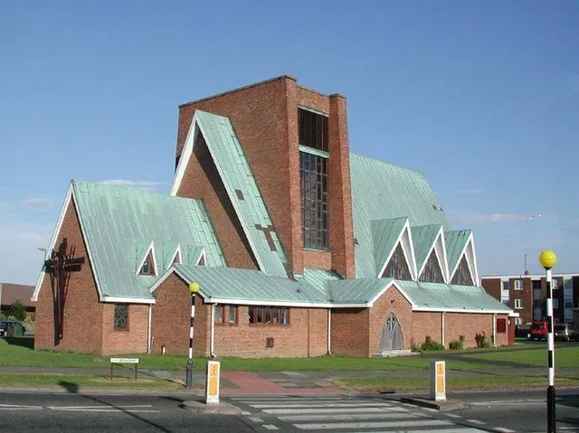
Fleetwood sits at the northern end of the Fylde peninsula in Lancashire, inside the Wyre council area and surrounded on three sides by water. The FY7 postcode covers the whole town. Cleveleys is its nearest neighbour, just over two miles south, with Thornton beyond that and Blackpool further down the coast. Knott End lies across the River Wyre.
People move here for the combination of coast and affordability. This is a working seaside town rather than a resort, and homes tend to cost less than in much of the North West, which matters if you are weighing up a swap.
The other pull is scale. With around 26,000 residents, Fleetwood is big enough to have its own hospital, high schools and a town centre, but small enough that you get to know the place quickly. Wyre as a whole is home to about 112,000 people, so you are never short of larger towns nearby when you want them.
Swapping to Fleetwood: key facts
Can I swap my council or housing association home to Fleetwood?
Yes, if you are already a council or housing association tenant. Mutual exchange means swapping homes with another social tenant, so it does not depend on the council waiting list: you need a tenant in or near Fleetwood who wants your area, and both landlords must agree. Landlords have 42 days to decide and can only refuse on set legal grounds.
How long is the council housing waiting list in Fleetwood?
5,744 households were on the Wyre housing register on 31 March 2025, up 19% on a year earlier. Source: Local Authority Housing Statistics, Ministry of Housing, Communities and Local Government.
How much is social rent in Fleetwood?
Average weekly social rents in the Wyre council area in 2024/25: 1 bed £0 council, £89 housing association; 2 bed £0 council, £102 housing association; 3 bed £0 council, £111 housing association. Affordable rent homes cost more, typically 60 to 80% of market rent. Source: Regulator of Social Housing.
How much social housing is there in Fleetwood and who owns it?
7.6% of homes in the Wyre council area are social housing (council 1.1%, housing association 6.6%), against 17.1% across England, according to the 2021 Census. The biggest social landlords there are Regenda Limited (2,851 homes), Jigsaw Homes North (656 homes) and Great Places Housing Association (431 homes).
How Busy Is The Swap Market In Fleetwood?
Figures as of 21 October 2026, updated every night. The waiting list figure is from 2024 to 2025 government data.
Which homes are available to swap near Fleetwood?
Homes are shown near their address, not on it. Contains OS data © Crown copyright and database right. Source: Office for National Statistics, Open Government Licence.
No homes listed within 5 miles at the moment. New homes are listed every week: see homes across Lancashire, use the alert form below, or list your own home so tenants here can find you.
What is housing like in Fleetwood and who lives there?
Fleetwood's housing is mostly terraces and post-war estates. Across the Wyre council area, 73.3% of homes are owned outright or with a mortgage, 18.2% are privately rented and just 7.6% are social rented, made up of 1.1% council and 6.6% housing association. That is well below the England figure of 17.1%, so social homes here are in demand and a mutual exchange can be a realistic route in.
The main social landlords in Wyre are Regenda Limited with around 2,851 homes, Jigsaw Homes North with 656, Great Places Housing Association with 431, Places for People Homes with 397 and Progress Housing Association with 302. Wyre's housing register held 5,744 households at March 2025, which is a measure of demand rather than a simple queue.
Average weekly social rents in Wyre for 2024/25 were £89 for a one bed, £102 for two beds and £111 for three. The area skews older than England, with 27.7% aged 65 and over and 15.7% under 16.
Council waiting list and lettings
Households on the register by the size of home they need.
A register counts households who have applied, so it isn't a simple queue: some are already social tenants hoping to transfer, and people can be on more than one council's list.
Typical weekly social rents in the Wyre council area
| Size | Council | Housing association |
|---|---|---|
| Bedsit | £0 | £80 |
| 1 bed | £0 | £89 |
| 2 bed | £0 | £102 |
| 3 bed | £0 | £111 |
| 4 bed | £0 | £125 |
Social rent averages for 2024/25. Affordable rent homes cost more, typically 60 to 80% of market rent.
Biggest social landlords in the council area
- Regenda Limited2,851 homes
- Jigsaw Homes North656 homes
- Great Places Housing Association431 homes
- Places for People Homes Limited397 homes
- Progress Housing Association Limited302 homes
- Heylo Housing Registered Provider Limited83 homes
- Legal & General Affordable Homes Limited53 homes
- Your Housing Limited34 homes
What is it like to live in Fleetwood?
Day to day, it is a flat, walkable town. Streets of terraces and post-war estates sit within easy reach of the shops, and you rarely need to go far for the basics. Aldi is about a third of a mile away, Asda just under a mile, with Heron Foods nearby and a Co-op and Morrisons further out towards Cleveleys and Thornton.
For everyday needs there are several pharmacies within a mile, including Albert Wilde on the doorstep, Johns Chemists, Warburtons' and Boots. Fleetwood Library is a little over a mile away, with Knott End and Cleveleys libraries also within reach. Community life is a real strength here: Westview and Larkholme community centres, Milton Youth and Community Centre, the YMCA and the Men's Shed all give people somewhere to go and something to join.
What are the schools and family life like in Fleetwood?
Families are well served for schools close to home. Fleetwood Flakefleet Primary, Charles Saer Community Primary and St Wulstan's and St Edmund's Catholic Academy are all around a third of a mile away, with Shakespeare Primary at half a mile and Larkholme Primary under a mile.
For older children, Fleetwood High School is a short walk at about a third of a mile, and Cardinal Allen Catholic High School is under a mile. Rossall School sits just over a mile out. Great Arley School and Thornton-Cleveleys Red Marsh School, both around two and a half miles away, are specialist provision. Always check catchments and admissions with the schools themselves before you commit to a swap.
Beyond school, Memorial Park is the main local green space at half a mile, with The Mount a little further and North Drive Park and Jubilee Gardens within three miles. Milton Youth and Community Centre and the YMCA run things for young people, and the beach gives children somewhere to burn off energy for free.
Primary schools
- Fleetwood Flakefleet Primary School0.3 mi
- Charles Saer Community Primary School0.3 mi
- St Wulstan's and St Edmund's Catholic Academy0.3 mi
- Shakespeare Primary School0.5 mi
- Larkholme Primary School0.8 mi
Secondary schools
- Fleetwood High School0.3 mi
- Cardinal Allen Catholic High School0.8 mi
- Rossall School1.3 mi
- Great Arley School2.5 mi
- Thornton-Cleveleys Red Marsh School2.5 mi
Parks
- Memorial Park0.5 mi
- The Mount1.1 mi
- North Drive Park1.8 mi
- Jubilee Gardens2.1 mi
Libraries
- Fleetwood Library1.3 mi
- Knott End Library2.2 mi
- Cleveleys Library2.3 mi
- Thornton Library3 mi
What shops and everyday essentials are in Fleetwood?
Supermarkets
- Aldi0.4 mi
- Asda0.9 mi
- Heron Foods1 mi
- Co-op Food2.2 mi
- Morrisons2.9 mi
Pharmacies
- Albert Wilde Ltdnearby
- Johns (Chemists) Ltd0.4 mi
- Asda0.9 mi
- Warburtons' Chemist Ltd1.1 mi
- Boots1.1 mi
Hospitals
- Fleetwood Hospital1.4 mi
How do you get around Fleetwood?
Fleetwood is a town built for walking. The land is flat, the streets are laid out on a clear grid and most people can reach the shops, a school and a park on foot. If you do not drive, that counts for a lot.
Buses run through the town and link it down the coast towards Cleveleys, where there is a bus station about two and a half miles away. From there you have wider connections across the Fylde. It is worth checking the exact routes and times for the street you are considering, as frequency varies across the town.
By car, Fleetwood is at the end of the peninsula, so most journeys start by heading south through Thornton and Cleveleys before you pick up the wider road network. That makes it quiet and self-contained, but it does mean trips out take a little longer than the map suggests. Allow extra time in summer when the coast gets busier. Parking is generally easier here than in bigger coastal towns.
Bus stations
- Cleveleys Bus Station2.5 mi
What is there to do in Fleetwood?
The seafront is the main event. Fleetwood's coastal setting means walks, sea views and open sky are part of normal life, and the parks back that up: Memorial Park, The Mount, North Drive Park and Jubilee Gardens are all within a few miles.
For indoor leisure, Maxi Fitness is under a mile away and JD Gyms a little over two miles, with a Vue cinema about two and a half miles out towards Cleveleys. The libraries at Fleetwood, Knott End, Cleveleys and Thornton are useful for more than books, with groups and free computer access.
Pubs are a big part of the social scene. The Queens, The Rossall Tavern, The Three Lights, Strawberry Gardens and the Royal Oak are all within a mile. Add the community centres and the Men's Shed and you have a town where it is fairly easy to meet people, which is not something you can say everywhere.
Gyms
- Maxi Fitness0.8 mi
- JD Gyms2.3 mi
Cinemas
- Vue2.3 mi
Pubs and bars
- Queens0.3 mi
- The Rossall Tavern0.6 mi
- The Three Lights0.6 mi
- Strawberry Gardens0.8 mi
- Royal Oak0.9 mi
Community centres
- Westview Community Centre0.3 mi
- Larkholme Community Centre0.5 mi
- Men's Shed Fleetwoodd0.6 mi
- Milton Youth and Community Centre0.9 mi
- YMCA1.1 mi
What is work and the local economy like in Fleetwood?
Figures for the wider Wyre council area show 50.7% of adults in work, below the England average of 57.4%. That partly reflects the age profile: more than a quarter of Wyre residents are 65 or over, so a good share are retired rather than looking for work.
Unemployment in Wyre sits at 2.6%, lower than the 3.5% recorded for England, and unemployment-related benefit claims run at about 3% of working-age people against 4% nationally. So the picture is of a quieter labour market rather than a struggling one.
Locally, Fleetwood Hospital is a notable employer, and the schools, shops, supermarkets and community organisations in the town provide jobs too. Many people commute south through Cleveleys and Thornton towards Blackpool and the wider Fylde for work. If your job is flexible or home-based, Fleetwood's lower housing costs make that trade-off easier.
Figures are for the Wyre council area, Census 2021 and ONS claimant count.
How safe is Fleetwood?
Like every town centre, Fleetwood has police incidents logged each month. In August 2026 there were 188 within about a mile of the centre, made up of:
- Anti-social behaviour reports42
- Vehicle crime1
- Bicycle theft2
- Shoplifting3
- Other theft10
- Theft from the person1
Source: data.police.uk street-level crime. Counts cover a fixed one-mile radius around the centre, so busy high streets and stations always record far more than the residential streets around them, and most incidents are minor. Compare like with like: a similar-sized town centre, not a village.
Is Fleetwood a good place for social housing tenants?
If Fleetwood sounds like it could work for you, the next step is straightforward. Put your own home on Mutual Home Exchange with clear photos, an honest description of the rooms and garden, and a note about your landlord and tenancy type. Good listings get far more replies than vague ones.
Then add Fleetwood, or the FY7 postcode district, to your desired areas. It is worth adding nearby places such as Cleveleys and Thornton too, since they share many of the same schools, shops and bus links and widen your chances of a match.
Matches rarely appear overnight, so check back regularly and reply promptly when someone gets in touch. When you find a possible swap, visit in person, walk the streets at different times of day, check the school run and the bus route you would actually use, and confirm both landlords are happy before anything is agreed. A little patience usually pays off.
Tell me when a home appears near Fleetwood
One email, the first time a council or housing association home is listed within your chosen distance. No newsletter, no spam.
Live in Fleetwood? Add a photo
Tenants' own photos help other people picture the place. Approved photos are credited to you. Submit a photo.
Nearby place guides
Thinking of moving a little further? Compare homes to swap, rents and local landlords in places near Fleetwood.
All place guides in Lancashire → · All place guides in the North West → · All regions →