What it's like to live in Maesteg
Maesteg is a valleys town of around 17,000 people in Bridgend, south Wales, sat at the head of the Llynfi valley with hills on either side. It feels close-knit and practical rather than polished, and it suits families and anyone who wants a proper town with its own high street. Maesteg Welfare Park and a community hospital on the doorstep are real pluses.
"I'd move here" adds Maesteg to the areas on your listing, so homes here are matched to you first.
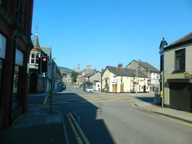
Maesteg sits in the Llynfi valley in Bridgend county borough, in the south Wales valleys. Bridgend town lies down the valley to the south, with Port Talbot over the hill to the west and Cardiff and Swansea both reachable for work, shopping or days out.
People move here for space and value. Homes in the valleys usually give you more room for your money than the coast or the cities, and you get a town with its own station, bus station, hospital and schools rather than a commuter village that empties by nine in the morning.
The other draw is the setting. Maesteg is ringed by hills and open country, so you are never far from a view or a walk, while still being on a rail line that runs south towards Bridgend and beyond. For tenants looking to swap out of a busier or pricier area without losing everyday services, it is worth a serious look.
Swapping to Maesteg: key facts
Can I swap my council or housing association home to Maesteg?
Yes, if you are already a council or housing association tenant. Mutual exchange means swapping homes with another social tenant, so it does not depend on the council waiting list: you need a tenant in or near Maesteg who wants your area, and both landlords must agree. Landlords have 42 days to decide and can only refuse on set legal grounds.
How much social housing is there in Maesteg and who owns it?
13.9% of homes in the Bridgend council area are social housing (council 3.3%, housing association 10.6%), against 17.1% across England, according to the 2021 Census. The biggest social landlords there are Valleys to Coast Housing Limited (6,110 homes), Wales & West Housing Association Limited (1,380 homes) and Hafod Housing Association Limited (1,323 homes).
How Busy Is The Swap Market In Maesteg?
Figures as of 4 November 2026, updated every night.
Which homes are available to swap near Maesteg?
Homes are shown near their address, not on it. Contains OS data © Crown copyright and database right. Source: Office for National Statistics, Open Government Licence.
No homes listed within 5 miles at the moment. New homes are listed every week: see homes across Bridgend, use the alert form below, or list your own home so tenants here can find you.
What is housing like in Maesteg and who lives there?
Home ownership dominates around here. Across the Bridgend council area, 70.5% of homes are owned outright or with a mortgage, 15.3% are privately rented and 13.9% are socially rented. That social rented share is below the England figure of 17.1%, so swaps and lettings are worth chasing when they come up.
Most social housing is run by housing associations rather than the council: 10.6% of homes against 3.3% council. Valleys to Coast Housing is by far the biggest landlord with around 6,110 homes, followed by Wales and West Housing with 1,380 and Hafod Housing with 1,323. Codi Group and United Welsh also hold smaller numbers locally.
The population skews a little older than England overall, with 20.7% aged 65 and over and 24.8% aged 25 to 44. Maesteg itself has roughly 17,000 residents, so it is a town where neighbourhoods feel established and people often stay put for years.
Who owns the homes
Share of homes in the Bridgend council area, Census 2021.
Ages
Share of people in each age group, Census 2021.
Biggest social landlords in the council area
- Valleys to Coast Housing Limited6,110 homes
- Wales & West Housing Association Limited1,380 homes
- Hafod Housing Association Limited1,323 homes
- Codi Group Ltd469 homes
- United Welsh Housing Association Limited101 homes
- First Choice Housing Association Limited51 homes
- Beacon Cymru Group Ltd38 homes
- Trivallis Limited18 homes
Compare these landlords against every other on tenant satisfaction, repairs and complaints.
What is it like to live in Maesteg?
Day to day, most of what you need sits within a short walk of the town centre. There are three big supermarkets close together, an Aldi, an Asda and a Tesco, with Filco a mile and a half away, plus Well Pharmacy and Maesteg Pharmacy in the centre and others out at Nantyffyllon and Caerau.
The town spreads along the valley floor and up the slopes, so expect hills on some streets and flatter walking nearer the centre. Maesteg Community Hospital is under half a mile out. Beyond the shops, life is fairly local: the park, a handful of pubs and clubs, and Llangynwyd Village Hall up the road for community events. It is a place where you get to know neighbours quickly.
What are the schools and family life like in Maesteg?
Families are well served for primary schools. Plasnewydd Primary is barely a minute from the centre, with St Mary's and St Patrick's Catholic Primary and Ysgol Cynwyd Sant, a Welsh-medium option, both around a third of a mile away. Nantyffyllon Primary is under a mile out, so most parts of town have a choice within a short walk or a quick bus ride.
For older children, Maesteg School is close to the centre, and Ysgol Gyfun Gymraeg Llangynwyd, a Welsh-medium secondary, is just over two miles away. Welsh-medium education through both primary and secondary is a genuine option here, which matters to a lot of families moving into the valleys.
For days out with children, Maesteg Welfare Park is the main green space, a few minutes from the middle of town, with Parc Tir Iarll a mile and a half away. Maesteg Community Hospital is nearby for local appointments, and across the Bridgend council area 17.8% of residents are under 16, close to the figure for England.
Primary schools
- Plasnewydd Primary Schoolnearby
- St Mary's & St Patrick's Catholic Primary School0.3 mi
- Ysgol Cynwyd Sant0.3 mi
- Maesteg School0.4 mi
- Nantyffyllon Primary School0.8 mi
Secondary schools
- Ysgol Gyfun Gymraeg Llangynwyd2.1 mi
Parks
- Maesteg Welfare Park0.3 mi
- Parc Tir Iarll1.5 mi
What shops and everyday essentials are in Maesteg?
Supermarkets
- Aldinearby
- Asdanearby
- Tesco0.3 mi
- Filco1.6 mi
Pharmacies
- Well Pharmacynearby
- Maesteg Pharmacynearby
- Nanty Pharmacy0.7 mi
- Caerau Pharmacy1.7 mi
Hospitals
- Maesteg Community Hospital0.4 mi
How do you get around Maesteg?
Maesteg has its own railway station a quarter of a mile from the centre, plus a second stop at Maesteg Ewenny Road and another at Garth just over a mile away. That gives the town a decent rail link south down the valley towards Bridgend, where you can pick up wider connections.
Maesteg Bus Station sits right in the town centre, roughly a hundred metres from the main shops. Having a proper bus station rather than a roadside stop makes a real difference if you do not drive, and it keeps the valley villages connected to the town.
By car you are on valley roads heading south to Bridgend and the motorway network, or over the hills westward. Walking works well in and around the centre, where the station, bus station, supermarkets, pharmacies and park are all within half a mile of each other. Further out, the ground rises, so some streets involve a climb and a buggy or shopping bags make it harder work.
Train stations
- Maestegnearby
- Maesteg Ewenny Road0.6 mi
- Garth (Bridgend)1.1 mi
Bus stations
- Maesteg Bus Stationnearby
What is there to do in Maesteg?
Maesteg Welfare Park is the heart of outdoor life here, a short stroll from the town centre and an easy default for a kickabout, a walk or letting the children run about. Parc Tir Iarll, about a mile and a half out, gives you a second option when you fancy a change of scene.
The social side runs through the town's pubs and clubs. The Star and The Sawyer's Arms are right in the centre, with the Bird in Hand, Harlequins and Maesteg Royal British Legion Club all within a few minutes' walk. They are local, familiar places rather than destination bars, which is much of their appeal.
Llangynwyd Village Hall, under two miles away, hosts community activity for the villages above the town. Beyond that, the hills around the valley are the big draw, and the train south opens up Bridgend and the coast when you want shops, cinema or the seaside.
Pubs and bars
- The Starnearby
- The Sawyer's Armsnearby
- Maesteg Royal British Legion Clubnearby
- Bird in Handnearby
- Harlequinsnearby
Community centres
- Llangynwyd Village Hall1.8 mi
What is work and the local economy like in Maesteg?
The employment picture here is best read across the wider Bridgend council area, home to about 145,000 people. Just over half of adults, 53.6%, are in work, a little below the England figure of 57.4%. Unemployment sits at 2.9%, which is lower than the England average of 3.5%.
Benefit claims tell a similar story. In September 2026, 3% of people aged 16 to 64 in the Bridgend area were claiming unemployment-related benefits, against 4% across England. So while fewer people are in work overall, the proportion actively out of work and claiming is modest.
In practice, many people in Maesteg travel for work rather than find it on the doorstep. The train and the roads south towards Bridgend matter here, and the age profile, with 27.4% of the council area aged 45 to 64 and 20.7% over 65, points to a settled population with plenty of people at or near retirement.
Figures are for the Bridgend council area, Census 2021 and ONS claimant count.
How safe is Maesteg?
Like every town centre, Maesteg has police incidents logged each month. In August 2026 there were 125 within about a mile of the centre, made up of:
Source: data.police.uk street-level crime. Counts cover a fixed one-mile radius around the centre, so busy high streets and stations always record far more than the residential streets around them, and most incidents are minor. Compare like with like: a similar-sized town centre, not a village.
Is Maesteg a good place for social housing tenants?
If Maesteg looks like the right fit, the next step is simple. Create a listing for your current home with clear photos and an honest description of the rooms, the garden or balcony, the heating and anything a swapper should know before they get in touch.
Then set Maesteg, or the CF34 postcode district, as one of your desired areas. That puts you in front of tenants here who are looking to move in your direction, and it means you see new listings in the town as they appear rather than hearing about them too late.
It is worth being open about why you want the move and flexible on exactly which part of town. Valley terraces, estate homes and flats all sit within a short distance of the same shops, station and park, so a street you had not considered may still work well. Ask questions, arrange a viewing, and check with your landlord about the mutual exchange process before you agree anything.
Tell me when a home appears near Maesteg
One email, the first time a council or housing association home is listed within your chosen distance. No newsletter, no spam.
Live in Maesteg? Add a photo
Tenants' own photos help other people picture the place. Approved photos are credited to you. Submit a photo.
Nearby place guides
Thinking of moving a little further? Compare homes to swap, rents and local landlords in places near Maesteg.
All place guides in Bridgend → · All place guides in Wales → · All regions →