What it's like to live in Prescot
Prescot is a small, busy town in Knowsley, Merseyside, with about 12,800 people and a proper town centre rather than a row of shops. It suits families and anyone who likes having things close to hand, with Eaton Street Park on the doorstep and Knowsley Safari Park just down the road.
"I'd move here" adds Prescot to the areas on your listing, so homes here are matched to you first.
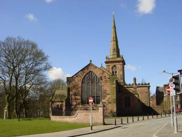
Prescot sits in the borough of Knowsley, in Merseyside, east of Liverpool and west of St Helens. It is a town of roughly 12,800 people, close enough to both cities to use them, but with its own centre and identity.
What tends to draw people here is the balance. You get a walkable town centre with a shopping centre and big supermarkets, a hospital just over a mile away, and several primary and secondary schools within a short distance. Knowsley Safari Park is on the edge of town and has its own station.
For tenants weighing up a swap, the practical pull is simple: a compact Merseyside town with its own rail station, main roads out towards Liverpool and St Helens, and social rents that sit at the lower end for the region. Knowsley is a smaller borough than its neighbours, and Prescot is one of its best-connected spots.
Swapping to Prescot: key facts
Can I swap my council or housing association home to Prescot?
Yes, if you are already a council or housing association tenant. Mutual exchange means swapping homes with another social tenant, so it does not depend on the council waiting list: you need a tenant in or near Prescot who wants your area, and both landlords must agree. Landlords have 42 days to decide and can only refuse on set legal grounds.
How long is the council housing waiting list in Prescot?
2,802 households were on the Knowsley housing register on 31 March 2025, up 19% on a year earlier. 587 social homes were let through the council in 2024 to 2025, roughly 4.8 households for every home let. Source: Local Authority Housing Statistics, Ministry of Housing, Communities and Local Government.
How much is social rent in Prescot?
Average weekly social rents in the Knowsley council area in 2024/25: 1 bed £0 council, £86 housing association; 2 bed £0 council, £99 housing association; 3 bed £0 council, £111 housing association. Affordable rent homes cost more, typically 60 to 80% of market rent. Source: Regulator of Social Housing.
How much social housing is there in Prescot and who owns it?
25.3% of homes in the Knowsley council area are social housing (council 10.8%, housing association 14.5%), against 17.1% across England, according to the 2021 Census. The biggest social landlords there are Livv Housing Group (12,818 homes), ForHousing Limited (1,879 homes) and The Riverside Group Limited (1,016 homes).
How Busy Is The Swap Market In Prescot?
Figures as of 24 October 2026, updated every night. The waiting list figure is from 2024 to 2025 government data.
Which homes are available to swap near Prescot?
Homes are shown near their address, not on it. Contains OS data © Crown copyright and database right. Source: Office for National Statistics, Open Government Licence.
No homes listed within 5 miles at the moment. New homes are listed every week: see homes across Merseyside, use the alert form below, or list your own home so tenants here can find you.
What is housing like in Prescot and who lives there?
Knowsley has a high share of social housing: 25.3% of homes across the borough are socially rented, well above the England figure of 17.1%. Of that, 10.8% is council and 14.5% housing association. Just under 60% of homes are owned and 14.3% are privately rented.
Livv Housing Group is by far the biggest landlord in the borough with around 12,818 homes, followed by ForHousing with 1,879, The Riverside Group with 1,016, Your Housing with 767 and Onward Homes with 662. Average weekly social rents in Knowsley for 2024/25 were about £86 for a one bed, £99 for a two bed and £111 for a three bed.
The age profile across Knowsley is close to the national average, with slightly more children and slightly fewer pensioners. Demand for social housing is real: 2,802 households were on the council's register at the end of March 2025, with 587 homes let through the council in 2024-25. A register is not a simple queue, which is part of why mutual exchange suits so many people.
Who owns the homes
Share of homes in the Knowsley council area, Census 2021.
Ages
Share of people in each age group, Census 2021.
Council waiting list and lettings
Households on the register by the size of home they need.
That is roughly 4.8 households waiting for every social home let in a year. Mutual exchange doesn't use the waiting list: if you already have a council or housing association home, swapping with another tenant can be a quicker way to move to Prescot.
A register counts households who have applied, so it isn't a simple queue: some are already social tenants hoping to transfer, and people can be on more than one council's list.
Typical weekly social rents in the Knowsley council area
Social rent averages for 2024/25. Affordable rent homes cost more, typically 60 to 80% of market rent.
Biggest social landlords in the council area
- Livv Housing Group12,818 homes
- ForHousing Limited1,879 homes
- The Riverside Group Limited1,016 homes
- Your Housing Limited767 homes
- Onward Homes Limited662 homes
- Torus62 Limited626 homes
- Plus Dane Housing Limited515 homes
- Sanctuary Housing Association205 homes
What is it like to live in Prescot?
Day to day, most of what you need sits in a tight knot around the centre. Prescot Shopping Centre, a Tesco Extra, an M&S Foodhall and a Heron Foods are all within a short stroll, alongside Rowlands Pharmacy, Boots and a Tesco pharmacy. The streets around the centre are a mix of older terraces and newer estates.
Green space is nearby too. The Eaton Street Park is about a tenth of a mile out, with a wildflower meadow beside it, and KGV Browns Field and The Black Path give you more room to walk. Whiston Hospital is just over a mile away, which matters more than people realise until they need it. There are community centres at Bryer Road and the Robert Foulkes Centre, plus libraries at Whiston Hospital, Huyton and Rainhill within a couple of miles.
What are the schools and family life like in Prescot?
Families are well served for schools. Our Lady's Catholic Primary School is around a third of a mile away, with Evelyn Community Primary, Eccleston Lane Ends, Prescot Primary and St Mary and St Paul's CE all within two thirds of a mile. That is an unusual amount of choice for a town this size, though places depend on admissions and distance, so check with the schools directly.
For older children, The Prescot School is roughly a third of a mile from the centre, with Saint Edmund Arrowsmith Catholic Academy just over a mile, Lord Derby Academy at 1.6 miles and De La Salle School under two and a half. Alt Bridge School, a special school, is around 1.4 miles away.
Outside school hours there is Eaton Street Park and its wildflower meadow, KGV Browns Field and The Black Path for walks and kickabouts. Southmead Children's Centre is about a mile and a half away, and Merseyside Youth Association's Our Place is a similar distance. Across Knowsley, 19.5% of residents are under 16, slightly above the England figure, so it is a borough with plenty of young families.
Primary schools
- Our Lady's Catholic Primary School0.3 mi
- Evelyn Community Primary School0.5 mi
- Eccleston Lane Ends Primary School0.6 mi
- Prescot Primary School0.6 mi
- St Mary and St Paul's CE Primary School0.6 mi
Secondary schools
- The Prescot School0.3 mi
- Saint Edmund Arrowsmith Catholic Academy1.3 mi
- Alt Bridge School1.4 mi
- Lord Derby Academy1.6 mi
- De La Salle School2.4 mi
Parks
- The Eaton Street Parknearby
- Eaton Street Park Wildflower Meadownearby
- KGV Browns Field Prescot0.5 mi
- Rollercoaster0.6 mi
- The Black Path0.8 mi
Libraries
- Whiston Hospital Library1.1 mi
- Thatto Heath Library2 mi
- Huyton Library2 mi
- Rainhill Community Library2 mi
- Stockbridge Village Library2.5 mi
What shops and everyday essentials are in Prescot?
Supermarkets
- Heron Foodsnearby
- Tesco Extranearby
- M&S Foodhall0.3 mi
- M.P. Food, News & Wine Store1.4 mi
- Asda1.7 mi
Pharmacies
- Rowlands Pharmacynearby
- Tesco Pharmacynearby
- Boots0.3 mi
- Prescriptions Pharmacy0.3 mi
- Neils Pharmacy0.7 mi
Hospitals
- Whiston Hospital1.1 mi
Shopping centres
- Prescot Shopping Centrenearby
How do you get around Prescot?
Prescot has its own train station about half a mile from the centre, with Eccleston Park a mile away, Whiston just over a mile and Rainhill under two. Knowsley Safari Park station is only around half a mile out. That gives you several options if your line is disrupted or your work takes you in a different direction.
The town is easy on foot. Shops, pharmacies, the shopping centre and Eaton Street Park are all within a few minutes of each other, and plenty of residents manage the centre without a car. Pavements and short distances make the school run and the weekly shop straightforward.
By car, Prescot sits between Liverpool and St Helens on the main routes east out of the city, so journeys to either are short. Whiston Hospital is a little over a mile away. Parking is a mixed bag in the centre, as in most towns of this size, so check what comes with any home you are considering before you commit.
Train stations
- Prescot0.5 mi
- Knowsley Safari Park Train Station0.6 mi
- Eccleston Park1 mi
- Whiston1.1 mi
- Rainhill1.8 mi
What is there to do in Prescot?
For a town of its size, Prescot has a decent night out. The Stage Door is right in the centre, with Deanes House, The Sun Inn, Mercutio's and a Wetherspoon, The Watch Maker, all within a couple of hundred metres. It means you can walk home, which counts for a lot.
If you like to keep active, PureGym Prescot and The Yoga Loft are a short walk away, and there are martial arts clubs including Gracie Barra Prescot, Urban Kingz and Family Martial Arts Prescot nearby. Eaton Street Park, its wildflower meadow, KGV Browns Field and The Black Path give you free outdoor space on the doorstep.
For shopping and browsing, Prescot Shopping Centre sits in the middle of town with Tesco Extra, M&S Foodhall and Heron Foods close by, and an Asda under two miles out. Libraries at Huyton, Rainhill and Thatto Heath are all about two miles away, and Knowsley Safari Park is on the town's edge.
Gyms
- The Yoga Loftnearby
- PureGym Prescotnearby
- Urban Kingz0.3 mi
- Gracie Barra Prescot0.4 mi
- Family Martial Arts Prescot0.5 mi
Pubs and bars
- The Stage Doornearby
- Deanes Housenearby
- The Watch Maker - JD Wetherspoonnearby
- The Sun Innnearby
- Mercutio'snearby
Community centres
- Bryer Road Community Centre0.7 mi
- Robert Foulkes Centre0.9 mi
- Merseyside Youth Association - Our Place1.3 mi
- George Howard Centre1.5 mi
- Southmead Children's Centre1.5 mi
What is work and the local economy like in Prescot?
Figures here cover the wider Knowsley council area rather than Prescot alone. At the 2021 Census, 55.9% of adults were in work, a little below the England average of 57.4%, with unemployment at 3.5%, exactly in line with England.
More recent benefit data for September 2026 puts unemployment-related claimants at 4.3% of working-age residents in Knowsley, against 4% across England. So the local job market is slightly tighter than the national picture, but not dramatically so.
Prescot's advantage is reach. Whiston Hospital is just over a mile away and is a large local employer, and the town centre itself has shops, supermarkets and pubs. Beyond that, the rail station and main roads put Liverpool and St Helens within easy commuting distance, which widens your options considerably if your trade or sector is not well represented locally. If you are moving for work, it is worth checking your journey at the times you would actually travel.
Figures are for the Knowsley council area, Census 2021 and ONS claimant count.
How safe is Prescot?
Like every town centre, Prescot has police incidents logged each month. In August 2026 there were 223 within about a mile of the centre, made up of:
Source: data.police.uk street-level crime. Counts cover a fixed one-mile radius around the centre, so busy high streets and stations always record far more than the residential streets around them, and most incidents are minor. Compare like with like: a similar-sized town centre, not a village.
Is Prescot a good place for social housing tenants?
If Prescot looks like the right fit, the next step is straightforward. Put your own home on Mutual Home Exchange with clear photos, an honest description of the rooms, garden and parking, and a note about the area you are in. Tenants looking to move are more likely to get in touch when they can picture the place properly.
Then add Prescot, or the L34 postcode district, to your list of desired areas. You can add nearby places too, such as Whiston, Huyton or Rainhill, which share many of the same schools, stations and services and may bring up matches you would otherwise miss.
Swaps take patience. Check in regularly, reply to messages quickly and be upfront about what your home does and does not offer. Once you find a possible match, both landlords have to agree before anything is signed, so start those conversations early and keep notes. Listing is free, and the more specific you are about what you want, the better the matches tend to be.
Tell me when a home appears near Prescot
One email, the first time a council or housing association home is listed within your chosen distance. No newsletter, no spam.
Live in Prescot? Add a photo
Tenants' own photos help other people picture the place. Approved photos are credited to you. Submit a photo.
Nearby place guides
Thinking of moving a little further? Compare homes to swap, rents and local landlords in places near Prescot.
All place guides in Merseyside → · All place guides in the North West → · All regions →