What it's like to live in Fleet
Fleet is a tidy, green commuter town in Hart, Hampshire, home to around 23,485 people. It feels suburban and settled rather than busy, with a long high street, plenty of trees and open space close at hand. It suits families and anyone who wants calm streets with a proper town centre, with The Views Meadow and Calthorpe Park almost on the doorstep.
"I'd move here" adds Fleet to the areas on your listing, so homes here are matched to you first.
Fleet sits in north-east Hampshire, in the Hart district, between Basingstoke to the west and Farnborough and Aldershot to the east. Guildford and Reading are within reach, and London is a straight run up the railway line. The postcode district is GU51.
People move here for the combination: a small town of about 23,485 residents, surrounded by greenery, but with a fast train link and good roads. It is the kind of place people choose when they want to stay connected to work in bigger towns or the capital without living in one.
For social housing tenants, Fleet is worth knowing about precisely because it is unusual. Hart has a much smaller social rented sector than England as a whole, so homes do not come up often and swapping can be a realistic route in. If you are drawn by schools, open space and the railway, it is a place worth setting as a desired area and being patient about.
Swapping to Fleet: key facts
Can I swap my council or housing association home to Fleet?
Yes, if you are already a council or housing association tenant. Mutual exchange means swapping homes with another social tenant, so it does not depend on the council waiting list: you need a tenant in or near Fleet who wants your area, and both landlords must agree. Landlords have 42 days to decide and can only refuse on set legal grounds.
How long is the council housing waiting list in Fleet?
1,336 households were on the Hart housing register on 31 March 2025, up 7% on a year earlier. 184 social homes were let through the council in 2024 to 2025, roughly 7.3 households for every home let. Source: Local Authority Housing Statistics, Ministry of Housing, Communities and Local Government.
How much is social rent in Fleet?
Average weekly social rents in the Hart council area in 2024/25: 1 bed £0 council, £117 housing association; 2 bed £0 council, £141 housing association; 3 bed £0 council, £159 housing association. Affordable rent homes cost more, typically 60 to 80% of market rent. Source: Regulator of Social Housing.
How much social housing is there in Fleet and who owns it?
8.8% of homes in the Hart council area are social housing (council 0.9%, housing association 7.9%), against 17.1% across England, according to the 2021 Census. The biggest social landlords there are Vivid Housing Limited (2,732 homes), Abri Group Limited (593 homes) and Metropolitan Housing Trust Limited (453 homes).
How Busy Is The Swap Market In Fleet?
Figures as of 22 October 2026, updated every night. The waiting list figure is from 2024 to 2025 government data.
Which homes are available to swap near Fleet?
Homes are shown near their address, not on it. Contains OS data © Crown copyright and database right. Source: Office for National Statistics, Open Government Licence.
No homes listed within 5 miles at the moment. New homes are listed every week: see homes across Hampshire, use the alert form below, or list your own home so tenants here can find you.
What is housing like in Fleet and who lives there?
Hart has far less social housing than most of England: 8.8% of homes are socially rented here against 17.1% nationally, split between 7.9% housing association and just 0.9% council. Ownership dominates at 75.7%, with 13.6% privately rented. That scarcity is the single most important thing to understand about moving here.
The biggest social landlords in the council area are Vivid Housing with around 2,732 homes, followed by Abri Group with 593, Metropolitan Housing Trust with 453, Sovereign Network Group with 431 and Anchor Hanover with 156. Average weekly social rents across Hart in 2024/25 were about £117 for a one bed, £141 for two and £159 for three.
The age profile of the council area leans slightly older and more family-heavy than England: 19.1% under 16, 28.1% aged 45 to 64 and 19.7% aged 65 and over. At 31 March 2025 Hart's housing register held 1,336 households, with 184 social homes let through the council during 2024-25, which is a fair signal of how tightly supply is stretched.
Council waiting list and lettings
Households on the register by the size of home they need.
That is roughly 7.3 households waiting for every social home let in a year. Mutual exchange doesn't use the waiting list: if you already have a council or housing association home, swapping with another tenant can be a quicker way to move to Fleet.
A register counts households who have applied, so it isn't a simple queue: some are already social tenants hoping to transfer, and people can be on more than one council's list.
Typical weekly social rents in the Hart council area
| Size | Council | Housing association |
|---|---|---|
| Bedsit | £0 | £97 |
| 1 bed | £0 | £117 |
| 2 bed | £0 | £141 |
| 3 bed | £0 | £159 |
| 4 bed | £0 | £176 |
Social rent averages for 2024/25. Affordable rent homes cost more, typically 60 to 80% of market rent.
Biggest social landlords in the council area
- Vivid Housing Limited2,732 homes
- Abri Group Limited593 homes
- Metropolitan Housing Trust Limited453 homes
- Sovereign Network Group431 homes
- Anchor Hanover Group156 homes
- Home Group Limited61 homes
- Synergy Housing Limited58 homes
- Clarion Housing Association Limited51 homes
What is it like to live in Fleet?
Day to day, most of what you need sits within a short stretch. The Hart Shopping Centre is right in the centre, with Waitrose and Sainsbury's close by, a Co-operative Food a short walk out and Morrisons under a mile away. Fleet Library is in the middle of town, there's a Superdrug pharmacy nearby and Fleet Community Hospital is about half a mile out.
The residential streets spread out from the centre towards Church Crookham and Heatherside, and they are mostly quiet, low-rise and leafy. Community life has somewhere to land: The Harlington hosts events in the centre, The Point Youth Centre and Fleet Parish Community Centre are close by, with Hareshill Community Centre and The Key Centre a little further out.
What are the schools and family life like in Fleet?
Fleet is a strong fit for families. Within easy reach you'll find Heatherside Junior School, Heatherside Infant School and the combined Heatherside Infant and Junior Schools, all around 0.4 miles out, plus Tavistock Infant School and All Saints Church of England Aided Junior School at roughly 0.7 miles. Having that many primaries so close means fewer long school runs.
For older children, Court Moor School is about 0.7 miles away and Calthorpe Park School about 0.8 miles, so most of the town is within a walk or a short bus ride of a secondary. St Nicholas' School, an independent, sits a little over two miles out. Places depend on admissions criteria, so check the latest catchment details before you commit to a swap.
Outside school hours there is plenty to fill a weekend. Calthorpe Park, Oakley Park, The Views Meadow and Edenbrook Country Park give children space to run, and The Point Youth Centre and Fleet Parish Community Centre run activities in the middle of town. Fleet Library is a short walk from the centre too.
Primary schools
- Heatherside Junior School0.4 mi
- Heatherside Infant and Junior Schools0.4 mi
- Heatherside Infant School0.4 mi
- Tavistock Infant School0.7 mi
- All Saints Church of England Aided Junior School0.7 mi
Secondary schools
- Court Moor School0.7 mi
- Calthorpe Park School0.8 mi
- St Nicholas' School2.1 mi
Parks
- The Views Meadownearby
- Calthorpe Park0.4 mi
- Oakley Park0.5 mi
- Lea Green0.8 mi
- Edenbrook Country Park1.1 mi
Libraries
- Fleet Librarynearby
What shops and everyday essentials are in Fleet?
Supermarkets
- Waitrosenearby
- Sainsbury'snearby
- The Co-operative Food0.4 mi
- Morrisons0.9 mi
- Co-op Food1.4 mi
Pharmacies
- Superdrugnearby
- WellBeing Pharmacy0.8 mi
- Church Crookham Pharmacy1.3 mi
Hospitals
- Fleet Community Hospital0.5 mi
Shopping centres
- Hart Shopping Centrenearby
How do you get around Fleet?
Fleet station is about 0.9 miles from the centre, on the main line that runs towards London in one direction and Basingstoke and the south west in the other. Winchfield station is a second option about 2.8 miles away, handy if you live on that side of town or want a different stopping pattern. For many households here, the train is the main reason they chose Fleet.
By road, the town sits close to the main routes through north Hampshire, which makes driving to Farnborough, Aldershot, Basingstoke and Reading straightforward. Parking is generally easier than in a bigger town, though the centre gets busier on weekends.
On foot, Fleet works well. The shopping centre, library, supermarkets, gyms and pubs cluster within a few hundred metres of each other, and the nearest parks are minutes away. Buses link the town centre with surrounding villages and neighbouring towns, so a car is not essential if you live centrally, but outlying streets will feel more spread out and the walk to the station takes a little while.
Train stations
- Fleet0.9 mi
- Winchfield2.8 mi
What is there to do in Fleet?
Green space is Fleet's strongest card. The Views Meadow is right by the centre, Calthorpe Park and Oakley Park are both under half a mile out, Lea Green is a little further, and Edenbrook Country Park about a mile away gives you a bigger stretch for long walks or a dog.
In town, The Harlington is the main venue for events and community activity. Fleet Library is close by. If you like to train, there is a decent spread for a town this size: Anytime Fitness, Club Reformer Studios, Results and Physique Architect Gyms are all within a few minutes of the centre, with Elements Yoga Studio nearby too.
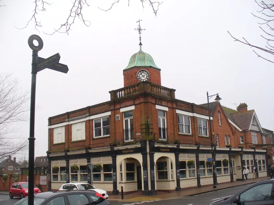
For eating and drinking, the centre has the Old Emporium, The Prince Arthur, Harlington Bar, Esco and the Broadway Club, all clustered within a short stroll. It is a town-centre scene rather than a nightlife one: fine for a meal out, a quiz night or a Sunday drink, with Farnborough, Guildford and Reading reachable when you want something bigger.
Gyms
- Club Reformer Studiosnearby
- Anytime Fitnessnearby
- Elements Yoga Studionearby
- Resultsnearby
- Physique Architect Gyms0.3 mi
Pubs and bars
- Old Emporiumnearby
- Harlington Barnearby
- Esconearby
- The Prince Arthurnearby
- Broadway Clubnearby
Community centres
- The Harlingtonnearby
- The Point Youth Centrenearby
- Fleet Parish Community Centrenearby
- Hareshill Community Centre0.9 mi
- The Key Centre1 mi
What is work and the local economy like in Fleet?
Fleet is a commuter town first and foremost, and the figures for the wider Hart council area back that up. Some 62.8% of adults are in work, well above the England average of 57.4%, while unemployment sits at 2.4% against 3.5% nationally. Benefit claimants related to unemployment were 1.7% of working-age people in September 2026, compared with 4% across England.
In practice, many residents travel out: by train towards London, Woking and Basingstoke, or by road to Farnborough, Aldershot, Reading and Guildford. That makes the station and the main roads important to household budgets as well as daily routine.
Locally, work tends to come from the things that keep a town running: the shops and the Hart Shopping Centre, the supermarkets, Fleet Community Hospital, the schools, gyms, pubs and community venues. If you are moving here without a job lined up, it is worth being realistic about commuting costs, because a lot of the better-paid work in this area sits outside the town itself.
Figures are for the Hart council area, Census 2021 and ONS claimant count.
How safe is Fleet?
Like every town centre, Fleet has police incidents logged each month. In August 2026 there were 111 within about a mile of the centre, made up of:
- Anti-social behaviour reports22
- Vehicle crime2
- Bicycle theft1
- Shoplifting7
- Other theft7
- Theft from the person2
Source: data.police.uk street-level crime. Counts cover a fixed one-mile radius around the centre, so busy high streets and stations always record far more than the residential streets around them, and most incidents are minor. Compare like with like: a similar-sized town centre, not a village.
Is Fleet a good place for social housing tenants?
If Fleet appeals, the practical step is simple: list your own home on Mutual Home Exchange and add Fleet to your desired areas. A mutual exchange works on what other tenants are looking for, so the more clearly you describe your property, the easier it is for the right person to find you.
Given how small the social rented sector is in Hart, it is worth being flexible. Add nearby areas as well as Fleet itself, say honestly what you can and cannot live with, and keep your listing active and up to date. Good photos and a short, truthful description of the home, the street and the local area do more than anything else.
Before you agree anything, visit at different times of day, walk the route to the station or the school you have in mind, and check what your landlord needs from you. Both landlords must approve an exchange. Set your preferences, be patient, and let people searching for a move out of Fleet come to you.
Tell me when a home appears near Fleet
One email, the first time a council or housing association home is listed within your chosen distance. No newsletter, no spam.
Live in Fleet? Add a photo
Tenants' own photos help other people picture the place. Approved photos are credited to you. Submit a photo.
Nearby place guides
Thinking of moving a little further? Compare homes to swap, rents and local landlords in places near Fleet.
All place guides in Hampshire → · All place guides in the South East → · All regions →