What it's like to live in Whitstable
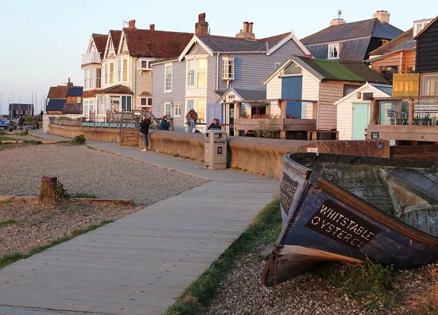
Whitstable is a small seaside town on the north Kent coast, part of the Canterbury district, with a population of around 30,000. It has the feel of a working harbour town that has grown popular: narrow streets, weatherboard houses, pubs and a long shingle shore. It suits people who want sea air and a proper town centre close by, with Long Rock and Victory Wood nearby for wide open space.
"I'd move here" adds Whitstable to the areas on your listing, so homes here are matched to you first.
Whitstable sits on the Kent coast in the Canterbury district, facing the Thames Estuary. Canterbury itself is the nearest city, with Herne Bay and Faversham the closest other towns along the coast and the A299 Thanet Way running east to west behind the town.
People move here for the combination of sea and services. It is a seaside town that has kept a full high street, a railway station and its own hospital, rather than relying entirely on a bigger neighbour. That makes it unusual among English coastal towns of its size, and it is a big part of why demand to live here is steady.
The town is part of a wider council area of just over 157,000 people, so Whitstable itself is modest in scale. Be honest with yourself about what that means: it is a town where you will see familiar faces, where the centre is busy in summer and quieter in winter, and where house prices and rents reflect its popularity. For a social tenant, a swap is often the realistic route in, and that is exactly what this site is for.
Swapping to Whitstable: key facts
Can I swap my council or housing association home to Whitstable?
Yes, if you are already a council or housing association tenant. Mutual exchange means swapping homes with another social tenant, so it does not depend on the council waiting list: you need a tenant in or near Whitstable who wants your area, and both landlords must agree. Landlords have 42 days to decide and can only refuse on set legal grounds. In 2024 to 2025, 57 council homes in Canterbury changed tenants by mutual exchange.
How long is the council housing waiting list in Whitstable?
1,356 households were on the Canterbury housing register on 31 March 2025. 554 social homes were let through the council in 2024 to 2025, roughly 2.4 households for every home let. Source: Local Authority Housing Statistics, Ministry of Housing, Communities and Local Government.
How much is social rent in Whitstable?
Average weekly social rents in the Canterbury council area in 2024/25: 1 bed £95 council, £107 housing association; 2 bed £111 council, £126 housing association; 3 bed £126 council, £140 housing association. Affordable rent homes cost more, typically 60 to 80% of market rent. Source: Regulator of Social Housing.
How much social housing is there in Whitstable and who owns it?
12.2% of homes in the Canterbury council area are social housing (council 7.8%, housing association 4.4%), against 17.1% across England, according to the 2021 Census. The biggest social landlords there are Canterbury City Council (5,132 homes), Moat Homes Limited (649 homes) and Hyde Housing Association Limited (615 homes).
How Busy Is The Swap Market In Whitstable?
Figures as of 24 October 2026, updated every night. The waiting list figure is from 2024 to 2025 government data.
Which homes are available to swap near Whitstable?
Homes are shown near their address, not on it. Contains OS data © Crown copyright and database right. Source: Office for National Statistics, Open Government Licence.
No homes listed within 5 miles at the moment. New homes are listed every week: see homes across Kent, use the alert form below, or list your own home so tenants here can find you.
What is housing like in Whitstable and who lives there?
Social renting is less common around here than nationally. Across the Canterbury council area, 12.2% of homes are socially rented, against 17.1% for England, split between council homes at 7.8% and housing association homes at 4.4%. Nearly two thirds of homes, 64.8%, are owned outright or with a mortgage, and 22% are privately rented.
Canterbury City Council is by far the largest social landlord with 5,132 homes. Moat Homes, Hyde Housing Association, Sanctuary Housing Association and Town and Country Housing each run between roughly 540 and 650 homes in the district. Average weekly social rents for 2024/25 were £98 for a one bed, £116 for a two bed and £129 for a three bed.
The age profile tilts older than England: 21.8% are 65 or over and only 16.2% are under 16. In 2024-25 the council let 554 social homes and 57 council homes changed hands through mutual exchange, with 1,356 households on the housing register at the end of March 2025. A register is not a simple queue, which is why swapping is worth taking seriously.
Who owns the homes
Share of homes in the Canterbury council area, Census 2021.
Ages
Share of people in each age group, Census 2021.
Council waiting list and lettings
Households on the register by the size of home they need.
That is roughly 2.4 households waiting for every social home let in a year. Mutual exchange doesn't use the waiting list: if you already have a council or housing association home, swapping with another tenant can be a quicker way to move to Whitstable.
A register counts households who have applied, so it isn't a simple queue: some are already social tenants hoping to transfer, and people can be on more than one council's list.
Typical weekly social rents in the Canterbury council area
Social rent averages for 2024/25. Affordable rent homes cost more, typically 60 to 80% of market rent.
Biggest social landlords in the council area
- Canterbury City Council5,132 homes
- Moat Homes Limited649 homes
- Hyde Housing Association Limited615 homes
- Sanctuary Housing Association585 homes
- Town and Country Housing547 homes
- Southern Housing398 homes
- Anchor Hanover Group166 homes
- Places for People Homes Limited147 homes
What is it like to live in Whitstable?
Day to day, most things sit within a short walk of the centre. A Co-op Food is close to the High Street, with a Tesco Extra, Aldi, M&S Foodhall and Sainsbury's a mile or so out. Boots and PRX Pharmacy are right in the middle of town, with Tankerton and Estuary View pharmacies serving the eastern side.
Whitstable Library is a couple of minutes from the centre, and Swalecliffe has its own branch. Kingsdown Park Gardens and Plot 10 give local green space under a mile away. Community life is well served, with the Umbrella Centre, the Waterloo Centre and St Andrew's Church Centre all close to the middle of town, plus a youth centre a short walk away.
What are the schools and family life like in Whitstable?
Families are well served for primary schooling. St Alphege CE Infant School and Whitstable and Seasalter Endowed Church of England Junior School are both within a few minutes of the centre, with Whitstable Junior School and Westmeads Community Infant School also under a quarter of a mile away. St Mary's Catholic Primary School is a little over half a mile out. Several options that close together is rare, though places still depend on admissions, so check with the council.
For older children, ISP School Whitstable is the secondary option listed within three miles. If that does not fit your child, be prepared for a journey to schools outside the town, so look carefully at travel before you swap.
Outside school, Whitstable Youth Centre is a short walk from the centre and Whitstable Library runs as a local hub. Kingsdown Park Gardens and Plot 10 give somewhere close for younger children to run about, and the woodland at Victory Wood, under three miles away, is a good weekend trip. The beach itself is the town's biggest free attraction for families.
Primary schools
- St. Alphege CE Infant Schoolnearby
- Whitstable and Seasalter Endowed Church of England Junior Schoolnearby
- Whitstable Junior Schoolnearby
- Westmeads Community Infant Schoolnearby
- St Mary's Catholic Primary School0.6 mi
Secondary schools
- ISP School Whitstablenearby
Parks
- Plot 100.8 mi
- Kingsdown Park Gardens0.8 mi
- Long Rock1.9 mi
- Victory Wood - Woodland Trust2.8 mi
Libraries
- Whitstable Librarynearby
- Swalecliffe Library1.8 mi
What shops and everyday essentials are in Whitstable?
Supermarkets
- Co-op Foodnearby
- Tesco Extra1.1 mi
- Aldi1.3 mi
- M&S Foodhall1.3 mi
- Sainsbury's1.6 mi
Pharmacies
- Bootsnearby
- PRX Pharmacynearby
- Tyrell & Jones Pharmacy0.4 mi
- Tankerton Pharmacy0.9 mi
- Estuary View Pharmacy1.3 mi
Hospitals
- Whitstable and Tankerton Hospital1.1 mi
- Estuary View Medical Centre1.3 mi
Shopping centres
- South Quay Shed0.3 mi
How do you get around Whitstable?
Whitstable railway station is about a third of a mile from the centre, which puts trains within walking distance for many households. Chestfield & Swalecliffe station is a second option just under two miles east, handy if you settle on that side of town.
The town centre is compact and flat in places, so walking works well for shopping, school runs and the library. Streets near the harbour are narrow and parking can be tight, which is worth thinking about if you run a car. Further out, towards the supermarkets and Estuary View, you are more likely to drive or take a bus.
By road, the A299 Thanet Way links Whitstable to Canterbury, Faversham and the Thanet towns, and on to the M2 corridor. If you do not drive, plan a journey or two for yourself before you commit: check the bus times you would actually use for work, school and hospital appointments, and see how they fit around your week in winter as well as summer.
Train stations
- Whitstable0.4 mi
- Chestfield & Swalecliffe1.9 mi
What is there to do in Whitstable?
The coast shapes most of what people do here. The shore, Long Rock and the woodland at Victory Wood cover a decent range, from a quick walk after tea to a proper day out. Kingsdown Park Gardens and Plot 10 are the handiest everyday green spaces.
The town centre has a strong pub scene for its size. The Ship Centurion, The Peter Cushing, The Twelve Taps, The Duke of Cumberland and the Royal Naval Reserve are all within a short stroll of each other, which makes a quiet evening out easy without needing to travel. South Quay Shed adds a small shopping destination near the harbour.
For exercise, the options listed are smaller and more specialist: Pilates Movement Matters and Fighting Lions, both close to the centre. If you want a large leisure centre with a pool, expect to look beyond the town. Whitstable Library and the community centres at Umbrella and Waterloo are where a lot of groups and classes happen, and they are worth a visit early on if you are new.
Gyms
- Pilates Movement Mattersnearby
- Fighting Lionsnearby
Pubs and bars
- The Ship Centurionnearby
- The Peter Cushingnearby
- The Twelve Tapsnearby
- The Duke of Cumberlandnearby
- Royal Naval Reservenearby
Community centres
- Umbrella Centrenearby
- Waterloo Centrenearby
- Whitstable Youth Centre0.4 mi
- St. Andrew's Church Centre0.6 mi
- All Saints Hall0.7 mi
What is work and the local economy like in Whitstable?
Employment figures cover the wider Canterbury council area rather than Whitstable alone, and they need reading carefully. Just under half of adults, 49.8%, are in work, against 57.4% across England. Unemployment sits at 3.9%, close to the England figure of 3.5%.
The low employment rate is partly explained by who lives in the district. Canterbury has a large 16 to 24 population, 16.4% compared with 10.6% nationally, so a good share of that group are studying rather than working. Benefit claimants connected to unemployment stood at 3.2% of working-age people in September 2026, below the England figure of 4%.
In practice, many Whitstable residents look to Canterbury and the wider coast for work, and the train and the A299 make that realistic. Locally, the town supports retail, hospitality, health and care work, with the supermarkets, pubs and Whitstable and Tankerton Hospital among the visible employers. Seasonal trade matters here, so winter hours can be thinner than summer ones in tourism-facing jobs.
Figures are for the Canterbury council area, Census 2021 and ONS claimant count.
How safe is Whitstable?
Like every town centre, Whitstable has police incidents logged each month. In August 2026 there were 132 within about a mile of the centre, made up of:
Source: data.police.uk street-level crime. Counts cover a fixed one-mile radius around the centre, so busy high streets and stations always record far more than the residential streets around them, and most incidents are minor. Compare like with like: a similar-sized town centre, not a village.
Is Whitstable a good place for social housing tenants?
If Whitstable is where you want to be, the practical step is to list your own home properly and set Whitstable as a desired area. Tenants searching from elsewhere will only find you if your advert exists, so get it up before you start hunting.
Make the listing honest and detailed. Say how many bedrooms you have, which floor you are on, whether there is a garden, parking or a lift, what the heating is like and what the local area offers. Add clear photos of every room. A swap works both ways: someone has to want your home as much as you want theirs, and a thorough advert does most of that work for you.
Then be patient and stay open. Consider Tankerton, Swalecliffe and Chestfield as well as central Whitstable, since they bring you into the same schools, stations and shops. Check messages regularly, reply quickly, and always visit in person before agreeing anything. Both landlords must approve the exchange, so start those conversations early and keep your rent account in good order.
Tell me when a home appears near Whitstable
One email, the first time a council or housing association home is listed within your chosen distance. No newsletter, no spam.
Live in Whitstable? Add a photo
Tenants' own photos help other people picture the place. Approved photos are credited to you. Submit a photo.
Nearby place guides
Thinking of moving a little further? Compare homes to swap, rents and local landlords in places near Whitstable.
All place guides in Kent → · All place guides in the South East → · All regions →