What it's like to live in Fulwood
Fulwood is a large suburb on the northern edge of Preston in Lancashire, home to around 28,000 people. It feels settled and residential rather than busy, with long tree-lined roads, local parades of shops and a strong cluster of schools. It suits families and anyone who wants Royal Preston Hospital, a library and a Booths supermarket close at hand.
"I'd move here" adds Fulwood to the areas on your listing, so homes here are matched to you first.
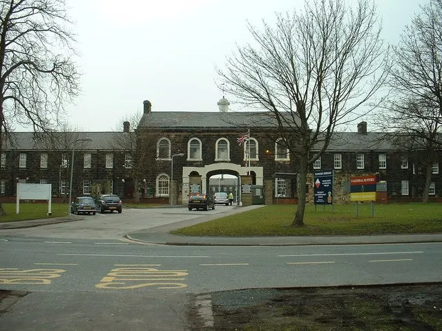
Fulwood sits at the northern end of Preston, in Lancashire, within the Preston council area. It is part of the city rather than a separate town, with the city centre around two to two and a half miles away and the wider North West on your doorstep via Preston's road and rail links.
People move here mainly for the schools and the services. There is an unusually dense choice of primary and secondary schools within a mile, Royal Preston Hospital is a few minutes away, and two private hospitals sit nearby too. For anyone working in healthcare or education, that matters.
The other draw is position. You get a quieter, mostly residential setting, but Preston railway station, the bus station and the main shopping centres are all a short journey south. Blackpool, Blackburn, Lancaster and Manchester are all reachable from Preston, which makes Fulwood a sensible base if family or work pull you in different directions. Rents in the social sector across the council area are modest compared with much of England, which is worth weighing up if you are comparing swaps.
Swapping to Fulwood: key facts
Can I swap my council or housing association home to Fulwood?
Yes, if you are already a council or housing association tenant. Mutual exchange means swapping homes with another social tenant, so it does not depend on the council waiting list: you need a tenant in or near Fulwood who wants your area, and both landlords must agree. Landlords have 42 days to decide and can only refuse on set legal grounds.
How long is the council housing waiting list in Fulwood?
4,034 households were on the Preston housing register on 31 March 2025, up 4% on a year earlier. 346 social homes were let through the council in 2024 to 2025, roughly 11.7 households for every home let. Source: Local Authority Housing Statistics, Ministry of Housing, Communities and Local Government.
How much is social rent in Fulwood?
Average weekly social rents in the Preston council area in 2025/26: 1 bed £0 council, £86 housing association; 2 bed £0 council, £100 housing association; 3 bed £0 council, £111 housing association. Affordable rent homes cost more, typically 60 to 80% of market rent. Source: Regulator of Social Housing.
How much social housing is there in Fulwood and who owns it?
18.4% of homes in the Preston council area are social housing (council 3.2%, housing association 15.3%), against 17.1% across England, according to the 2021 Census. The biggest social landlords there are Community Gateway Association Limited (6,812 homes), Places for People Homes Limited (2,173 homes) and Your Housing Limited (956 homes).
How much is Council Tax in Fulwood?
In 2026 to 2027, Council Tax in the Preston council area is £1,717 a year for Band A, £2,003 for Band B, £2,290 for Band C and £2,576 for Band D, for two adults, including police, fire and the average parish charge. The England average for Band D is £2,392. Someone living alone gets 25% off. Source: Ministry of Housing, Communities and Local Government.
What is the average salary in Fulwood?
The typical (median) full-time salary for people living in the Preston council area was £37,214 a year before tax in 2025, against £39,243 across England. For jobs based in the area, including people who travel in, it was £38,066. Source: Office for National Statistics, Annual Survey of Hours and Earnings.
Who is the MP for Fulwood?
Fulwood is split between more than one constituency. Maya Ellis (Labour) is the MP for Ribble Valley, which covers the centre; the area also includes Preston. Correct on 12 November 2026. Source: UK Parliament.
How Busy Is The Swap Market In Fulwood?
Figures as of 12 November 2026, updated every night. The waiting list figure is from 2024 to 2025 government data.
Homes to swap near Fulwood
Homes are shown near their address, not on it. Contains OS data © Crown copyright and database right. Source: Office for National Statistics, Open Government Licence.
No homes listed within 5 miles at the moment. New homes are listed every week: see homes across Lancashire, use the alert form below, or list your own home so tenants here can find you.
Housing in Fulwood
Fulwood is mostly owner-occupied territory within a city that has a decent social sector. Across the Preston council area, 18.4% of homes are socially rented, a little above the England figure of 17.1%. Most of that is housing association stock at 15.3%, with council housing making up just 3.2%. Owner occupation is 58.3% and private renting 22.4%.
The main social landlords in the area are Community Gateway Association with around 6,812 homes, Places for People Homes with 2,173, Your Housing with 956, Onward Homes with 946 and Jigsaw Homes North with 727. If you are looking to swap, those are the names you are most likely to be dealing with.
Average weekly social rents in the council area for 2025/26 are about £86 for one bed, £100 for two beds and £111 for three beds. The council's housing register held 4,034 households at 31 March 2025, with 346 social homes let through the council in 2024-25, which is part of why mutual exchange is a realistic route. The age profile locally skews slightly younger than England, with fewer residents over 65.
Who owns the homes
Share of homes in the Preston council area, Census 2021.
Ages
Share of people in each age group, Census 2021.
Council waiting list and lettings
Households on the register by the size of home they need.
That is roughly 11.7 households waiting for every social home let in a year. Mutual exchange doesn't use the waiting list: if you already have a council or housing association home, swapping with another tenant can be a quicker way to move to Fulwood.
A register counts households who have applied, so it isn't a simple queue: some are already social tenants hoping to transfer, and people can be on more than one council's list.
Typical weekly social rents in the Preston council area
Social rent averages for 2025/26. Affordable rent homes cost more, typically 60 to 80% of market rent.
Biggest social landlords in the council area
- Community Gateway Association Limited6,812 homes
- Places for People Homes Limited2,173 homes
- Your Housing Limited956 homes
- Onward Homes Limited946 homes
- Jigsaw Homes North727 homes
- Progress Housing Association Limited287 homes
- Heylo Housing Registered Provider Limited263 homes
- Great Places Housing Association244 homes
Compare these landlords against every other on tenant satisfaction, repairs and complaints.
Living in Fulwood
Day to day, most things are within a short walk or a quick drive. Fulwood Library sits right in the middle of the area, barely a few minutes from the main roads, and there are pharmacies on the doorstep at Broadway and Sharoe Green. For a bigger shop there's Booths nearby, with Lidl, Aldi, a Co-op Food and an Asda all within about a mile.
Green space is close rather than on every corner. King Georges Playing Fields, Moor Park and Haslam Park are all within a mile and a half, and Eaves Brook Linear Park gives a quieter walk. The city centre, with its shopping centres and cinemas, is only a couple of miles south, so Fulwood gives you suburban calm without cutting you off from it.
Schools in Fulwood
Few places have this many schools so close together. Within half a mile or so there are Queen's Drive Primary School, Fulwood, St Peter's Church of England Primary School and Nursery, Our Lady and St Edward's Catholic Primary School and St Clare's Catholic Primary School, with St Pius X Preparatory School also nearby. That choice includes church and Catholic options as well as community schools, and St Peter's has a nursery attached.
Secondary choice is just as strong. Corpus Christi Catholic High School and Fulwood Academy are both around 0.4 miles away, with Archbishop Temple Church of England High School and Our Lady's Catholic High School under a mile. Moorbrook School, just over a mile off, adds specialist provision. Admission criteria vary, so it is worth checking catchments before you commit to a swap.
For family life beyond school, King Georges Playing Fields and Moor Park give space to run about, Fulwood Library is a few minutes away for story times and homework, and 1st Broughton Scouts and St Anthony's Social Club are within a mile. The Preston area has a slightly younger age profile than England, with just under 20% of residents under 16.
Primary schools
- Queen's Drive Primary School Inspected 20240.4 mi
- Fulwood, St Peter's Church of England Primary School and Nursery Good 20240.5 mi
- Our Lady and St Edward's Catholic Primary School Report card 20260.5 mi
- St Clare's Catholic Primary School Report card 20260.5 mi
- St Pius X Preparatory School0.6 mi
Secondary schools
- Corpus Christi Catholic High School Inspected 20250.4 mi
- Fulwood Academy Good 20230.4 mi
- Archbishop Temple Church of England High School Inspected 20250.6 mi
- Our Lady's Catholic High School Good 20220.8 mi
- Moorbrook School Inspected 20251.1 mi
Parks
- King Georges Playing Fields1.2 mi
- Moor Park1.4 mi
- Haslam Park1.5 mi
- Eaves Brook Linear Park1.6 mi
- Ashton Park2.2 mi
Libraries
- Fulwood Librarynearby
- The Gosall Library0.9 mi
- Sharoe Green Library1 mi
- Ingol Library1.4 mi
- Library and Learning Information Services1.9 mi
Green good or better (on report cards, the expected standard or better), amber requires improvement or an area needs attention, red inadequate or an area needs urgent improvement, with the year of the inspection. Since September 2024 Ofsted no longer gives one overall grade, so newer results ("Report card", "Inspected") are coloured by their weakest area. Click a school for its full report. Ofsted data at 31 October 2026.
Shops in Fulwood
Supermarkets
- Booths0.3 mi
- Lidl0.7 mi
- Aldi0.9 mi
- Co-op Food1 mi
- Asda1.2 mi
Pharmacies
- Broadway Pharmacynearby
- Sharoe Green Pharmacy0.3 mi
- Asda Pharmacy1.1 mi
- Rowlands Pharmacy1.3 mi
- Boots1.5 mi
Hospitals
- Royal Preston Hospital0.3 mi
- Greater Lancashire Hospital0.9 mi
- Ramsay Fulwood Hall Hospital1.2 mi
Shopping centres
- The Silk Route2.1 mi
- St. John's Shopping Centre2.2 mi
- Miller Arcade2.3 mi
- St George's Centre2.3 mi
- Fishergate Shopping Centre2.4 mi
Getting around Fulwood
Fulwood is well placed for roads. It sits on Preston's northern side, close to the main routes in and out of the city, which makes driving to the centre or out towards the wider North West straightforward. Parking is generally easier here than in central Preston, though school-run traffic around the cluster of schools can be slow at peak times.
By bus, Preston Bus Station is about 2.2 miles away and services run along Fulwood's main roads towards the city centre. If you rely on the bus, check the specific route and frequency for the street you would be swapping to, as coverage is better on the main corridors than on the quieter residential closes.
For trains, Preston station is around 2.5 miles away, with Preston Riverside a little further at 2.8 miles. Preston is a major stop on the West Coast Main Line, so longer journeys are realistic without a car. Locally, walking works well for shops, the library, pharmacies and schools, most of which are under a mile. Getting into the city centre on foot is possible but is a proper walk rather than a stroll.
Train stations
- Preston2.5 mi
- Preston Riverside2.8 mi
Bus stations
- Preston Bus Station2.2 mi
Things to do in Fulwood
Everyday leisure in Fulwood leans local. There are pubs and bars right in the area, including the Black Bull, Crafty Beggars and 313 Lounge Bar, with The Sherwood and The Phantom Winger under a mile. Three libraries sit within a mile: Fulwood, The Gosall and Sharoe Green, with Ingol a little further.
For green space, Moor Park and Haslam Park are both around a mile and a half away, Ashton Park a touch over two miles, and Eaves Brook Linear Park offers a quieter waterside walk. King Georges Playing Fields is the closest open space for sport and kickabouts.
For bigger nights and bigger shops, Preston city centre does the heavy lifting. The ARC Cinema and Odeon Preston are both just over two miles away, as are Fishergate Shopping Centre, St George's Centre, St John's and the Victorian Miller Arcade. Nightlife venues including 53 Degrees, Switch and Popworld are in the same direction. Gyms are mostly city-side too, with PureGym, Ultraflex, Everlast and Total Fitness around two miles, plus Padel Republic at 1.6 miles.
Gyms
- Padel Republic1.6 mi
- PureGym1.7 mi
- Ultraflex1.7 mi
- Everlast Gyms2 mi
- Total Fitness2.1 mi
Cinemas
- The ARC Cinema2.2 mi
- Odeon Preston2.3 mi
Pubs and bars
- Black Bullnearby
- Crafty Beggarsnearby
- 313 Lounge Barnearby
- The Sherwood0.7 mi
- The Phantom Winger0.7 mi
Nightlife
- 53 Degrees1.9 mi
- Switch2.2 mi
- Popworld2.3 mi
- The Warehouse2.4 mi
Community centres
- St Anthony's Social Club0.9 mi
- 1st Broughton Scouts1 mi
- St Margaret's Parish Centre1.4 mi
- Plungington Community Centre1.5 mi
- Emmanuel Street Labour Club1.6 mi
Jobs in Fulwood
Preston is a working city with a mixed economy, and Fulwood's biggest single presence is health. Royal Preston Hospital is only 0.3 miles away, with Greater Lancashire Hospital and Ramsay Fulwood Hall Hospital also within a mile and a quarter. Add the large number of schools nearby and you have a lot of health and education work on the doorstep.
Across the Preston council area, 56.2% of adults are in work, just below the England figure of 57.4%. Unemployment sits at 3.8% compared with 3.5% nationally, and 4.7% of 16 to 64 year olds were claiming unemployment-related benefits in September 2026, against 4% for England. The gap is small but real, so it is worth lining up work or a plan before a move.
If you are job hunting, several recruitment agencies operate within a few miles, including NYS Nursing Agency, Office Angels, The Best Connection and Acorn Recruitment and Training. Preston station also makes commuting further afield practical, which widens your options considerably.
Figures are for the Preston council area, Census 2021 and ONS claimant count.
Typical Pay
Median yearly pay before tax for full-time workers, 2025. Half earn more than this and half earn less.
Where The Jobs Are
The five biggest industries by share of employee jobs, 2024. "Health" includes hospitals, GP surgeries and care homes.
Jobcentres And Recruitment Agencies
- NYS Nursing Agency Ltd1.1 mi
- Wcl1.5 mi
- Office Angels2.2 mi
- The Best Connection2.2 mi
- Acorn Recruitment and Training2.3 mi
- 1st Med Recruitment2.4 mi
From OpenStreetMap, which doesn't list every agency. Find more on Find a job (GOV.UK).
Council tax and MP in Fulwood
Council Tax 2026 to 2027
Yearly bill for two adults, including police, fire and the average parish charge. Most council and housing association homes are in Bands A to C. Living alone takes 25% off, and you may get Council Tax Reduction on a low income.
Your MP
Fulwood has more than one MP. Maya Ellis (Labour) is the MP for Ribble Valley, which covers the centre; the area also includes Preston. Find the MP for your postcode.
An MP can help with problems involving government departments and, sometimes, your landlord or council.
Broadband in Fulwood
Share of homes that can get each speed, Ofcom, January 2026. Check an address on Ofcom's broadband checker.
Deprivation in Fulwood
The Preston council area ranks 50th of 296 council areas in England on the Index of Multiple Deprivation 2025, where 1st is the most deprived. 17.2% of its neighbourhoods are among the most deprived 10% in England.
The index combines seven measures, including income, work, health, education and housing. It describes areas, not the people who live in them.
Is Fulwood safe?
Like every town centre, Fulwood has police incidents logged each month. In September 2026 there were 137 within about a mile of the centre, made up of:
Source: data.police.uk street-level crime. Counts cover a fixed one-mile radius around the centre, so busy high streets and stations always record far more than the residential streets around them, and most incidents are minor. Compare like with like: a similar-sized town centre, not a village.
Swapping to Fulwood
If Fulwood looks like the right fit, the next step is simple: put your own home on Mutual Home Exchange and set Fulwood or the PR2 postcode district as a desired area. Listing is free for council and housing association tenants, and a clear, honest advert with good photos tends to get the most interest.
Be specific about what you have and what you need. Mention the number of bedrooms, the floor, any garden or parking, and whether your home suits someone with mobility needs. Say what you are looking for too: a particular school catchment, a bus route into Preston, or a quieter street. The more detail you give, the easier it is for someone in Fulwood to see whether a swap would work both ways.
Swaps can take time, so it helps to keep your desired areas a little broad, perhaps adding neighbouring parts of Preston alongside Fulwood. Check in regularly, reply to messages promptly, and remember that both landlords must approve any exchange before you move.
Home alerts for Fulwood
One email, the first time a council or housing association home is listed within your chosen distance. No newsletter, no spam.
Nearby place guides
Thinking of moving a little further? Compare homes to swap, rents and local landlords in places near Fulwood.
All place guides in Lancashire → · All place guides in the North West → · All regions →