What it's like to live in Whitefield
Whitefield is a town of around 23,000 people in the borough of Bury, in Greater Manchester's North West. It feels settled and suburban rather than busy: rows of family housing, a handful of pubs, and green space close at hand. It suits families and anyone who wants a quieter base with Whitefield Park and a Morrisons just minutes away.
2 council and housing association homes are available to swap within 5 miles of Whitefield, and 3,035 households are on the Bury council waiting list (31 March 2025).
"I'd move here" adds Whitefield to the areas on your listing, so homes here are matched to you first.
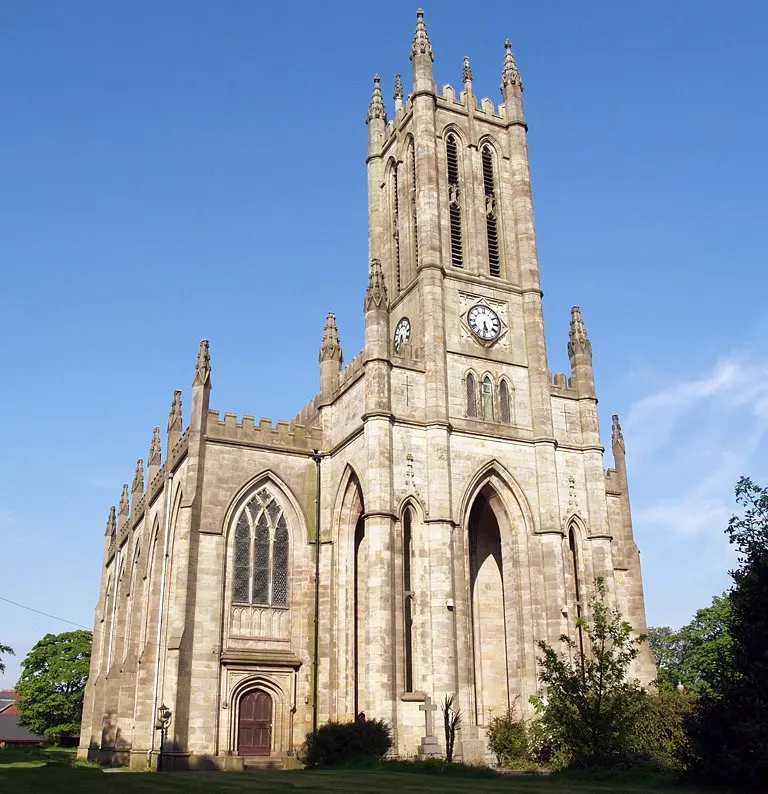
Whitefield sits in the Bury council area, between Bury itself to the north and Prestwich and Manchester to the south. Radcliffe is a mile and a half west, and Salford towns like Swinton and Clifton lie a short drive south-west. The postcode district is M45.
People move here for the balance. It is a proper town with its own schools, shops and parks, but it is close enough to bigger centres that work, shopping and hospital appointments are all within reach. Bury Bus Station is about three miles away, Radcliffe Bus Station closer still.
For tenants thinking about a swap, Whitefield tends to appeal to households who want more space and greenery than inner Manchester offers without moving far from it. The wider Bury borough has a population of about 193,851, so there is a decent spread of towns and services nearby. Whitefield itself, at roughly 23,283 people, is small enough to feel familiar after a few months.
Swapping to Whitefield: key facts
Can I swap my council or housing association home to Whitefield?
Yes, if you are already a council or housing association tenant. Mutual exchange means swapping homes with another social tenant, so it does not depend on the council waiting list: you need a tenant in or near Whitefield who wants your area, and both landlords must agree. Landlords have 42 days to decide and can only refuse on set legal grounds. In 2024 to 2025, 43 council homes in Bury changed tenants by mutual exchange. On 24 October 2026, 2 homes were listed to swap within 5 miles on Mutual Home Exchange.
How long is the council housing waiting list in Whitefield?
3,035 households were on the Bury housing register on 31 March 2025, up 37% on a year earlier. 487 social homes were let through the council in 2024 to 2025, roughly 6.2 households for every home let. Source: Local Authority Housing Statistics, Ministry of Housing, Communities and Local Government.
How much is social rent in Whitefield?
Average weekly social rents in the Bury council area in 2024/25: 1 bed £83 council, £89 housing association; 2 bed £91 council, £101 housing association; 3 bed £100 council, £114 housing association. Affordable rent homes cost more, typically 60 to 80% of market rent. Source: Regulator of Social Housing.
How much social housing is there in Whitefield and who owns it?
14.9% of homes in the Bury council area are social housing (council 8.3%, housing association 6.6%), against 17.1% across England, according to the 2021 Census. The biggest social landlords there are Bury Metropolitan Borough Council (7,672 homes), Onward Homes Limited (1,284 homes) and Irwell Valley Housing Association Limited (1,056 homes).
How Busy Is The Swap Market In Whitefield?
Figures as of 24 October 2026, updated every night. The waiting list figure is from 2024 to 2025 government data.
Which homes are available to swap near Whitefield?
Homes are shown near their address, not on it. Contains OS data © Crown copyright and database right. Source: Office for National Statistics, Open Government Licence.
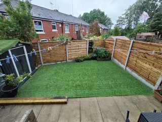
What is housing like in Whitefield and who lives there?
Housing in the Bury borough leans towards ownership: 66.9% of homes are owner-occupied, 17.7% privately rented and 14.9% socially rented. That social rented share is below the England figure of 17.1%, split between council homes at 8.3% and housing association homes at 6.6%. Social housing here is a smaller slice of the market, which is part of why a mutual exchange can be a practical route in.
Bury Metropolitan Borough Council is by far the biggest social landlord with 7,672 homes, followed by Onward Homes (1,284), Irwell Valley Housing Association (1,056), Great Places (695) and Places for People Homes (426). Average weekly social rents across the borough in 2024/25 were about £85 for a one bed, £95 for two beds and £104 for three.
The age profile is close to the national average, with 20% under 16, 26% aged 25 to 44 and 18.3% aged 65 or over. Bury's housing register held 3,035 households at 31 March 2025, and 43 council homes changed hands through mutual exchange in 2024-25.
Who owns the homes
Share of homes in the Bury council area, Census 2021.
Ages
Share of people in each age group, Census 2021.
Council waiting list and lettings
Households on the register by the size of home they need.
That is roughly 6.2 households waiting for every social home let in a year. Mutual exchange doesn't use the waiting list: if you already have a council or housing association home, swapping with another tenant can be a quicker way to move to Whitefield.
A register counts households who have applied, so it isn't a simple queue: some are already social tenants hoping to transfer, and people can be on more than one council's list.
Typical weekly social rents in the Bury council area
Social rent averages for 2024/25. Affordable rent homes cost more, typically 60 to 80% of market rent.
Biggest social landlords in the council area
- Bury Metropolitan Borough Council7,672 homes
- Onward Homes Limited1,284 homes
- Irwell Valley Housing Association Limited1,056 homes
- Great Places Housing Association695 homes
- Places for People Homes Limited426 homes
- The Guinness Partnership Limited241 homes
- Sanctuary Housing Association199 homes
- Prestwich and North Western Housing Association Limited188 homes
What is it like to live in Whitefield?
Day to day, most things you need sit within half a mile or so. Morrisons and Aldi are both about a third of a mile out, with a Co-op, a Spar and a Tesco a little further. Well Pharmacy and Whitefield Pharmacy cover prescriptions, and Prestwich Pharmacy is just over a mile away.
Green space is one of Whitefield's quiet strengths. Whitefield Park, Victoria Park in Besses and Hamilton Road Park are all about two hundred metres away, with Fusiliers Memorial Meadow and Springwater Park under a mile. Pubs like the Songbird, New Grove Inn, The Bee Hive and Eagle & Child give the place a local, lived-in feel. The nearest library is Radcliffe, about 1.4 miles out, so that is a short trip rather than a stroll.
What are the schools and family life like in Whitefield?
Families are well served for schools. Higher Lane Primary School is just 0.1 miles away, with Whitefield Community Primary at 0.4 miles and Ribble Drive Community Primary at 0.5 miles. St Michael's Roman Catholic Primary and All Saints' Church of England Primary are both around 0.6 miles, so there is faith and non-faith choice close by.
For older children, Philips High School sits 0.3 miles from the centre, with The Heys School 1.1 miles and Parrenthorn High School 1.3 miles. Elms Bank and Cloughside College, both about 0.8 miles away, add specialist provision. Always check the current admissions criteria and catchment for the specific address you are swapping into, as places are not guaranteed by distance alone.
Outside school hours, three parks sit within a quarter of a mile, which makes after-school and weekend time easy. St Mary's Youth Centre is about 1.5 miles away and Radcliffe Youth and Community Centre 1.8 miles. Across the Bury borough, 20% of residents are under 16, a little above the England average, so this is a family-heavy area.
Primary schools
- Higher Lane Primary Schoolnearby
- Whitefield Community Primary School0.4 mi
- Ribble Drive Community Primary School0.5 mi
- St Michael's Roman Catholic Primary School0.6 mi
- All Saints' Church of England Primary School0.6 mi
Secondary schools
- Philips High School0.3 mi
- Elms Bank0.8 mi
- Cloughside College0.8 mi
- The Heys School1.1 mi
- Parrenthorn High School1.3 mi
Parks
- Whitefield Parknearby
- Victoria Park (Besses)nearby
- Hamilton Road Parknearby
- Fusiliers Memorial Meadow0.5 mi
- Springwater Park0.9 mi
Libraries
- Radcliffe Library1.4 mi
- Clifton Library2.3 mi
- Coronation Road Community Centre and Library2.6 mi
- Lower Kersal Library2.8 mi
What shops and everyday essentials are in Whitefield?
Supermarkets
- Morrisons0.3 mi
- Aldi0.3 mi
- Co-op Food0.7 mi
- Spar0.8 mi
- Tesco0.9 mi
Pharmacies
- Well Pharmacy0.4 mi
- Whitefield Pharmacy0.7 mi
- Prestwich Pharmacy1.1 mi
- Asda1.6 mi
- Sedgley Park Pharmacy2.2 mi
Hospitals
- Prestwich Hospital (Edenfield Centre)1.4 mi
- Cygnet Hospital2.8 mi
How do you get around Whitefield?
Whitefield is a place where a lot of journeys are short enough to walk. Schools, parks, supermarkets and pharmacies cluster within half a mile of the centre, so everyday errands rarely need a car.
For buses, Radcliffe Bus Station is about 1.6 miles away and Bury Bus Station around three miles, both useful interchanges for routes across the borough and towards Manchester. Local stops serve the main roads through the town, so check the exact street you are considering before you commit.
Trains are not on the doorstep. The nearest stations are Clifton, about two miles away, and Swinton (Manchester) at roughly 2.9 miles, both in the Salford direction. That makes a car, a bus connection or a lift part of most rail journeys. By road, Whitefield's position between Bury, Prestwich and Salford means several main routes are close, and driving to nearby towns is straightforward outside peak times. If you do not drive, it is worth testing your likely commute at the time of day you would actually travel.
Train stations
- Clifton2 mi
- Swinton (Manchester)2.9 mi
Bus stations
- Radcliffe Bus Station1.6 mi
- Bury Bus Station3 mi
What is there to do in Whitefield?
Green space is the main draw. Whitefield Park, Victoria Park in Besses and Hamilton Road Park are all roughly 0.2 miles from the town centre, and Fusiliers Memorial Meadow is half a mile out. Springwater Park, at 0.9 miles, gives you somewhere bigger for a proper walk at the weekend.
For eating and drinking, the Songbird and New Grove Inn are right in the centre, with The Bee Hive and Eagle & Child a couple of minutes away and the Northern Crafthouse around 0.4 miles. It is a decent mix of traditional locals and somewhere a bit more modern.
If you train, The Gym and Total Fitness are both about 0.4 miles away, with The Box and Muscle 'n' Fitness Gym a couple of miles out towards neighbouring areas. Community centres including Prestwich Liberal Club, St Margarets and Church Lane are within a mile and a half. Radcliffe Library, 1.4 miles away, is the closest library, with Clifton Library at 2.3 miles.
Gyms
- The Gym0.4 mi
- Total Fitness0.4 mi
- The Box2.3 mi
- Muscle 'n' Fitness Gym2.6 mi
Pubs and bars
- Songbirdnearby
- New Grove Innnearby
- The Bee Hivenearby
- Eagle & Childnearby
- Northern Crafthouse0.4 mi
Community centres
- Prestwich Liberal Club1 mi
- St Margarets Community Centre1.2 mi
- Church Lane Community Centre1.3 mi
- St Mary's Youth Center1.5 mi
- Radcliffe Youth and Community Centre1.8 mi
What is work and the local economy like in Whitefield?
Employment in the Bury council area tracks the national picture closely. Census 2021 figures show 57.1% of adults in work, against 57.4% across England, and unemployment at 3.2% compared with 3.5% nationally. In other words, this is an average sort of job market rather than a struggling one.
More recent figures put unemployment-related benefit claimants at 4.4% of 16-64 year olds in August 2026, slightly above the England rate of 4%. Worth knowing, but not alarming.
Whitefield's real advantage for work is position. It sits between Bury, Radcliffe, Prestwich and the Salford towns, so people here commonly look across the whole of Greater Manchester for jobs rather than relying on one town. Local employers include the schools, shops, supermarkets, pharmacies and health services listed here, including Prestwich Hospital's Edenfield Centre 1.4 miles away. If you depend on public transport for work, factor in that the nearest train stations are a couple of miles off.
Figures are for the Bury council area, Census 2021 and ONS claimant count.
Is Whitefield a good place for social housing tenants?
Right now: 2 homes to swap within 5 miles of Whitefield.
If Whitefield looks like it could work for you, the practical next step is to get your own home listed. A clear, honest advert with good photos, the number of bedrooms, the floor and any garden or parking is what makes other tenants get in touch.
Then add Whitefield, or the M45 postcode district, to your desired areas. It is worth adding nearby places too, such as Radcliffe, Prestwich or Bury, because the right swap often turns up a mile or two from where you first pictured yourself. Keep your preferences a little wider than feels natural and you will see far more matches.
When an offer comes, visit at different times of day, walk the route to the school or bus stop you would actually use, and ask about the heating and running costs. Both landlords have to approve a mutual exchange, so check with yours early about what they need. Take your time: a swap you are sure about is worth waiting a few extra weeks for.
Tell me when a home appears near Whitefield
One email, the first time a council or housing association home is listed within your chosen distance. No newsletter, no spam.
Live in Whitefield? Add a photo
Tenants' own photos help other people picture the place. Approved photos are credited to you. Submit a photo.
Nearby place guides
Thinking of moving a little further? Compare homes to swap, rents and local landlords in places near Whitefield.
All place guides in Greater Manchester → · All place guides in the North West → · All regions →