What it's like to live in Romiley
Romiley is a small town of about 10,900 people on the eastern edge of Stockport, in Greater Manchester. It has a proper village feel: a compact centre, a cluster of pubs around the station and green space on the doorstep. It suits families and anyone who wants quiet streets with Romiley Park and the hills towards Marple close by.
"I'd move here" adds Romiley to the areas on your listing, so homes here are matched to you first.
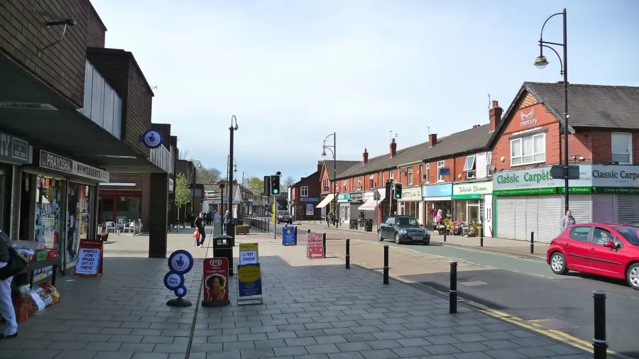
Romiley sits in the borough of Stockport, in the North West, with the SK6 postcode it shares with Marple and Bredbury. Stockport town centre is a few miles west, and Manchester lies beyond that. Marple is the nearest neighbour to the east, where the land starts climbing towards the Peak District.
What draws people here is the balance. You get a named, settled town with its own railway station rather than an anonymous suburb, but you are still inside a large borough with hospitals, colleges and big shopping centres within a short journey. For tenants moving from busier parts of Greater Manchester, that mix of quiet and connection is usually the pull.
Stockport as a whole has a population of around 294,773, so Romiley is a small piece of a big borough. Social housing is a smaller share here than the England average, which means swaps matter: a mutual exchange is often the most realistic route into a place like this. Families tend to move for the schools and the green space, and older tenants for the flat, walkable centre.
Swapping to Romiley: key facts
Can I swap my council or housing association home to Romiley?
Yes, if you are already a council or housing association tenant. Mutual exchange means swapping homes with another social tenant, so it does not depend on the council waiting list: you need a tenant in or near Romiley who wants your area, and both landlords must agree. Landlords have 42 days to decide and can only refuse on set legal grounds. In 2024 to 2025, 191 council homes in Stockport changed tenants by mutual exchange.
How long is the council housing waiting list in Romiley?
8,208 households were on the Stockport housing register on 31 March 2025, up 29% on a year earlier. 921 social homes were let through the council in 2024 to 2025, roughly 8.9 households for every home let. Source: Local Authority Housing Statistics, Ministry of Housing, Communities and Local Government.
How much is social rent in Romiley?
Average weekly social rents in the Stockport council area in 2025/26: 1 bed £83 council, £98 housing association; 2 bed £95 council, £109 housing association; 3 bed £106 council, £119 housing association. Affordable rent homes cost more, typically 60 to 80% of market rent. Source: Regulator of Social Housing.
How much social housing is there in Romiley and who owns it?
13.3% of homes in the Stockport council area are social housing (council 7.8%, housing association 5.5%), against 17.1% across England, according to the 2021 Census. The biggest social landlords there are Stockport Metropolitan Borough Council (10,896 homes), Great Places Housing Association (1,735 homes) and The Guinness Partnership Limited (1,327 homes).
How much is Council Tax in Romiley?
In 2026 to 2027, Council Tax in the Stockport council area is £1,746 a year for Band A, £2,037 for Band B, £2,328 for Band C and £2,619 for Band D, for two adults, including police, fire and the average parish charge. The England average for Band D is £2,392. Someone living alone gets 25% off. Source: Ministry of Housing, Communities and Local Government.
What is the average salary in Romiley?
The typical (median) full-time salary for people living in the Stockport council area was £39,318 a year before tax in 2025, against £39,243 across England. For jobs based in the area, including people who travel in, it was £35,406. Source: Office for National Statistics, Annual Survey of Hours and Earnings.
Who is the MP for Romiley?
Lisa Smart (Liberal Democrat) is the MP for Hazel Grove, the constituency that covers Romiley. Correct on 11 November 2026. Source: UK Parliament.
How Busy Is The Swap Market In Romiley?
Figures as of 12 November 2026, updated every night. The waiting list figure is from 2024 to 2025 government data.
Homes to swap near Romiley
Homes are shown near their address, not on it. Contains OS data © Crown copyright and database right. Source: Office for National Statistics, Open Government Licence.
No homes listed within 5 miles at the moment. New homes are listed every week: see homes across Greater Manchester, use the alert form below, or list your own home so tenants here can find you.
Housing in Romiley
Stockport is a borough of owner-occupiers. Across the council area, 71.1% of homes are owned outright or with a mortgage, 14.4% are privately rented and 13.3% are socially rented, below the England figure of 17.1%. Council homes make up 7.8% and housing association homes 5.5%. In practice, social homes in Romiley are in demand and don't come up often.
Average weekly social rents in Stockport for 2025/26 are around £88 for one bed, £100 for two beds and £109 for three beds. Stockport Metropolitan Borough Council is by far the biggest social landlord with 10,896 homes, followed by Great Places Housing Association, The Guinness Partnership, Mosscare St. Vincent's and Your Housing.
The age profile across the borough is close to the national average, with slightly more residents aged 65 and over at 20.1%. At 31 March 2025 there were 8,208 households on Stockport's housing register, and 921 social homes were let through the council in 2024-25. A register is not a simple queue, which is why 191 council homes changed hands by mutual exchange that year.
Who owns the homes
Share of homes in the Stockport council area, Census 2021.
Ages
Share of people in each age group, Census 2021.
Council waiting list and lettings
Households on the register by the size of home they need.
That is roughly 8.9 households waiting for every social home let in a year. Mutual exchange doesn't use the waiting list: if you already have a council or housing association home, swapping with another tenant can be a quicker way to move to Romiley.
A register counts households who have applied, so it isn't a simple queue: some are already social tenants hoping to transfer, and people can be on more than one council's list.
Typical weekly social rents in the Stockport council area
Social rent averages for 2025/26. Affordable rent homes cost more, typically 60 to 80% of market rent.
Biggest social landlords in the council area
- Stockport Metropolitan Borough Council10,896 homes
- Great Places Housing Association1,735 homes
- The Guinness Partnership Limited1,327 homes
- Mosscare St. Vincent's Housing Group Limited1,180 homes
- Your Housing Limited1,006 homes
- Stockport Homes Limited1,000 homes
- Onward Homes Limited847 homes
- Sanctuary Housing Association793 homes
Compare these landlords against every other on tenant satisfaction, repairs and complaints.
Living in Romiley
Day to day, most of what you need sits within half a mile. There's an Aldi and a Co-operative Food nearby, Cohens Chemist for prescriptions, and a Morrisons and Asda a little further out towards Bredbury. Bredbury Shops and, further in, Clarendon and Merseyway shopping centres cover the bigger trips.
Streets are a mix of older terraces, inter-war semis and newer estates, so homes vary street by street. Romiley Park is the main local green space, with Bredbury Recreation Ground and Brabyns Park within a couple of miles. Bredbury Library is half a mile away. Stepping Hill Hospital is under three miles for anything serious. It is the sort of place where the shops, the station and the park are all part of the same short walk.
Schools in Romiley
Families are well served for schools. Romiley Primary School is 0.3 miles away, with St Christopher's Catholic Primary at 0.5 miles and Greave Primary and Bredbury Green Primary both around 0.7 miles. Overdale Centre is also within a mile. That gives real choice within a short walk or very short drive.
For secondary, Harrytown Catholic High School is half a mile away and Werneth School 0.7 miles. Marple Hall School is about a mile, with Castle Hill High School and Bridge House School within two. Admission depends on catchments and places available in the year you need, so check with Stockport Council before counting on a particular school.
Outside school, Romiley Park is the obvious spot for younger children, with Bredbury Recreation Ground, Pennine Park and Brabyns Park nearby for a change of scene. Bredbury Library is a short hop for books and school holiday activities. There's a Scout Association base under a mile away and Brabyns Recreation Centre within 1.5 miles. Across Stockport, 18.8% of residents are under 16, slightly above the England figure.
Primary schools
- Romiley Primary School Good 20200.3 mi
- St Christopher's Catholic Primary School Good 20230.5 mi
- Greave Primary School Report card 20260.7 mi
- Bredbury Green Primary School Good 20240.7 mi
- Overdale Centre0.8 mi
Secondary schools
- Harrytown Catholic High School Inspected 20240.5 mi
- Werneth School Report card 20260.7 mi
- Marple Hall School Good 20231 mi
- Castle Hill High School Outstanding 20231.4 mi
- Bridge House School1.7 mi
Parks
- Romiley Park0.3 mi
- Bredbury Recreation Ground1 mi
- Penine Park1.1 mi
- Brabyns Park1.4 mi
- Woodlands Park1.6 mi
Libraries
- Bredbury Library0.5 mi
- Brinnington Library1.9 mi
- Great Moor Library2.5 mi
- Hyde Library2.6 mi
- Hazel Grove Library2.6 mi
Green good or better (on report cards, the expected standard or better), amber requires improvement or an area needs attention, red inadequate or an area needs urgent improvement, with the year of the inspection. Since September 2024 Ofsted no longer gives one overall grade, so newer results ("Report card", "Inspected") are coloured by their weakest area. Click a school for its full report. Ofsted data at 31 October 2026.
Shops in Romiley
Supermarkets
- Aldi0.3 mi
- The Co-operative Food0.5 mi
- Morrisons1.3 mi
- Co-op Food1.7 mi
- Asda1.7 mi
Pharmacies
- Cohens Chemist0.6 mi
- Medichem Pharmacy0.9 mi
- Lilley's1.7 mi
- Well Pharmacy1.8 mi
- Superdrug1.8 mi
Hospitals
- Park Lodge Independent Hospital0.4 mi
- The Meadows1.6 mi
- Marple Cottage Surgery1.9 mi
- Devonshire Neurorehabilitation Centre2.3 mi
- Stepping Hill Hospital2.7 mi
Shopping centres
- Bredbury Shops1.3 mi
- Clarendon Shopping Centre2.6 mi
- Merseyway Shopping Centre2.9 mi
Getting around Romiley
Romiley station is barely a tenth of a mile from the centre, which is the single biggest practical advantage of living here. Bredbury and Woodley stations are around a mile away, with Rose Hill Marple and Marple within two miles, so you have options if one line suits you better than another.
Buses serve the area and link towards Marple, where the stands at Marple Sixth Form College sit about 1.8 miles away. If you rely on buses, it is worth checking the specific routes and evening times for your street before you commit, as frequency varies across the borough.
By car, you are well placed for Stockport town centre and the roads out towards Manchester and the Peak District, though the roads through Romiley and Bredbury get busy at school run and commuting times. On foot, the centre is compact and most everyday errands, the park, the station and a pharmacy are doable without driving. Hillier streets towards the edges can be hard work if walking is difficult for you, so look at the gradient around any home you are offered.
Train stations
- Romileynearby
- Bredbury1 mi
- Woodley1.1 mi
- Rose Hill Marple1.4 mi
- Marple1.7 mi
Bus stations
- Marple Sixth Form College Stand 11.8 mi
- Marple Sixth Form College Stand 31.8 mi
- Marple Sixth Form College Stand 21.8 mi
- Marple Sixth Form College Stand 41.8 mi
- Marple Sixth Form College Stand 51.8 mi
Things to do in Romiley
Romiley's centre punches above its size for pubs. The Romiley Arms, The Friendship and Platform One are all right by the station, with the Duke of York and Stock Dove a short walk on. It makes for an easy night out that doesn't need a taxi home.
For exercise, Life Leisure is 0.3 miles away, with PureGym, Manchester Strength & Conditioning and Life Leisure Brinnington Park Fitness all within a couple of miles. Green space is the other draw: Romiley Park first, then Brabyns Park and Woodlands Park for longer walks.
Film fans have the Regent at 1.8 miles and The Light Stockport just under three. Bredbury Hall is the nearest nightlife venue at 1.3 miles, with Holy Diver further in towards Stockport. Community life runs through places like Gee X Community Centre, Marple Con Club and Ludworth & Mellor Women's Institute, all within about two miles. Bigger shopping and eating out means heading to Stockport town centre, which is easy enough by train.
Gyms
- Life Leisure0.3 mi
- PureGym1.7 mi
- Manchester Strength & Conditioning1.8 mi
- Life Lesuire Brinnington Park Fitness2.1 mi
- Unit Fitness2.6 mi
Cinemas
- Regent1.8 mi
- The Light Stockport2.9 mi
Pubs and bars
- The Romiley Armsnearby
- The Friendshipnearby
- Platform Onenearby
- Duke of Yorknearby
- Stock Dove0.3 mi
Nightlife
- Bedbury Hall1.3 mi
- Holy Diver2.8 mi
Community centres
- The Scout Association0.8 mi
- Brabyns Recreation Centre1.4 mi
- Gee X Community Centre1.7 mi
- Ludworth & Mellor Women's Institute1.8 mi
- Marple Con Club1.9 mi
Jobs in Romiley
Employment figures cover the wider Stockport council area rather than Romiley alone, but they paint a steady picture. 58.5% of adults are in work, a little above the England figure of 57.4%, and unemployment sits at 2.8% against 3.5% nationally. Unemployment-related benefit claims stood at 3% of 16 to 64 year olds in August 2026, below the England figure of 4%.
Stockport is a borough of around 294,773 people, so the local job market is broad rather than tied to one employer. Health and care, retail, schools and office work in Stockport town centre are the mainstays for many households, with Stepping Hill Hospital under three miles from Romiley.
The train station matters here for work as much as leisure. Commuting into Stockport or Manchester is realistic without a car, which widens your options if you are job hunting after a move. If you work shifts or unsocial hours, check last train and bus times before you decide, as that is where an otherwise good commute can fall down.
Figures are for the Stockport council area, Census 2021 and ONS claimant count.
Typical Pay
Median yearly pay before tax for full-time workers, 2025. Half earn more than this and half earn less.
Where The Jobs Are
The five biggest industries by share of employee jobs, 2024. "Health" includes hospitals, GP surgeries and care homes.
Jobcentres And Recruitment Agencies
- Jobcentre Plus2.7 mi
- Think Employment Stockport2.8 mi
- Jobwise2.8 mi
- The Best Connection Employment Group2.9 mi
- Education and Careers Advice Service2.9 mi
- Apprenticeships Store2.9 mi
From OpenStreetMap, which doesn't list every agency. Find more on Find a job (GOV.UK).
Council tax and MP in Romiley
Council Tax 2026 to 2027
Yearly bill for two adults, including police, fire and the average parish charge. Most council and housing association homes are in Bands A to C. Living alone takes 25% off, and you may get Council Tax Reduction on a low income.
Your MP
Lisa Smart (Liberal Democrat) is the MP for Hazel Grove, which covers Romiley. Near the edges, find the MP for your postcode.
An MP can help with problems involving government departments and, sometimes, your landlord or council.
Broadband in Romiley
Share of homes that can get each speed, Ofcom, January 2026. Check an address on Ofcom's broadband checker.
Deprivation in Romiley
The Stockport council area ranks 158th of 296 council areas in England on the Index of Multiple Deprivation 2025, where 1st is the most deprived. 7.9% of its neighbourhoods are among the most deprived 10% in England.
The index combines seven measures, including income, work, health, education and housing. It describes areas, not the people who live in them.
Swapping to Romiley
If Romiley looks like the right fit, the practical next step is to get your own home listed. A mutual exchange works both ways: someone has to want what you have, so good photos, honest room descriptions and a clear note about your garden, parking or floor level make a real difference.
Set Romiley as a desired area, and think about adding neighbouring places like Bredbury, Woodley and Marple too. They sit within a couple of miles, share the same railway lines and schools, and widening your search that little bit can turn a long wait into a match. Be clear about what you need: bedroom count, ground floor, or a particular school catchment.
Then keep your listing active and reply quickly when someone gets in touch. Swaps often come together between people who are both ready to move. Arrange to view, check the home and the street in person, and make sure both landlords approve before anything is agreed.
Home alerts for Romiley
One email, the first time a council or housing association home is listed within your chosen distance. No newsletter, no spam.
Nearby place guides
Thinking of moving a little further? Compare homes to swap, rents and local landlords in places near Romiley.
All place guides in Greater Manchester → · All place guides in the North West → · All regions →
On X: Homes Near Romiley
Home to swap: 1-bed flat in Ashton-under-Lyne. Looking to move to Hyde.
#AshtonUnderLyne #Hyde #JigsawHomesTameside