What it's like to live in Sprowston
Sprowston is a big suburban community of around 17,125 people on the northern edge of Norwich, in the Broadland district of Norfolk. It feels settled and practical rather than showy, with a mix of older streets and newer estates. It suits families and anyone who wants city amenities close by without living in the middle of them. Sparhawk Park and Sprowston Library are both within half a mile.
"I'd move here" adds Sprowston to the areas on your listing, so homes here are matched to you first.
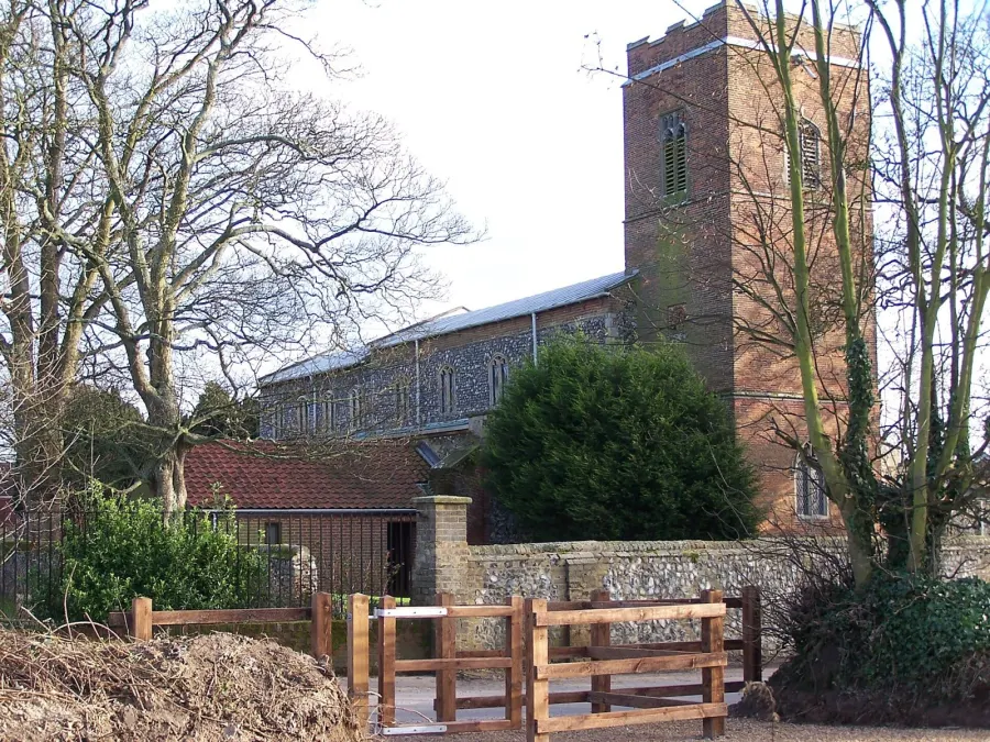
Sprowston sits in the Broadland district of Norfolk, immediately north-east of Norwich. The city centre is a little over two miles away, close enough that Sprowston works as a suburb while keeping its own schools, library and shops. Norfolk's coast and the Broads are both within easy reach by car.
People move here for the balance. You get a full set of everyday services on the doorstep plus the pull of a cathedral city with shopping centres, cinemas and a mainline train station a short hop away. That combination tends to appeal to families, to people starting a new job in Norwich, and to anyone trading a tight city flat for something with more room around it.
Broadland as a whole is a largely owner-occupied district of about 131,721 people, so social housing here is less common than the England average. That makes a mutual exchange a realistic route in for tenants who want to be in this part of Norfolk. Nearby Norwich, Thorpe St Andrew and Rackheath are all within a short drive if Sprowston itself does not have what you need.
Swapping to Sprowston: key facts
Can I swap my council or housing association home to Sprowston?
Yes, if you are already a council or housing association tenant. Mutual exchange means swapping homes with another social tenant, so it does not depend on the council waiting list: you need a tenant in or near Sprowston who wants your area, and both landlords must agree. Landlords have 42 days to decide and can only refuse on set legal grounds.
How long is the council housing waiting list in Sprowston?
869 households were on the Broadland housing register on 31 March 2025, down 17% on a year earlier. 459 social homes were let through the council in 2024 to 2025, roughly 1.9 households for every home let. Source: Local Authority Housing Statistics, Ministry of Housing, Communities and Local Government.
How much is social rent in Sprowston?
Average weekly social rents in the Broadland council area in 2024/25: 1 bed £0 council, £95 housing association; 2 bed £0 council, £111 housing association; 3 bed £130 council, £122 housing association. Affordable rent homes cost more, typically 60 to 80% of market rent. Source: Regulator of Social Housing.
How much social housing is there in Sprowston and who owns it?
9.7% of homes in the Broadland council area are social housing (council 1.1%, housing association 8.6%), against 17.1% across England, according to the 2021 Census. The biggest social landlords there are Clarion Housing Association Limited (4,037 homes), Flagship Housing Limited (1,104 homes) and Saffron Housing Trust Limited (437 homes).
How Busy Is The Swap Market In Sprowston?
Figures as of 23 October 2026, updated every night. The waiting list figure is from 2024 to 2025 government data.
Which homes are available to swap near Sprowston?
Homes are shown near their address, not on it. Contains OS data © Crown copyright and database right. Source: Office for National Statistics, Open Government Licence.
No homes listed within 5 miles at the moment. New homes are listed every week: see homes across Norfolk, use the alert form below, or list your own home so tenants here can find you.
What is housing like in Sprowston and who lives there?
Housing in Broadland leans heavily towards ownership. Across the council area, 77.1% of homes are owned, 12.3% are privately rented and just 9.7% are social rented, split between 1.1% council and 8.6% housing association. That is well below the England figure of 17.1%, so social homes here are in demand and a mutual exchange is often the most practical way to move in.
Clarion Housing Association is much the largest social landlord locally with around 4,037 homes, followed by Flagship Housing with 1,104, Saffron Housing Trust with 437, Broadland Housing Association with 371 and Orbit with 350. Average weekly social rents in the council area for 2024/25 were £95 for one bed, £111 for two beds and £122 for three.
The age profile is older than average: 28.3% are aged 45 to 64 and 16.1% are under 16. For context on demand, Broadland's housing register held 869 households at 31 March 2025, with 459 social homes let through the council in 2024-25.
Council waiting list and lettings
Households on the register by the size of home they need.
That is roughly 1.9 households waiting for every social home let in a year. Mutual exchange doesn't use the waiting list: if you already have a council or housing association home, swapping with another tenant can be a quicker way to move to Sprowston.
A register counts households who have applied, so it isn't a simple queue: some are already social tenants hoping to transfer, and people can be on more than one council's list.
Typical weekly social rents in the Broadland council area
| Size | Council | Housing association |
|---|---|---|
| Bedsit | £0 | £89 |
| 1 bed | £0 | £95 |
| 2 bed | £0 | £111 |
| 3 bed | £130 | £122 |
| 4 bed | £0 | £143 |
Social rent averages for 2024/25. Affordable rent homes cost more, typically 60 to 80% of market rent.
Biggest social landlords in the council area
- Clarion Housing Association Limited4,037 homes
- Flagship Housing Limited1,104 homes
- Saffron Housing Trust Limited437 homes
- Broadland Housing Association Limited371 homes
- Orbit Housing Association Limited350 homes
- Legal & General Affordable Homes Limited209 homes
- Orbit Group Limited160 homes
- Sage Homes RP Limited93 homes
What is it like to live in Sprowston?
Day to day, most things you need are near at hand. There is a Tesco Extra about half a mile away, with Lidl, Aldi and Morrisons all within just over a mile, so weekly shopping does not mean a trek into the city. Pharmacies are a little further out, around a mile, at Wellbeing and Woodside.
Green space is scattered through the area rather than in one big block. Sparhawk Park sits right on the doorstep, Barkers Lane Open Space is half a mile away, and Catton Park and Fountain Park are both about a mile. The Sprowston Diamond Centre and other community centres nearby give the area a bit of a hub, and The Blue Boar is the closest pub at under half a mile.
What are the schools and family life like in Sprowston?
Families are well served for schools. Sparhawk Infant School & Nursery is 0.2 miles away, with Cecil Gowing Infant School, Sprowston Infant School and Sprowston Junior School all within about a third of a mile, and Falcon Junior School at 0.4 miles. That cluster of infant and junior schools is one of the practical reasons people pick Sprowston.
For older children, Sprowston Community Academy is just 0.3 miles away. Open Academy is 0.8 miles, Sewell Park Academy 1.2 miles and Hall School 1.3 miles, with Include School Norfolk at 1.7 miles. Admission depends on places and catchments rather than distance alone, so check with Norfolk County Council before you count on a particular school.
Outside school hours there is Sparhawk Park on the doorstep, Barkers Lane Open Space nearby, and bigger green space at Catton Park about a mile away. Sprowston Library is a short walk and the Diamond Centre, Frere Road Community Centre and Woodside Centre host local groups, including 231 Squadron Air Cadets a short way off.
Primary schools
- Sparhawk Infant School & Nurserynearby
- Cecil Gowing Infant School0.3 mi
- Sprowston Infant School0.3 mi
- Sprowston Junior School0.3 mi
- Falcon Junior School0.4 mi
Secondary schools
- Sprowston Community Academy0.3 mi
- Open Academy0.8 mi
- Sewell Park Academy1.2 mi
- Hall School1.3 mi
- Include School Norfolk1.7 mi
Parks
- Sparhawk Parknearby
- Barkers Lane Open Space0.5 mi
- Catton Park1.1 mi
- Fountain Park1.1 mi
- Saint Clements Park1.2 mi
Libraries
- Sprowston Library0.4 mi
- St Williams Way Library1.4 mi
- Plumstead Road Library1.4 mi
- Mile Cross Library1.9 mi
- Norfolk and Norwich Millennium Library2.4 mi
What shops and everyday essentials are in Sprowston?
Supermarkets
- Tesco Extra0.5 mi
- Lidl0.6 mi
- Aldi0.8 mi
- Morrisons1.1 mi
- Norwich Fresh Store1.3 mi
Pharmacies
- Wellbeing Pharmacy1 mi
- Woodside Pharmacy1.2 mi
- Hunt's Pharmacy1.3 mi
- Woodgrove Pharmacy1.4 mi
- Lionwood Pharmacy1.6 mi
Hospitals
- Magna Medical Centre2.4 mi
- Norwich Community Hospital3 mi
Shopping centres
- Castle Quarter shopping centre2.3 mi
- Chantry Place2.5 mi
How do you get around Sprowston?
Norwich railway station is about 2.2 miles away, which puts regional and longer-distance trains within reach without a long journey first. Norwich Bus Station, the hub for services around Norfolk, is roughly 2.6 miles off, and local bus stops serve the main roads through Sprowston for trips into the city.
By car, Sprowston is well placed for the northern side of Norwich and for roads out towards the coast and the Broads. Parking varies a lot street by street: older terraces and some estate roads are tighter than the newer developments, so it is worth looking at an evening when you view a property.
On foot, the core of Sprowston is manageable. Schools, the library, parks and the big supermarkets are all within a mile or so, which means plenty of short trips can be done without driving. Walking the whole way into Norwich centre is possible but it is a steady two miles plus, so most people use the bus or drive for that. Norwich Community Hospital is around three miles away.
Train stations
- Norwich2.2 mi
Bus stations
- Norwich Bus Station2.6 mi
What is there to do in Sprowston?
Close to home, life is low-key: parks, the library, and a decent run of pubs. The Blue Boar is the nearest at 0.4 miles, with The Brickmakers, The Woodman, The Maids Head and The Heath House all within just over a mile. Catton Park and Fountain Park give you somewhere bigger to walk at about a mile out.
For a night out or a bigger shop, Norwich does the heavy lifting. Castle Quarter shopping centre is 2.3 miles away and Chantry Place 2.5 miles. There are three cinemas within reach: Cinema City at 2.1 miles, plus the Odeon and Vue at around 2.3 miles. The city's bars and clubs cluster about two miles off, so a taxi home is short.
If you train or exercise, there is a spread of options between one and two miles, including Elite Strength & Conditioning, Nuffield Health, Fully Pumped Gym, FireFly Poles Studio and PureGym. Community centres nearby often run classes and groups too.
Gyms
- Elite Strength & Conditioning1.5 mi
- Nuffield Health Fitness & Wellbeing1.6 mi
- Fully Pumped Gym1.6 mi
- FireFly Poles Studio1.7 mi
- PureGym1.8 mi
Cinemas
- Cinema City2.1 mi
- Odeon2.3 mi
- Vue Cinema2.3 mi
Pubs and bars
- The Blue Boar0.4 mi
- The Brickmakers0.7 mi
- The Woodman0.8 mi
- The Maids Head1 mi
- The Heath House1.1 mi
Nightlife
- AK2.1 mi
- Kudos2.1 mi
- popWorld2.1 mi
- Bar & Beyond2.1 mi
- Qube2.1 mi
Community centres
- Sprowston Diamond Centre0.7 mi
- 231 Squadron Air Cadets0.9 mi
- Frere Road Community Centre1 mi
- Woodside Centre1.2 mi
- Greenfields Community Centre1.4 mi
What is work and the local economy like in Sprowston?
Broadland is a district where work is widely spread rather than built around one big employer, and its proximity to Norwich matters. Many residents commute the short distance into the city for jobs in retail, health, education and offices, while Sprowston's own supermarkets, schools and services employ locally.
The figures for the wider Broadland council area show a steady picture. At the 2021 Census, 56.6% of adults were in work, close to the England figure of 57.4%, while unemployment stood at 2% against 3.5% for England. More recently, 2.1% of 16 to 64 year olds were claiming unemployment-related benefits in September 2026, against 4% across England.
That relatively low unemployment is good news if you are job hunting, though it also reflects an older population: 25.9% of Broadland residents are 65 or over, compared with 18.4% nationally. Being within a couple of miles of Norwich station widens the net if you need to look further afield for work or training.
Figures are for the Broadland council area, Census 2021 and ONS claimant count.
How safe is Sprowston?
Like every town centre, Sprowston has police incidents logged each month. In August 2026 there were 111 within about a mile of the centre, made up of:
- Anti-social behaviour reports22
- Vehicle crime4
- Bicycle theft1
- Shoplifting10
- Other theft9
- Theft from the person1
Source: data.police.uk street-level crime. Counts cover a fixed one-mile radius around the centre, so busy high streets and stations always record far more than the residential streets around them, and most incidents are minor. Compare like with like: a similar-sized town centre, not a village.
Is Sprowston a good place for social housing tenants?
If Sprowston looks like the right fit, the next step is simple. Create a listing for your current home with clear photos and an honest description of the layout, the garden or balcony, the heating and any parking. Tenants looking at a swap want to picture themselves living there, and detail saves everyone wasted messages.
Then set Sprowston as one of your desired areas. It is worth adding nearby options too, such as Norwich itself or neighbouring parts of Broadland, because that widens the pool of people who might match with you. Mention what matters to you, whether that is being near the infant and junior schools, a ground-floor home, or a short bus ride into the city.
Swaps take patience. Check the site regularly, reply quickly and politely, and always view in person before you agree anything. Remember your landlord and the other tenant's landlord both need to approve the exchange. Get your listing up and the right match can find you while you get on with everything else.
Tell me when a home appears near Sprowston
One email, the first time a council or housing association home is listed within your chosen distance. No newsletter, no spam.
Live in Sprowston? Add a photo
Tenants' own photos help other people picture the place. Approved photos are credited to you. Submit a photo.
Nearby place guides
Thinking of moving a little further? Compare homes to swap, rents and local landlords in places near Sprowston.
All place guides in Norfolk → · All place guides in the East of England → · All regions →