What it's like to live in Bromsgrove
Bromsgrove is a mid-sized Worcestershire market town with a compact centre, plenty of everyday shops and open countryside not far beyond the edges. It suits families and anyone who wants town facilities without big-city scale. Sanders Park and Bromsgrove Recreation Ground are both close to the middle of town, and the library sits right by the shops.
"I'd move here" adds Bromsgrove to the areas on your listing, so homes here are matched to you first.
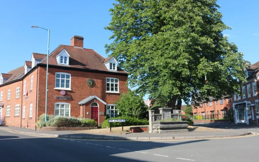
Bromsgrove sits in north Worcestershire, on the edge of the West Midlands but with green country close by. The town itself is home to around 29,000 people, while the wider Bromsgrove council area covers about 99,000.
It's a market town with a proper centre, a good spread of supermarkets, schools within a short walk of most of the town and a station with links towards Birmingham and Worcester. The postcode district is B60.
This guide is for council and housing association tenants weighing up a mutual exchange here. It sticks to what we know about the place: what daily life looks like, what the schools and parks are like nearby, and what social housing is like in the district.
Swapping to Bromsgrove: key facts
Can I swap my council or housing association home to Bromsgrove?
Yes, if you are already a council or housing association tenant. Mutual exchange means swapping homes with another social tenant, so it does not depend on the council waiting list: you need a tenant in or near Bromsgrove who wants your area, and both landlords must agree. Landlords have 42 days to decide and can only refuse on set legal grounds.
How long is the council housing waiting list in Bromsgrove?
2,755 households were on the Bromsgrove housing register on 31 March 2025, up 16% on a year earlier. 281 social homes were let through the council in 2024 to 2025, roughly 9.8 households for every home let. Source: Local Authority Housing Statistics, Ministry of Housing, Communities and Local Government.
How much is social rent in Bromsgrove?
Average weekly social rents in the Bromsgrove council area in 2025/26: 1 bed £0 council, £97 housing association; 2 bed £0 council, £115 housing association; 3 bed £0 council, £128 housing association. Affordable rent homes cost more, typically 60 to 80% of market rent. Source: Regulator of Social Housing.
How much social housing is there in Bromsgrove and who owns it?
10.7% of homes in the Bromsgrove council area are social housing (council 3.5%, housing association 7.2%), against 17.1% across England, according to the 2021 Census. The biggest social landlords there are Bromsgrove District Housing Trust Limited (3,809 homes), Bromford Housing Association Limited (341 homes) and Citizen Housing Group Limited (262 homes).
How Busy Is The Swap Market In Bromsgrove?
Figures as of 5 November 2026, updated every night. The waiting list figure is from 2024 to 2025 government data.
Which homes are available to swap near Bromsgrove?
Homes are shown near their address, not on it. Contains OS data © Crown copyright and database right. Source: Office for National Statistics, Open Government Licence.
No homes listed within 5 miles at the moment. New homes are listed every week: see homes across Worcestershire, use the alert form below, or list your own home so tenants here can find you.
What is housing like in Bromsgrove and who lives there?
Social housing is thinner on the ground here than in most of England. Just 10.7% of homes in the Bromsgrove council area are socially rented, against 17.1% nationally, split between 3.5% council and 7.2% housing association. Most homes, 77.5%, are owner-occupied, with 10.6% privately rented.
Bromsgrove District Housing Trust is by far the biggest social landlord with around 3,756 homes. Bromford, Platform, Citizen Housing Group and Midland Heart hold smaller numbers between them.
Average weekly social rents in the district for 2024/25 were £94 for a one-bed, £111 for a two-bed and £125 for a three-bed. Because the social stock is comparatively small, swaps here don't come up as often as in bigger urban areas, which is all the more reason to get your listing in early and be patient.
Who owns the homes
Share of homes in the Bromsgrove council area, Census 2021.
Ages
Share of people in each age group, Census 2021.
Council waiting list and lettings
Households on the register by the size of home they need.
That is roughly 9.8 households waiting for every social home let in a year. Mutual exchange doesn't use the waiting list: if you already have a council or housing association home, swapping with another tenant can be a quicker way to move to Bromsgrove.
A register counts households who have applied, so it isn't a simple queue: some are already social tenants hoping to transfer, and people can be on more than one council's list.
Typical weekly social rents in the Bromsgrove council area
Social rent averages for 2025/26. Affordable rent homes cost more, typically 60 to 80% of market rent.
Biggest social landlords in the council area
- Bromsgrove District Housing Trust Limited3,809 homes
- Bromford Housing Association Limited341 homes
- Citizen Housing Group Limited262 homes
- Platform Housing Limited260 homes
- Midland Heart Limited129 homes
- Stonewater Limited92 homes
- Southern Housing51 homes
- Housing 2151 homes
Compare these landlords against every other on tenant satisfaction, repairs and complaints.
What is it like to live in Bromsgrove?
Day to day, a lot is packed into a small area. Bromsgrove Town Centre, Bromsgrove Retail Park, Asda, Aldi, Lidl, Waitrose and Poundland all sit within half a mile of the centre, along with Boots and several other pharmacies. Health services are close too, including BHI Parkside, Churchfields Surgery and the Modality Treatment Centre.
The area skews a little older than England as a whole: 22.9% of people in the council area are 65 or over, against 18.4% nationally. Under-16s make up 18.1%, so there are still plenty of families about. As with any busy town centre, police record a number of incidents each month within a mile of the middle, most of them minor.
What are the schools and family life like in Bromsgrove?
For a town this size, the choice of schools is one of Bromsgrove's strong points. Bromsgrove uses a first-school system, and Meadows First School, Finstall First School, St Peter's Catholic First School, Millfields First School and The Orchards School are all within a mile of the centre.
For older children, North Bromsgrove High School And Sixth Form is a third of a mile from the middle of town and South Bromsgrove High is around three quarters of a mile. Having two secondaries that close is unusual and worth factoring in if you've got teenagers.
Outside school, there are parks on the doorstep at Shipleys, Bromsgrove Recreation Ground, Sanders Park, Aston Fields Recreation Ground and Pennine Open Space. Bromsgrove Library is a short walk from the centre, and Catshill Community Library serves the north of town. Girlguiding Bromsgrove Headquarters and the Evergreens Scout Hut cover groups for children.
Primary schools
- Meadows First School0.4 mi
- Bromsgrove Prep School0.5 mi
- Finstall First School0.5 mi
- The Orchards School0.8 mi
- Millfields First School0.8 mi
Secondary schools
- Parkside Middle School0.3 mi
- North Bromsgrove High School0.3 mi
- St John's Church of England Middle School Academy0.4 mi
- Bromsgrove School0.5 mi
- South Bromsgrove High0.7 mi
Parks
- Sanders Park0.6 mi
- King George's Field0.8 mi
- Penmanor Playing Field1.3 mi
- Brine Well Park2.8 mi
- Henbrook Park Area2.8 mi
Libraries
- Bromsgrove Librarynearby
- Catshill Library1.9 mi
What shops and everyday essentials are in Bromsgrove?
Supermarkets
- Asdanearby
- Aldi0.3 mi
- Lidl0.3 mi
- The Food Warehouse0.3 mi
- Waitrose0.3 mi
Pharmacies
- Knights Pharmacynearby
- Bromsgrove Pharmacy0.4 mi
Hospitals
- Princess of Wales Community Hospital0.6 mi
- Bromsgove Private Hospital2.3 mi
How do you get around Bromsgrove?
Bromsgrove station is about a mile from the town centre, so it's a walk, a short bus ride or a quick drive depending on how you're fixed. There are bus stops at Station Approach and at the station itself, plus stops out towards Old Birmingham Road and Doctors Hill for the edges of town.
Within the town, walking works well. The centre, library, retail park, leisure centre and several supermarkets all sit within about a third of a mile of each other, so a lot of errands can be done on foot from central addresses.
If you drive, you're well placed for the wider West Midlands and Worcestershire. If you don't, the combination of a compact centre and a nearby station and bus stops means you're not stuck, though you'll want to check the route from any specific address before you commit to a swap.
Train stations
- Bromsgrove1.1 mi
Bus stations
- Bromsgrove Bus Stationnearby
What is there to do in Bromsgrove?
The town centre carries most of the social life. There's a decent run of pubs and bars close together, including the Red Lion, the Slug & Lettuce, Verraco Lounge, marlene fink bar and Casa Med Tapas Bar and Restaurant, so a night out doesn't mean travelling.
For exercise, Bromsgrove Sport & Leisure Centre is a couple of minutes from the centre, with PureGym at the retail park and smaller independents like TR Fitness Studio and FunKtional Fitness Boutique nearby. The Ryland Centre is also close in.
Films and live music come via Bromsgrove Arts, home of Fairfield Flicks and Fairfield Music, about two and a half miles out. Community life runs through places like Connect Bromsgrove, The Pod and Starlight Cafe. The parks do a lot of heavy lifting the rest of the time, and there's countryside within easy reach of town.
Gyms
- Altered Images0.4 mi
- Foundry Gym0.4 mi
- Lifeline Fitness1 mi
- Revolution Gym1 mi
- Lowcost Gyms1 mi
Pubs and bars
- The Red Lionnearby
- The Grovenearby
- The Old Post Officenearby
- Golden Cross Hotelnearby
- The Queens Headnearby
Nightlife
- Love 2 Lovenearby
- Millfields Social Club0.8 mi
Community centres
- Finstall Village Hall1.3 mi
- Burcot Village Hall1.4 mi
- Avoncroft Arts Centre1.6 mi
- Catshill Village Hall2 mi
- Dodford Village Hall2.2 mi
What is work and the local economy like in Bromsgrove?
The Bromsgrove council area does well on the employment measures. 58.3% of adults are in work, a shade above the England figure of 57.4%, and unemployment sits at 2.5% against 3.5% nationally. In August 2026, 2.6% of working-age people were claiming unemployment-related benefits, compared with 4% across England.
That tells you this is a relatively settled, working area rather than one under heavy pressure. The town centre, retail park and supermarkets provide local jobs, and the station gives options for commuting further afield if that suits you.
The age profile backs this up: 28% of people in the council area are aged 45 to 64, more than the England average, with a slightly smaller share of young adults. It's a town that people tend to stay in rather than pass through.
Figures are for the Bromsgrove council area, Census 2021 and ONS claimant count.
How safe is Bromsgrove?
Like every town centre, Bromsgrove has police incidents logged each month. In August 2026 there were 160 within about a mile of the centre, made up of:
Source: data.police.uk street-level crime. Counts cover a fixed one-mile radius around the centre, so busy high streets and stations always record far more than the residential streets around them, and most incidents are minor. Compare like with like: a similar-sized town centre, not a village.
Is Bromsgrove a good place for social housing tenants?
Right now there's one social housing swap listed within fifteen miles of Bromsgrove on Mutual Home Exchange: a two-bed flat in Smethwick, about 11.4 miles away, whose tenant is looking for a sideways move. That's a thin picture, and it reflects how small the social rented sector is in this district.
That doesn't mean a move here is off the table. New homes appear all the time, and tenants looking to leave Bromsgrove will only find you if you're listed.
List your own home, describe it honestly, and set Bromsgrove as a desired area. Adding nearby towns and being flexible on property type will widen your options. Then check back regularly, because in an area with limited stock the right match often comes down to timing.
It's free to list, and it costs nothing to keep looking while you weigh things up.
Tell me when a home appears near Bromsgrove
One email, the first time a council or housing association home is listed within your chosen distance. No newsletter, no spam.
Live in Bromsgrove? Add a photo
Tenants' own photos help other people picture the place. Approved photos are credited to you. Submit a photo.
Nearby place guides
Thinking of moving a little further? Compare homes to swap, rents and local landlords in places near Bromsgrove.
All place guides in Worcestershire → · All place guides in the West Midlands → · All regions →
Latest From @HomeExchangeGB
Home to swap: 2-bed maisonette in Newport. Looking to move to Cranleigh.
#Newport #Cranleigh #WaverleyBoroughCouncil