What it's like to live in Hale
Hale is a well-heeled village-feel town of around 16,715 people in Trafford, on the Greater Manchester and Cheshire border. It is leafy, quiet and tidy, with smart streets and a village centre full of independent places to eat. It suits families and anyone who likes calm surroundings, with Stamford Park on the doorstep and Altrincham's shops and cinemas minutes away.
"I'd move here" adds Hale to the areas on your listing, so homes here are matched to you first.
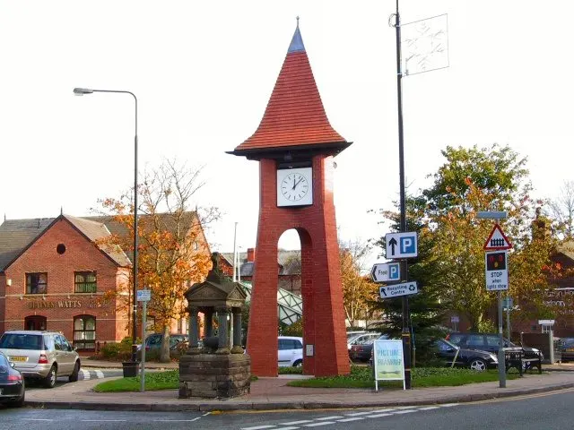
Hale sits in the south of Trafford, in Greater Manchester, right up against the Cheshire boundary. Altrincham is its immediate neighbour, barely half a mile away, and Manchester city centre lies to the north-east. Manchester Airport is about three miles off, which shapes a lot of life and work around here.
People move to Hale for the combination of a quiet, green setting and genuinely good connections. You get a small-town address with a train station, a major bus interchange next door in Altrincham, and motorway-standard links towards Manchester and Cheshire. For families, the pull is often the choice of well-regarded secondary schools within a mile.
It is worth being clear-eyed. Hale is one of the more affluent parts of the North West, and social housing makes up a smaller share of homes here than in many places. Swaps do come up, but it is a patient search rather than a quick one. If you want a settled, low-key base with Altrincham's shops, cinemas and station on your doorstep, it is a strong choice.
Swapping to Hale: key facts
Can I swap my council or housing association home to Hale?
Yes, if you are already a council or housing association tenant. Mutual exchange means swapping homes with another social tenant, so it does not depend on the council waiting list: you need a tenant in or near Hale who wants your area, and both landlords must agree. Landlords have 42 days to decide and can only refuse on set legal grounds.
How long is the council housing waiting list in Hale?
5,246 households were on the Trafford housing register on 31 March 2025, down 26% on a year earlier. 333 social homes were let through the council in 2024 to 2025, roughly 15.8 households for every home let. Source: Local Authority Housing Statistics, Ministry of Housing, Communities and Local Government.
How much is social rent in Hale?
Average weekly social rents in the Trafford council area in 2025/26: 1 bed £0 council, £96 housing association; 2 bed £0 council, £109 housing association; 3 bed £0 council, £122 housing association. Affordable rent homes cost more, typically 60 to 80% of market rent. Source: Regulator of Social Housing.
How much social housing is there in Hale and who owns it?
15% of homes in the Trafford council area are social housing (council 4.2%, housing association 10.8%), against 17.1% across England, according to the 2021 Census. The biggest social landlords there are London & Quadrant Housing Trust (8,758 homes), Irwell Valley Housing Association Limited (2,155 homes) and Your Housing Limited (1,975 homes).
How much is Council Tax in Hale?
In 2026 to 2027, Council Tax in the Trafford council area is £1,528 a year for Band A, £1,782 for Band B, £2,037 for Band C and £2,292 for Band D, for two adults, including police, fire and the average parish charge. The England average for Band D is £2,392. Someone living alone gets 25% off. Source: Ministry of Housing, Communities and Local Government.
What is the average salary in Hale?
The typical (median) full-time salary for people living in the Trafford council area was £42,973 a year before tax in 2025, against £39,243 across England. For jobs based in the area, including people who travel in, it was £38,682. Source: Office for National Statistics, Annual Survey of Hours and Earnings.
Who is the MP for Hale?
Mr Connor Rand (Labour) is the MP for Altrincham and Sale West, the constituency that covers Hale. Correct on 12 November 2026. Source: UK Parliament.
How Busy Is The Swap Market In Hale?
Figures as of 12 November 2026, updated every night. The waiting list figure is from 2024 to 2025 government data.
Homes to swap near Hale
Homes are shown near their address, not on it. Contains OS data © Crown copyright and database right. Source: Office for National Statistics, Open Government Licence.
No homes listed within 5 miles at the moment. New homes are listed every week: see homes across Greater Manchester, use the alert form below, or list your own home so tenants here can find you.
Housing in Hale
Hale is an owner-occupier area in an owner-occupier borough. Across Trafford, 69% of homes are owned outright or with a mortgage, 15.3% are privately rented and 15% are social rented, split between 4.2% council and 10.8% housing association. That social share is slightly below the England figure of 17.1%, so social homes here are in demand.
Average weekly social rents in Trafford for 2025/26 are around £96 for a one bed, £109 for two beds and £122 for three. The biggest social landlords in the borough are London & Quadrant Housing Trust with about 8,758 homes, Irwell Valley Housing Association with 2,155, Your Housing with 1,975, Great Places with 780 and Jigsaw Homes North with 698.
The age profile is fairly balanced: 26.5% of Trafford residents are 25 to 44, 26.3% are 45 to 64 and 17.6% are 65 or over, just under the national figure. Trafford's housing register held 5,246 households at the end of March 2025, with 333 social homes let through the council in 2024-25. A register is not a simple queue, which is one reason a mutual exchange can be worth pursuing.
Who owns the homes
Share of homes in the Trafford council area, Census 2021.
Ages
Share of people in each age group, Census 2021.
Council waiting list and lettings
Households on the register by the size of home they need.
That is roughly 15.8 households waiting for every social home let in a year. Mutual exchange doesn't use the waiting list: if you already have a council or housing association home, swapping with another tenant can be a quicker way to move to Hale.
A register counts households who have applied, so it isn't a simple queue: some are already social tenants hoping to transfer, and people can be on more than one council's list.
Typical weekly social rents in the Trafford council area
Social rent averages for 2025/26. Affordable rent homes cost more, typically 60 to 80% of market rent.
Biggest social landlords in the council area
- London & Quadrant Housing Trust8,758 homes
- Irwell Valley Housing Association Limited2,155 homes
- Your Housing Limited1,975 homes
- Great Places Housing Association780 homes
- Jigsaw Homes North698 homes
- Onward Homes Limited407 homes
- The Guinness Partnership Limited311 homes
- Mosscare St. Vincent's Housing Group Limited280 homes
Compare these landlords against every other on tenant satisfaction, repairs and complaints.
Living in Hale
Day to day, the centre is compact and easy to potter around. There is an M&S Foodhall a short walk off, with a Tesco Extra, Sainsbury's and Chi Yip Market all within half a mile or so, and an Asda a little further at 1.3 miles. Bladons pharmacy sits close by, with Rowlands and Boots nearby too.
Green space is one of Hale's strengths. Stamford Park is about a third of a mile away, with Springbank Park, Grove Park and, a mile out, John Leigh Park and Halecroft Park. Hale Library is a short walk, and Altrincham Library is under a mile. Altrincham Hospital and the Altrincham Health and Wellbeing Centre are both well under a mile, with Wythenshawe Hospital about two miles off. Be honest with yourself about cost, though: this is an expensive area to live in, and everyday prices reflect that.
Schools in Hale
Families are well served here. Stamford Park Primary School and Hale Preparatory School are both about 0.1 miles away, with Stamford Park Infant School at 0.2 miles. Bowdon Preparatory School and Altrincham Preparatory School are within 0.6 miles, though those are fee-paying, so check what is state-funded before you plan around them.
For older children, the choice within a mile is unusually good. Blessed Thomas Holford Catholic College and Altrincham Grammar School for Boys are both roughly half a mile away, Altrincham College is 0.7 miles, and North Cestrian School and Loreto Grammar School are under a mile. Grammar and faith schools have their own admissions rules, so look these up carefully before you commit to a swap.
Outside school, Stamford Park is the obvious everyday spot, with Springbank, Grove, John Leigh and Halecroft parks all close. Hale Library and Altrincham Library are both within a mile for reading groups and rainy days. Altrincham FC Community Sports Hall and The Hub are nearby for clubs and activities. Across Trafford, 20.7% of residents are under 16, above the England figure of 18.6%, so this is a family-heavy borough.
Primary schools
- Stamford Park Primary School Good 2024nearby
- Hale Preparatory Schoolnearby
- Stamford Park Infant Schoolnearby
- Bowdon Preparatory School0.5 mi
- Altrincham Preparatory School0.6 mi
Secondary schools
- Blessed Thomas Holford Catholic College Inspected 20250.5 mi
- Altrincham Grammar School for Boys Outstanding 20220.5 mi
- Altrincham College Report card 20260.7 mi
- North Cestrian School0.9 mi
- Loreto Grammar School Outstanding 20220.9 mi
Parks
- Stamford Park0.3 mi
- Springbank Park0.5 mi
- Grove Park0.6 mi
- John Leigh Park1 mi
- Halecroft Park1 mi
Libraries
- Hale Library0.4 mi
- Altrincham Library0.7 mi
- Timperley Library1.6 mi
- Brooklands Library2.4 mi
- Coppice Library and Wellbeing Centre2.4 mi
Green good or better (on report cards, the expected standard or better), amber requires improvement or an area needs attention, red inadequate or an area needs urgent improvement, with the year of the inspection. Since September 2024 Ofsted no longer gives one overall grade, so newer results ("Report card", "Inspected") are coloured by their weakest area. Click a school for its full report. Ofsted data at 31 October 2026.
Shops in Hale
Supermarkets
- M&S Foodhall0.3 mi
- Tesco Extra0.5 mi
- Sainsbury's0.5 mi
- Chi Yip Market0.6 mi
- Asda1.3 mi
Pharmacies
- Bladons0.3 mi
- Rowlands Pharmacy0.5 mi
- Boots0.7 mi
- Cohens Chemist1 mi
- Hale Barns Pharmacy1.3 mi
Hospitals
- Altrincham Hospital0.6 mi
- Altrincham Health and Wellbeing Centre0.7 mi
- The Priory Hospital Altrincham1.1 mi
- Wythenshawe Hospital2.1 mi
Shopping centres
- Biza Tax & Duty Free2.6 mi
Getting around Hale
Hale station is about a third of a mile from the centre, which makes train travel genuinely easy. Altrincham station is 0.6 miles away and is the bigger hub, with Navigation Road at 1.1 miles and Ashley at 1.7 miles. Manchester Airport station is roughly three miles off, useful for both travel and shift work.
Buses run from Altrincham Interchange, the main bus station for the area, a short walk or quick ride away. Davenport Lane is about 1.5 miles out, and Manchester Airport The Station sits three miles away. Between the interchange and the local stops, getting to Altrincham, Sale and the wider borough without a car is realistic.
On foot, Hale works well. The village centre, the library, the park and several supermarkets are all within half a mile of each other, so a lot of everyday errands need no transport at all. Drivers get quick access towards Manchester, the airport and Cheshire, though parking in the village centre and around the station can be tight at busy times.
Train stations
- Hale0.3 mi
- Altrincham0.6 mi
- Navigation Road1.1 mi
- Ashley1.7 mi
- Manchester Airport3 mi
Bus stations
- Altrincham Interchange0.6 mi
- Davenport Lane1.5 mi
- Manchester Airport The Station3 mi
Things to do in Hale
For a place this size, there is plenty on. Hale's centre is known for its pubs, bars and places to eat, with The Butchers Bar, The Railway, The Tatton Arms and the King George all within half a mile, and the Cheshire Tap a touch further in Altrincham.
Two cinemas sit close by: Vue Altrincham at 0.5 miles and Everyman Altrincham at 0.6 miles. Altrincham's town centre is an easy walk or short hop for bigger shopping, and there is a Biza Tax & Duty Free outlet about 2.6 miles away near the airport.
If you like keeping active, the choice is broad. Total Fitness and PureGym are both around half a mile out, with Soul Reformer, Runway Pilates and Yogalife nearby for smaller classes. The parks give you free options every day of the week, and the community venues, including The Hub and Holy Angels Parish Hall, host local groups. Timperley Community Centre is about 1.6 miles away if you want to widen the net.
Gyms
- Soul Reformer0.3 mi
- Runway Pilates0.5 mi
- Total Fitness0.5 mi
- Yogalife0.6 mi
- PureGym0.6 mi
Cinemas
- Vue Altrincham0.5 mi
- Everyman Altrincham0.6 mi
Pubs and bars
- The Butchers Bar0.3 mi
- King George0.4 mi
- The Railway0.4 mi
- The Tatton Arms0.4 mi
- Cheshire Tap0.6 mi
Community centres
- Altrincham FC Community Sports Hall0.3 mi
- The Hub0.4 mi
- Comunity room0.5 mi
- Holy Angels Parish Hall1.2 mi
- Timperley Community Centre1.6 mi
Jobs in Hale
Across the Trafford council area, 59.9% of adults are in work, a little above the England figure of 57.4%. Unemployment sits at 3%, below the 3.5% England average, and unemployment-related benefit claims were running at 3% of 16 to 64 year olds against 4% nationally. On paper, this is one of the stronger local job markets in the North West.
Hale itself is mostly residential, so most people travel out to work. Altrincham is next door, Manchester city centre is a train ride away, and Manchester Airport sits around three miles off, which brings aviation, hospitality, retail and logistics work within reach. Local hospitals and health centres, including Wythenshawe Hospital about two miles away, are significant employers too.
If you need support with work, Jobcentre Plus is about 1.2 miles away. The good public transport links matter here: with the train station close and Altrincham Interchange nearby, commuting without a car is a realistic option rather than a struggle.
Figures are for the Trafford council area, Census 2021 and ONS claimant count.
Typical Pay
Median yearly pay before tax for full-time workers, 2025. Half earn more than this and half earn less.
Where The Jobs Are
The five biggest industries by share of employee jobs, 2024. "Health" includes hospitals, GP surgeries and care homes.
Jobcentres And Recruitment Agencies
- Jobcentre Plus1.2 mi
From OpenStreetMap, which doesn't list every agency. Find more on Find a job (GOV.UK).
Council tax and MP in Hale
Council Tax 2026 to 2027
Yearly bill for two adults, including police, fire and the average parish charge. Most council and housing association homes are in Bands A to C. Living alone takes 25% off, and you may get Council Tax Reduction on a low income.
Your MP
Mr Connor Rand (Labour) is the MP for Altrincham and Sale West, which covers Hale. Near the edges, find the MP for your postcode.
An MP can help with problems involving government departments and, sometimes, your landlord or council.
Broadband in Hale
Share of homes that can get each speed, Ofcom, January 2026. Check an address on Ofcom's broadband checker.
Deprivation in Hale
The Trafford council area ranks 201st of 296 council areas in England on the Index of Multiple Deprivation 2025, where 1st is the most deprived. 4.3% of its neighbourhoods are among the most deprived 10% in England.
The index combines seven measures, including income, work, health, education and housing. It describes areas, not the people who live in them.
Swapping to Hale
If Hale looks like the right fit, the practical step is to list your own home on Mutual Home Exchange and add Hale, or the WA15 postcode district, as a desired area. Swaps here depend on someone in Hale wanting what you have, so a clear, honest advert with good photos does a lot of the work.
It pays to be flexible. Adding nearby areas such as Altrincham, Timperley or Bowdon widens your options a great deal while keeping you close to the same schools, parks and stations. Many people find their match a street or two outside the exact place they first had in mind.
Check the numbers before you commit. Compare the rent on any home you are offered with what you pay now, think about travel costs to work or school, and confirm the property size and type suit your household. Both landlords have to agree the exchange. Take your time, ask questions, and visit in person if you can before saying yes.
Home alerts for Hale
One email, the first time a council or housing association home is listed within your chosen distance. No newsletter, no spam.
Nearby place guides
Thinking of moving a little further? Compare homes to swap, rents and local landlords in places near Hale.
All place guides in Greater Manchester → · All place guides in the North West → · All regions →
On X: Homes Near Hale
Home to swap: 2-bed house in Abingdon-on-Thames. Looking to move to Withington.
#AbingdonOnThames #Withington #ManchesterCityCouncil