What it's like to live in Banstead
2 council and housing association homes available to swap within 15 miles of Banstead.
"I'd move here" adds Banstead to the areas on your listing, so homes here are matched to you first.
Banstead is a small Surrey town of roughly 16,666 people, sitting on the downs between Sutton, Epsom and Coulsdon. It has a proper high street rather than a retail park: chemists, cafes, a Tesco Express, a Waitrose and an M&S Simply Food all within a short stroll of each other, with the library right in the middle of it.
It falls inside the Reigate and Banstead council area, though Banstead itself feels distinct from Reigate and Redhill further south. The postcode is SM7, which tells you something about the pull of Sutton and south London, even though the surroundings are green and low-rise.
For a tenant thinking about a mutual exchange, the appeal is a quiet, settled town with good day-to-day amenities and several train stations within a couple of miles. The trade-off is that social housing is thinner on the ground here than in much of England, so swaps need patience. If you want somewhere calm with London still reachable, it is worth a look.
Swapping to Banstead: key facts
Can I swap my council or housing association home to Banstead?
Yes, if you are already a council or housing association tenant. Mutual exchange means swapping homes with another social tenant, so it does not depend on the council waiting list: you need a tenant in or near Banstead who wants your area, and both landlords must agree. Landlords have 42 days to decide and can only refuse on set legal grounds. On 6 October 2026, 2 homes were listed to swap within 15 miles on Mutual Home Exchange.
How long is the council housing waiting list in Banstead?
1,062 households were on the Reigate and Banstead housing register on 31 March 2025, down 1% on a year earlier. 167 social homes were let through the council in 2024 to 2025, roughly 6.4 households for every home let. Source: Local Authority Housing Statistics, Ministry of Housing, Communities and Local Government.
How much is social rent in Banstead?
Average weekly social rents in the Reigate and Banstead council area in 2024/25: 1 bed £112 council, £121 housing association; 2 bed £125 council, £141 housing association; 3 bed £144 council, £161 housing association. Affordable rent homes cost more, typically 60 to 80% of market rent. Source: Regulator of Social Housing.
How much social housing is there in Banstead and who owns it?
11.5% of homes in the Reigate and Banstead council area are social housing (council 1.8%, housing association 9.7%), against 17.1% across England, according to the 2021 Census. The biggest social landlords there are Raven Housing Trust Limited (5,088 homes), Southern Housing (836 homes) and Hyde Housing Association Limited (341 homes).
Which homes are available to swap near Banstead?
 New 4 13 miles from Banstead
3bed
Wants: W11 or Notting Hill Kensington and Chelsea · 3 bed · open to offers
2 Bed House Close to Central London
Wants: Swindon · 2 bed · like for like
What is housing like in Banstead and who lives there?
Banstead sits in an area dominated by home ownership. Across Reigate and Banstead, 71.1% of homes are owner-occupied, 15.7% privately rented and just 11.5% social rented, well below the England figure of 17.1%. Council-owned stock is tiny at 1.8%, with housing associations holding most of the rest.
Raven Housing Trust is by far the largest social landlord locally with around 5,088 homes, followed by Southern Housing, Hyde, Metropolitan and Orbit. Average weekly social rents in the council area for 2024/25 were about £121 for a one bed, £141 for two and £161 for three.
The age mix is fairly balanced, with 27.1% aged 25 to 44 and 17.7% aged 65 and over, close to national levels. At 31 March 2025 there were 1,062 households on the council's housing register, and 167 social homes were let through the council that year, which gives a sense of how tightly held homes are here.
Council waiting list and lettings
Households on the register by the size of home they need.
That is roughly 6.4 households waiting for every social home let in a year. Mutual exchange doesn't use the waiting list: if you already have a council or housing association home, swapping with another tenant can be a quicker way to move to Banstead.
A register counts households who have applied, so it isn't a simple queue: some are already social tenants hoping to transfer, and people can be on more than one council's list.
Typical weekly social rents in the Reigate and Banstead council area
| Size | Council | Housing association |
|---|---|---|
| Bedsit | £0 | £114 |
| 1 bed | £112 | £121 |
| 2 bed | £125 | £141 |
| 3 bed | £144 | £161 |
| 4 bed | £0 | £176 |
Social rent averages for 2024/25. Affordable rent homes cost more, typically 60 to 80% of market rent.
Biggest social landlords in the council area
- Raven Housing Trust Limited5,088 homes
- Southern Housing836 homes
- Hyde Housing Association Limited341 homes
- Metropolitan Housing Trust Limited327 homes
- Orbit Housing Association Limited256 homes
- Mount Green Housing Association Limited250 homes
- Transform Housing & Support185 homes
- The Guinness Partnership Limited130 homes
What are the schools and family life like in Banstead?
Families are well served for younger children. St Annes Catholic Primary School is a few minutes from the centre, Banstead Infant School is just up the road, and Warren Mead Infant School is about a mile out. There are independent options nearby too, though those come at a cost.
Secondary schooling means travelling a little. Nonsuch High School for Girls and Oaks Park High School are around two and a half miles away, with Glyn School in Epsom a touch further. Plenty of local teenagers make that journey by bus or train, but it is worth planning before you move.
For days out, Lady Neville Recreation Ground and Banstead Wildlife Field are both a short walk, with Chatsworth Park and Beecholm Recreation Ground not far behind. Banstead Library runs from the town centre, and the community centre is close by. Across the wider council area just over a fifth of residents are under 16, slightly above the England average.
Primary schools
- St Annes Catholic Primary Schoolnearby
- Banstead Infant Schoolnearby
- The Old Barn Pre-Prep0.3 mi
- Banstead Preparatory School0.7 mi
- Warren Mead Infant School1 mi
Secondary schools
- Serenity School Coulsdon2.3 mi
- Oaks Park High School2.5 mi
- Nonsuch High School for Girls2.5 mi
- Sutton High School Sports Complex2.6 mi
- Glyn School2.7 mi
Parks
- Banstead Wildlife Field0.3 mi
- Lady Neville Recreation Ground0.3 mi
- Chatsworth Park0.6 mi
- Galley Hill Shooting Club0.6 mi
- Beecholm Recreation Ground0.7 mi
Libraries
- Banstead Library and Room Hirenearby
- Tattenhams Community Library and Room Hire1.7 mi
- Cheam Library2.7 mi
- Merton Tuition Centre - Cheam Library2.7 mi
- Sutton Central Library2.8 mi
What shops and everyday essentials are in Banstead?
Supermarkets
- Tesco Expressnearby
- Waitrose & Partners0.3 mi
- Kala's Convenience0.4 mi
- M&S Simply Food0.4 mi
- bp0.4 mi
Pharmacies
- Pearl Chemist (Banstead) & Travel Clinic - Part of Pearl Chemist Groupnearby
- Boots Pharmacynearby
- Victoria Chemistnearby
- Madisons Pharmacy - Travel Clinic and Weight Loss Clinic0.6 mi
- ASDA Pharmacy1.1 mi
Hospitals
- PHOENIX ULTRASOUND0.6 mi
- Royal Marsden Hospital Parking1.6 mi
- The Oak Centre For Children And Young People1.6 mi
- ERIGAL : Aliance Medical1.6 mi
- Royal Marsden Hospital - Sutton1.6 mi
Shopping centres
- Giftbucket2.3 mi
- Açougue Robert2.5 mi
- The Cabin2.8 mi
- Ashley Centre2.9 mi
- Times Square Shopping Centre2.9 mi
How do you get around Banstead?
Banstead station is about 0.6 miles from the centre, with bus stops right outside it. Epsom Downs, Belmont, Chipstead and Tattenham Corner stations are all within two miles, so depending on which end of town you live, you may have a choice of routes rather than just one.
The town centre itself is walkable. Shops, pharmacies, the library and the community centre cluster close together, which matters if you do not drive or if pushing a buggy up a hill is part of your day. Pavements and parade-style shopping make short trips easy.
By car you are close to Sutton and Epsom, with their bigger shopping centres and cinemas. Buses connect Banstead with the surrounding stations and towns, but as in a lot of Surrey, evening and Sunday services are thinner than weekday ones. If you rely on buses, check your exact stop and times before you commit to a swap.
Train stations
- Banstead0.6 mi
- Epsom Downs1.5 mi
- Belmont1.5 mi
- Chipstead1.7 mi
- Tattenham Corner1.9 mi
Bus stations
- Banstead Railway Station (Stop A)0.6 mi
- Banstead Railway Station (Stop B)0.7 mi
- Belmont / Station Road1.5 mi
- Belmont / Station Road1.5 mi
- Tattenham Corner Railway Station1.8 mi
What is there to do in Banstead?
Day to day, Banstead is more cafe than club. Caffe Italia, Park Life Cafe and Cafe Chai are all within a short walk, and The Woolpack and Galu Mediterranean Bar & Grill cover the evening end. It is a town where you bump into people you know rather than one with a big night out on the doorstep.
For exercise there are small local options like FrancescaFitPilates and a tai chi and qigong clinic, with Everlast Gyms about 1.6 miles away. The recreation grounds and green space around the town do a lot of the work for walkers and dog owners.
If you want more, Epsom and Sutton are close. ODEON Luxe Epsom and Epsom Picturehouse are under three miles, with the Ashley Centre and Times Square Shopping Centre around the same distance for proper shopping. Late-night venues are mostly in Epsom rather than Banstead itself.
Gyms
- FrancescaFitPilatesnearby
- Chi Clinic Tai Chi & Qigong0.6 mi
- Tornado ladies fitness Step0.9 mi
- Tornado's Ladies Fitness0.9 mi
- Everlast Gyms1.6 mi
Cinemas
- Backyard movies1.6 mi
- ODEON Luxe Epsom2.6 mi
- Epsom Picturehouse2.8 mi
- Omniplex Cinema Sutton3 mi
Pubs and bars
- Caffe Italianearby
- Park Life Café0.3 mi
- Café Chai Ltd0.3 mi
- The Woolpack0.4 mi
- Galu Mediterranean Bar & Grill0.5 mi
Nightlife
- MixTape1.6 mi
- Magic Shisha Lounge & Restaurant2.7 mi
- THE CAVE2.7 mi
- STIR EPSOM2.7 mi
- Caballo Lounge2.7 mi
Community centres
- Banstead Community Centrenearby
- Banstead Community Hall0.5 mi
- Nork Community Centre0.9 mi
- Nork Village Club (trading as Nork Park Social Club)0.9 mi
- St John’s Church, Belmont1.5 mi
What is work and the local economy like in Banstead?
The wider Reigate and Banstead area is a working area by the numbers. Census 2021 put 62.5% of adults in work against 57.4% across England, with unemployment at 2.8% compared with 3.5%. By August 2026, 2.2% of 16 to 64 year olds were claiming unemployment-related benefits, against 4% nationally.
Locally, much of the employment is the everyday sort: shops and cafes along the high street, care and health work, schools and services. The Royal Marsden Hospital site at Sutton is about 1.6 miles away and is a significant employer in this corner of Surrey.
Many people here commute. Trains from Banstead and the neighbouring stations serve London, and Sutton, Epsom and Croydon are all within easy reach by road or rail. That widens your options, but it also means travel costs are a real part of the household budget. Factor in season tickets or fuel before you decide a swap works.
Figures are for the Reigate and Banstead council area, Census 2021 and ONS claimant count.
How safe is Banstead?
Like every town centre, Banstead has police incidents logged each month. In July 2026 there were 55 within about a mile of the centre, made up of:
- Anti-social behaviour reports9
- Vehicle crime2
- Bicycle theft1
- Shoplifting1
- Other theft4
- Theft from the person1
Source: data.police.uk street-level crime. Counts cover a fixed one-mile radius around the centre, so busy high streets and stations always record far more than the residential streets around them, and most incidents are minor. Compare like with like: a similar-sized town centre, not a village.
Is Banstead a good place for council and housing association tenants?
Right now: 2 homes to swap within 15 miles of Banstead.
If Banstead suits you, the practical step is to get your own home listed and set Banstead as a desired area. Mutual exchange works on matches, and matches only happen when other tenants can see what you have and where you want to go.
Be honest and specific in your listing. Say how many bedrooms you have, which floor you are on, whether there is a garden, parking or a lift, and what the rent and landlord are. Photos help. So does saying plainly what you are looking for, whether that is a school run that works, a station within walking distance, or simply a quieter street.
Given how little social housing there is in this part of Surrey, a swap here can take time. Keep your desired areas broad enough to include nearby towns you would genuinely accept, check back regularly, and reply quickly when someone gets in touch. Patience and a clear, up-to-date listing are what usually get people over the line.
It costs nothing to list, so there is no reason to wait.
Tell me when a home appears near Banstead
One email, the first time a council or housing association home is listed within your chosen distance. No newsletter, no spam.
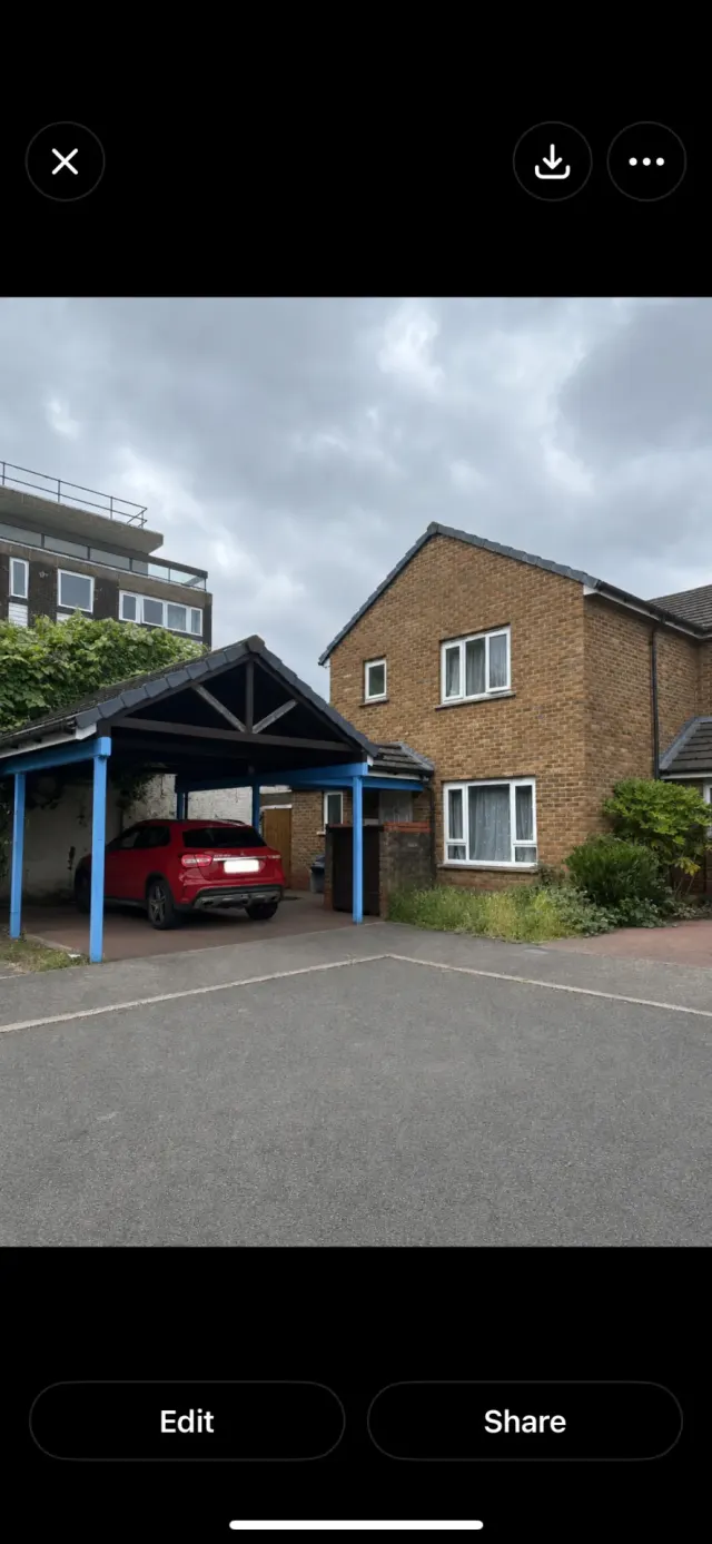
Live in Banstead? Add a photo
Tenants' own photos help other people picture the place. Approved photos are credited to you. Submit a photo.
Nearby place guides
Thinking of moving a little further? Compare homes to swap, rents and local landlords in places near Banstead.
All place guides in Surrey → · All place guides in the South East → · All regions →