What it's like to live in Brentwood
What is it like to live in Brentwood? It's a comfortable, fairly affluent Essex market town with a busy High Street, green commons and deer country on its edge. It suits families and working households who want town convenience without a big-city feel. Shenfield Common and Merrymeade Country Park are both a short stroll from the centre, and the shops are genuinely useful rather than token.
1 tenant wants to move to Brentwood. Live here? List your home and they could be your match.
"I'd move here" adds Brentwood to the areas on your listing, so homes here are matched to you first.
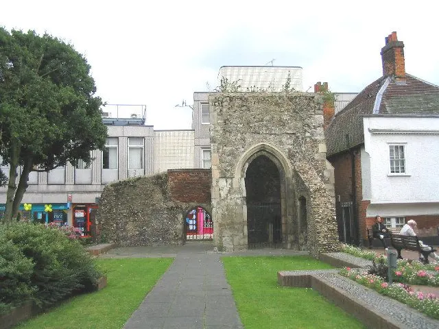
Brentwood sits in the south-west corner of Essex, close enough to London to feel connected and far enough out to have deer parks and commons on its doorstep. The CM15 postcode covers the town centre and the streets running off the High Street.
It's a well-served town. A shopping centre, several supermarkets, a library, a hospital and a long line of bus stops all sit within a short walk of the middle, and two train stations are close by. For a tenant thinking about a swap, the main things to weigh are the good transport and the small share of social housing.
Swapping to Brentwood: key facts
Can I swap my council or housing association home to Brentwood?
Yes, if you are already a council or housing association tenant. Mutual exchange means swapping homes with another social tenant, so it does not depend on the council waiting list: you need a tenant in or near Brentwood who wants your area, and both landlords must agree. Landlords have 42 days to decide and can only refuse on set legal grounds. In 2024 to 2025, 15 council homes in Brentwood changed tenants by mutual exchange. On 5 November 2026, 1 tenant wanted to move to Brentwood on Mutual Home Exchange.
How long is the council housing waiting list in Brentwood?
261 households were on the Brentwood housing register on 31 March 2025, up 9% on a year earlier. 144 social homes were let through the council in 2024 to 2025, roughly 1.8 households for every home let. Source: Local Authority Housing Statistics, Ministry of Housing, Communities and Local Government.
How much is social rent in Brentwood?
Average weekly social rents in the Brentwood council area in 2025/26: 1 bed £101 council, £126 housing association; 2 bed £117 council, £147 housing association; 3 bed £138 council, £171 housing association. Affordable rent homes cost more, typically 60 to 80% of market rent. Source: Regulator of Social Housing.
How much social housing is there in Brentwood and who owns it?
11.3% of homes in the Brentwood council area are social housing (council 8.2%, housing association 3.1%), against 17.1% across England, according to the 2021 Census. The biggest social landlords there are Brentwood Borough Council (2,377 homes), Delta Housing Limited (295 homes) and London & Quadrant Housing Trust (215 homes).
How Busy Is The Swap Market In Brentwood?
Figures as of 5 November 2026, updated every night. The waiting list figure is from 2024 to 2025 government data.
Which homes are available to swap near Brentwood?
Homes are shown near their address, not on it. Contains OS data © Crown copyright and database right. Source: Office for National Statistics, Open Government Licence.
1 tenant wants to move to Brentwood
Someone is already looking to swap into this area. Do you rent a council or housing association home here? Sign up today and you could become a home exchange match together.
What is housing like in Brentwood and who lives there?
Brentwood is mostly an owner-occupier town. Around 72% of homes are owned and 16% privately rented, with social housing at 11.3% — well below the England figure of 17.1%. That means social lets are less common here than in many Essex towns, so patience helps.
Brentwood Borough Council is by far the biggest social landlord with around 2,387 homes, followed by London & Quadrant, Clarion, Delta Housing and Brentwood Housing Trust.
Average weekly social rents in the council area in 2024/25 were about £106 for one bed, £118 for two and £141 for three. The council's housing register held 261 households in March 2025, and a register is not a simple queue.
Who owns the homes
Share of homes in the Brentwood council area, Census 2021.
Ages
Share of people in each age group, Census 2021.
Council waiting list and lettings
Households on the register by the size of home they need.
That is roughly 1.8 households waiting for every social home let in a year. Mutual exchange doesn't use the waiting list: if you already have a council or housing association home, swapping with another tenant can be a quicker way to move to Brentwood.
A register counts households who have applied, so it isn't a simple queue: some are already social tenants hoping to transfer, and people can be on more than one council's list.
Typical weekly social rents in the Brentwood council area
Social rent averages for 2025/26. Affordable rent homes cost more, typically 60 to 80% of market rent.
Biggest social landlords in the council area
- Brentwood Borough Council2,377 homes
- Delta Housing Limited295 homes
- London & Quadrant Housing Trust215 homes
- Clarion Housing Association Limited201 homes
- Brentwood Housing Trust Limited135 homes
- Estuary Housing Association Limited130 homes
- Anchor Hanover Group96 homes
- Notting Hill Genesis72 homes
Compare these landlords against every other on tenant satisfaction, repairs and complaints.
What is it like to live in Brentwood?
The centre packs a lot in: the Baytree Shopping Centre, Marks & Spencer, Sainsbury's, Iceland, a Tesco Express and Poundland are all within a couple of hundred metres of each other, plus several pharmacies including a late-night one.
As with any busy town centre, police record a few hundred incidents a month within a mile of the middle, mostly minor. The wider Brentwood area skews slightly older than England as a whole, with a fifth of residents aged 65 or over.
What are the schools and family life like in Brentwood?
There's a strong spread of schools nearby. Primaries within walking distance include St Thomas of Canterbury Church of England Primary, St Helen's Infant and Nursery, St Helen's Junior and Hogarth Primary.
For secondary, Brentwood County High School, Becket Keys Church of England Secondary and Brentwood Ursuline Convent High School for Girls are all within half a mile, with Shenfield High School and St Martin's School under two miles. Worth checking admissions rules early, as several are faith or single-sex schools.
For days out with children, Merrymeade Country Park, Shenfield Common, Brentwood Sports Ground and the South Weald Deer Enclosure are all close. Brentwood Library and Shenfield Library add somewhere free and warm to go.
Primary schools
- St Thomas of Canterbury Church of England Aided Primary School0.4 mi
- St Helen's Catholic Junior School0.5 mi
- St Helen's Catholic Infant & Nursery School0.5 mi
- Hogarth Primary School0.6 mi
- Shenfield St. Mary's Church of England Primary School0.9 mi
Secondary schools
- Brentwood Schoolnearby
- Brentwood Ursuline Convent High School0.3 mi
- Brentwood County High School0.4 mi
- Grove House School0.4 mi
- Becket Keys Church of England School0.5 mi
Parks
- North Road Playgroundnearby
- Shenfield Common0.3 mi
- Mayfiled Gardens Public Park0.5 mi
- Cleves Avenue0.5 mi
- La Plata Woods0.6 mi
Libraries
- Brentwood Librarynearby
- Shenfield Library1.1 mi
What shops and everyday essentials are in Brentwood?
Supermarkets
- Sainsbury'snearby
- Grace Asian Grocery Storenearby
- Day 10.3 mi
- Smoker Shop0.3 mi
- A J news & wine0.3 mi
Pharmacies
- Burntwood Pharmacynearby
- Ongar Road Pharmacy0.6 mi
- Day Lewis Pharmacy1 mi
- Rockleigh Court Pharmacy1.1 mi
- Ingrave Pharmacy1.1 mi
Hospitals
- Nuffield Hospital0.3 mi
- Brentwood Community Hospital0.5 mi
- Hartswood Hospital1.5 mi
- Leonard Lodge Nursing Home1.9 mi
- Hutton Village Nursing Home2.5 mi
How do you get around Brentwood?
Brentwood station is about half a mile from the centre and Shenfield is just over a mile away, giving you two options for trains towards London and out into Essex. That choice matters on days when one line is playing up.
Buses run from a cluster of stops along Brentwood High Street, so you can reach them on foot from most central streets without planning a trip to get to the trip.
On foot, the centre is compact and flat enough for everyday errands. If you drive, you're close to the main routes out of Essex, though town-centre parking and school-run traffic are the usual grumbles.
Train stations
- Brentwood0.6 mi
- Shenfield1.2 mi
What is there to do in Brentwood?
Green space is the town's best asset. South Weald Deer Enclosure is practically on the doorstep, and Shenfield Common and Merrymeade Country Park give you proper walking without needing a car.
For exercise indoors there's Better Gym, PureGym and a handful of smaller personal training studios within walking distance. Community centres including Merrymeade House, Maple Hall, Bishop's Hall Park Community Centre and The Knights Way Centre host local groups.
Evenings out range from pubs like the Victoria Arms and The Dairyman to bars and clubs such as Sugar Hut and Zebrano. If you want a quiet street, look a little away from the centre.
Gyms
- Better Gym Brentwoodnearby
- PureGymnearby
- Boxgym Fitness0.4 mi
- Anytime Fitness0.4 mi
Pubs and bars
- The Dairymannearby
- Victoria Armsnearby
- Sports Lounge Brentwoodnearby
- The Spread Eaglenearby
- The Duchess & Dressmaker0.3 mi
Nightlife
- Sugar Hutnearby
- The Vine0.3 mi
Community centres
- Three Arch Bridge Community Hall0.8 mi
- Shenfield Parish Hall0.9 mi
- Knights Way Centre1 mi
- South Weald Parish Hall1.3 mi
- Pilgrims Hatch Parish Room1.7 mi
What is work and the local economy like in Brentwood?
The wider Brentwood council area does well on work. Just over 60% of adults are in employment, above the England figure of 57.4%, and unemployment sits at 2.6% against 3.5% nationally. Benefit claimants among 16 to 64 year olds were 2.5% in August 2026, well under the England rate of 4%.
Plenty of residents commute, and the two nearby stations make that practical. Locally, the High Street, the Baytree Shopping Centre, supermarkets, the hospital and care services are the visible employers in walking distance.
Figures are for the Brentwood council area, Census 2021 and ONS claimant count.
How safe is Brentwood?
Like every town centre, Brentwood has police incidents logged each month. In August 2026 there were 217 within about a mile of the centre, made up of:
Source: data.police.uk street-level crime. Counts cover a fixed one-mile radius around the centre, so busy high streets and stations always record far more than the residential streets around them, and most incidents are minor. Compare like with like: a similar-sized town centre, not a village.
Is Brentwood a good place for social housing tenants?
Right now: 1 tenant wants to move here.
Mutual exchange is a realistic route into Brentwood. In 2024-25 the council recorded 15 swaps alongside 144 social lets, so swapping is a genuine part of how people move here.
If Brentwood appeals, list your own home on Mutual Home Exchange and set Brentwood as a desired area. Good photos, honest details about your home's size, heating and any garden, and a clear note about what you're looking for will get you far more replies.
It's free, and adding a few nearby areas alongside Brentwood widens your chances without ruling out the town you actually want.
Tell me when a home appears near Brentwood
One email, the first time a council or housing association home is listed within your chosen distance. No newsletter, no spam.
Live in Brentwood? Add a photo
Tenants' own photos help other people picture the place. Approved photos are credited to you. Submit a photo.
Nearby place guides
Thinking of moving a little further? Compare homes to swap, rents and local landlords in places near Brentwood.
All place guides in Essex → · All place guides in the East of England → · All regions →