What it's like to live in Chertsey
What is it like to live in Chertsey? It is a small, settled Surrey town in the borough of Runnymede, with a proper town centre rather than a commuter dormitory feel. It suits families and anyone who wants quiet streets with real amenities close by. Gogmore Farm Park is a few minutes from the middle of town, and the Thames-side villages of Laleham and Shepperton are nearby.
"I'd move here" adds Chertsey to the areas on your listing, so homes here are matched to you first.
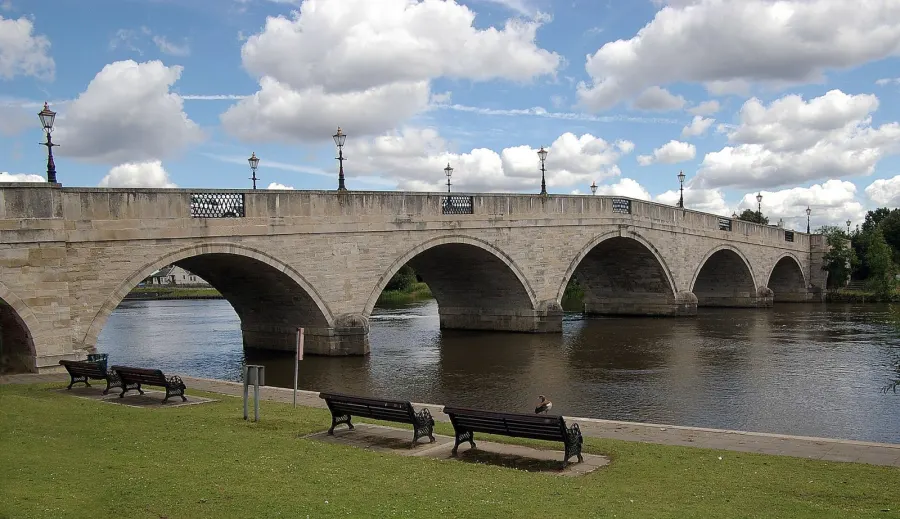
Chertsey is a town of around 16,000 people in the borough of Runnymede, in Surrey's north-west corner. It sits between Staines, Addlestone and Weybridge, close to the Thames, with its own railway station and a compact centre you can cross on foot.
It is not a big place, and that is part of the appeal. The shops, library, parks and station all sit within half a mile or so of each other, while bigger centres are a short hop away by train or bus.
This guide sets out what the town is actually like day to day, so you can judge whether a swap here would suit your household.
Swapping to Chertsey: key facts
Can I swap my council or housing association home to Chertsey?
Yes, if you are already a council or housing association tenant. Mutual exchange means swapping homes with another social tenant, so it does not depend on the council waiting list: you need a tenant in or near Chertsey who wants your area, and both landlords must agree. Landlords have 42 days to decide and can only refuse on set legal grounds. In 2024 to 2025, 16 council homes in Runnymede changed tenants by mutual exchange.
How long is the council housing waiting list in Chertsey?
1,122 households were on the Runnymede housing register on 31 March 2025, down 3% on a year earlier. 212 social homes were let through the council in 2024 to 2025, roughly 5.3 households for every home let. Source: Local Authority Housing Statistics, Ministry of Housing, Communities and Local Government.
How much is social rent in Chertsey?
Average weekly social rents in the Runnymede council area in 2025/26: 1 bed £118 council, £129 housing association; 2 bed £139 council, £155 housing association; 3 bed £152 council, £174 housing association. Affordable rent homes cost more, typically 60 to 80% of market rent. Source: Regulator of Social Housing.
How much social housing is there in Chertsey and who owns it?
12.9% of homes in the Runnymede council area are social housing (council 8%, housing association 5%), against 17.1% across England, according to the 2021 Census. The biggest social landlords there are Runnymede Borough Council (2,880 homes), Southern Housing (782 homes) and A2Dominion South Limited (473 homes).
How Busy Is The Swap Market In Chertsey?
Figures as of 6 November 2026, updated every night. The waiting list figure is from 2024 to 2025 government data.
Which homes are available to swap near Chertsey?
Homes are shown near their address, not on it. Contains OS data © Crown copyright and database right. Source: Office for National Statistics, Open Government Licence.
No homes listed within 5 miles at the moment. New homes are listed every week: see homes across Surrey, use the alert form below, or list your own home so tenants here can find you.
What is housing like in Chertsey and who lives there?
Social housing is fairly scarce here. Only 12.9% of homes in the Runnymede area are socially rented, against 17.1% across England, split between 8% council and 5% housing association. Two thirds of homes are owned outright or on a mortgage, and 19.1% are privately rented.
Runnymede Borough Council is by far the biggest social landlord with around 2,891 homes, followed by Southern Housing, A2Dominion South, Metropolitan Housing Trust and Accent Housing.
Average weekly social rents in the borough for 2024/25 were £117 for a one bed, £141 for a two bed and £152 for a three bed. The age mix across Runnymede is close to the national picture, with slightly more 16 to 24 year olds and slightly fewer over-65s than England as a whole.
Who owns the homes
Share of homes in the Runnymede council area, Census 2021.
Ages
Share of people in each age group, Census 2021.
Council waiting list and lettings
Households on the register by the size of home they need.
That is roughly 5.3 households waiting for every social home let in a year. Mutual exchange doesn't use the waiting list: if you already have a council or housing association home, swapping with another tenant can be a quicker way to move to Chertsey.
A register counts households who have applied, so it isn't a simple queue: some are already social tenants hoping to transfer, and people can be on more than one council's list.
Typical weekly social rents in the Runnymede council area
Social rent averages for 2025/26. Affordable rent homes cost more, typically 60 to 80% of market rent.
Biggest social landlords in the council area
- Runnymede Borough Council2,880 homes
- Southern Housing782 homes
- A2Dominion South Limited473 homes
- Metropolitan Housing Trust Limited464 homes
- Accent Housing Limited241 homes
- Paragon Asra Housing Limited215 homes
- Anchor Hanover Group169 homes
- Vivid Housing Limited83 homes
Compare these landlords against every other on tenant satisfaction, repairs and complaints.
What is it like to live in Chertsey?
Day to day life is straightforward. There is a Sainsbury's and an ALDI within a couple of minutes of the centre, a Tesco Express a little further out and a Co-op about a mile away, plus a Romanian food shop in the town centre. Several pharmacies are dotted around, and Chertsey Library is a short walk from the middle.
Pubs are a feature. The Crown, The Prince Regent and The Coach & Horses are all within a few minutes of the centre, with Jack Sparrow Bar for a later night. Chertsey Hall gives the town a community venue for groups and hire.
On safety, police recorded 144 incidents within about a mile of the centre in July 2026, mostly violence and anti-social behaviour, which is fairly typical for a busy town centre radius.
What are the schools and family life like in Chertsey?
There is a decent spread of primary schools. St Anne's Catholic Primary School and Pyrcroft Grange Primary School are both under a mile from the centre, with Meadowcroft Community Infant School just over a mile and Laleham Primary School around 1.4 miles. Check current Ofsted reports and admission distances, as places in Surrey can be tight.
For secondary, Chertsey High School is under a mile away, with Philip Southcote Secondary School close by and Jubilee High School about 1.6 miles. St George's College in Weybridge is nearby too.
Families are well served for outdoor space. Gogmore Farm Park is a short walk, and Free Prae Road Park, Chertsey Recreation Ground and Laleham Park Sports Ground are all within a mile. Across the Runnymede area, 17.9% of residents are under 16, just below the England figure.
Primary schools
- Stepgates Community School0.4 mi
- St Anne's Catholic Primary School0.4 mi
- Pyrcroft Grange Primary School0.6 mi
- Meadowcroft Community Primary School1.1 mi
- St Paul's C of E Primary School1.5 mi
Secondary schools
- Sir William Perkins's School0.6 mi
- Salesian College0.6 mi
- Chertsey High School0.8 mi
- Philip Southcote Sixth Form0.8 mi
- Philip Southcote School0.9 mi
Parks
- Gogmore Farmnearby
- Laleham Park0.9 mi
- Kingthorpe Gardens1.6 mi
- Homewood Park1.8 mi
- Silvery Sands1.8 mi
Libraries
- Chertsey Library0.3 mi
- Addlestone Library1.6 mi
- Weybridge Library2.3 mi
- Shepperton Library2.4 mi
- Virginia Water Community Library2.7 mi
What shops and everyday essentials are in Chertsey?
Supermarkets
- Sainsbury'snearby
- Aldinearby
- Co-op Food1.2 mi
- Tesco Extra1.5 mi
- Waitrose2.4 mi
Pharmacies
- Honeycomb Pharmacynearby
- Chertsey Pharmacy0.5 mi
- Tesco Pharmacy1.5 mi
- Addlestone Pharmacy1.6 mi
- FastHeal Pharmacy & Clinic2.2 mi
Hospitals
- St Peter's Hospital A&E1.4 mi
- St Peter's Hospital1.4 mi
Shopping centres
- Elmsleigh Shopping Centre2.9 mi
How do you get around Chertsey?
Chertsey station is about half a mile from the centre, which makes train travel realistic without a car. Addlestone is 1.6 miles away, with Shepperton, Virginia Water and Staines all under three miles if you want other lines.
Buses run from Charles Street in the town centre and from stops by the railway station, with services also reaching St Peter's Hospital and Addlestone station. It is worth checking the exact routes and frequencies for your own journey before you commit, as a small town timetable can be thinner in the evenings.
On foot, the centre works well. Shops, the library, parks, pharmacies and the station are all within roughly half a mile of each other. Drivers have the M25 and M3 corridor nearby, so wider Surrey and London are within reach.
Train stations
- Chertsey0.4 mi
- Addlestone1.6 mi
- Shepperton2.5 mi
- Virginia Water2.6 mi
- Staines2.8 mi
Bus stations
- Elmsleigh Bus Station2.8 mi
What is there to do in Chertsey?
The parks do a lot of the work here. Gogmore Farm Park, Free Prae Road Park and Chertsey Recreation Ground give you green space within walking distance, and Spelthorne Waterski Club and Laleham Park Sports Ground are close for something more active.
For fitness there is plenty of choice for a town this size, including Hitsona Chertsey, TH Fitness Club, Reformer Studio Chertsey and Dancing Mamas, all within a quarter of a mile of the centre.
Film fans have Sunset Cinema about a mile away, with The Light and Addlestone One around 1.6 miles and Vue in Staines just under three. Runnymede Jazz Club is nearby for live music, and the Elmsleigh Centre in Staines is the biggest shopping trip within three miles.
Gyms
- Hitsonanearby
- River Bourne Health Clubnearby
- Snap Fitness1.6 mi
- Akram Hot Yooga1.6 mi
- Anytime Fitness1.7 mi
Cinemas
- Sunset Cinema1 mi
- The Light1.6 mi
- Vue2.9 mi
Pubs and bars
- The Prince Regentnearby
- The Crownnearby
- Thyme at the Tavernnearby
- Coach & Horsesnearby
- Jack Sparrow0.3 mi
Community centres
- Chertsey Hallnearby
- Youth Club1.4 mi
- Addlestone Young People and Family Centre1.6 mi
- Addlestone Community Centre1.6 mi
- Thorpe Village Hall1.6 mi
What is work and the local economy like in Chertsey?
Runnymede is a working borough. Across the council area, 58.4% of adults are in work, a shade above the England figure of 57.4%, and unemployment sits at 3.6%. Benefit claims among 16 to 64 year olds were 2.6% in August 2026, well below the England average of 4%.
The Runnymede Hospital in Chertsey and St Peter's Hospital, reachable by bus, are significant local employers in the health sector.
Beyond that, the town's position matters most. With trains from Chertsey and road links to the M25 and M3, many people here commute out to Staines, Weybridge, Woking, Heathrow's surrounds or into London. If your work is flexible or London-based, that connectivity is the real draw.
Figures are for the Runnymede council area, Census 2021 and ONS claimant count.
How safe is Chertsey?
Like every town centre, Chertsey has police incidents logged each month. In August 2026 there were 137 within about a mile of the centre, made up of:
Source: data.police.uk street-level crime. Counts cover a fixed one-mile radius around the centre, so busy high streets and stations always record far more than the residential streets around them, and most incidents are minor. Compare like with like: a similar-sized town centre, not a village.
Is Chertsey a good place for social housing tenants?
Swap options in and around Chertsey are thin at the moment. There is one listing within 15 miles on Mutual Home Exchange, a two-bed flat in Wembley 13.8 miles away, open to any area. Given how little social housing there is in Runnymede, that is not surprising.
That makes being visible the main thing. List your own home with clear photos and an honest description, then set Chertsey and the wider Runnymede area as a desired location. New homes appear all the time, and tenants looking to leave Surrey will search for matches rather than wait.
It is free to list and free to search. Widen your area to include Addlestone, Staines and Shepperton if you can, and check back regularly.
Tell me when a home appears near Chertsey
One email, the first time a council or housing association home is listed within your chosen distance. No newsletter, no spam.
Live in Chertsey? Add a photo
Tenants' own photos help other people picture the place. Approved photos are credited to you. Submit a photo.
Nearby place guides
Thinking of moving a little further? Compare homes to swap, rents and local landlords in places near Chertsey.
All place guides in Surrey → · All place guides in the South East → · All regions →
Latest From @HomeExchangeGB
Home to swap: 2-bed house in Norwich. Looking to move to Romford.
#Norwich #Romford #LondonBoroughOfHaveringCouncil