What it's like to live in Crosby
What is it like to live in Crosby? It's a coastal town in Sefton, on the northern edge of Merseyside, with a settled, small-town feel and a strong local high street rather than big-city bustle. It suits families and anyone who wants Liverpool close by without living in it. The Marine Garden and Crosby Library are both minutes from the centre.
1 council and housing association home available to swap within 10 miles of Crosby.
"I'd move here" adds Crosby to the areas on your listing, so homes here are matched to you first.
Crosby sits on the Sefton coast in Merseyside, just north of Liverpool. Around 51,800 people live here, and the L22 part of town around Waterloo is where a lot of the daily life happens.
This guide is for council and housing association tenants thinking about a mutual exchange to Crosby. It covers the everyday things that matter when you're weighing up a move: getting to work, schools, parks, shops, rents across the wider Sefton area and what kind of homes come up.
We've stuck to what we can back up with facts about the area, so you can make your own mind up rather than be sold to.
Which homes are available to swap near Crosby?
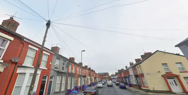
What is housing like in Crosby and who lives there?
Sefton is mostly an area of homeowners: 66.6% of homes are owned, 18.2% are privately rented and 14.4% are social rented, a little below the England figure of 17.1%. Council housing is a small slice at 3.4%, with housing associations holding 11%.
That means most social tenants here rent from an association. One Vision Housing is by far the biggest with 10,717 homes, followed by The Riverside Group with 2,364, Jigsaw Homes North with 1,588, Plus Dane with 896 and Prima Housing Group with 577.
Rents are reasonable. Average weekly social rents across Sefton in 2024/25 were £92 for a one bed, £100 for two beds and £115 for three beds.
Because the social stock is on the smaller side, swaps into Crosby can take patience. It's worth being flexible on exact streets.
Council waiting list and lettings
Households on the register by the size of home they need.
That is roughly 5.4 households waiting for every social home let in a year. Mutual exchange doesn't use the waiting list: if you already have a council or housing association home, swapping with another tenant can be a quicker way to move to Crosby.
A register counts households who have applied, so it isn't a simple queue: some are already social tenants hoping to transfer, and people can be on more than one council's list.
Typical weekly social rents in the Sefton council area
| Size | Council | Housing association |
|---|---|---|
| Bedsit | £0 | £80 |
| 1 bed | £0 | £92 |
| 2 bed | £0 | £100 |
| 3 bed | £0 | £115 |
| 4 bed | £0 | £124 |
Social rent averages for 2024/25. Affordable rent homes cost more, typically 60 to 80% of market rent.
Biggest social landlords in the council area
- One Vision Housing Limited10,717 homes
- The Riverside Group Limited2,364 homes
- Jigsaw Homes North1,588 homes
- Plus Dane Housing Limited896 homes
- Prima Housing Group Limited577 homes
- Anchor Hanover Group477 homes
- Regenda Limited430 homes
- Crosby Housing Association Limited429 homes
What is it like to live in Crosby?
Day to day, Crosby is well served. There's a Home Bargains, an Iceland and a Tesco Express all within a third of a mile of the centre, plus a Lidl about a mile out, so a basic shop doesn't mean a big trip.
The Sefton area skews older than England as a whole: 23.2% are 65 or over, against 18.4% nationally, and there are slightly fewer under-16s. That shows in the tone of the place, which is calm and neighbourly rather than young and loud.
As with any busy town centre, there are incidents recorded each month, mostly minor and mostly violence, anti-social behaviour and criminal damage.
What are the schools and family life like in Crosby?
There's a good spread of primary schools. Waterloo Primary School is practically on the doorstep at 0.1 miles, with St Johns C of E and St Edmund's & St Thomas' Catholic Primary both 0.4 miles away, then Rimrose Hope Church of England and Hatton Hill Primary under a mile.
For secondaries, Sacred Heart Catholic Academy is 0.7 miles, Chesterfield High School 1.3 miles, St Michael's Church of England High School 1.5 miles, Holy Family High School 1.8 miles and Hillside High School 2.8 miles. Several are walkable, which saves money and hassle at 8am.
For days out with kids, The Marine Garden, Victoria Park, Brook Vale Recreation Ground and More Park are all around 0.4 miles from the centre, with Potter's Barn Park a little further. Crosby Library is 0.1 miles away and there are community centres nearby, including Waterloo Community Centre and Ford Lane.
Primary schools
- Waterloo Primary Schoolnearby
- St Johns C Of E Primary School0.4 mi
- St Edmund's & St Thomas' Catholic Primary School0.4 mi
- Rimrose Hope Church of England Primary School0.8 mi
- Hatton Hill Primary School0.9 mi
Secondary schools
- Sacred Heart Catholic Academy0.7 mi
- Chesterfield High School1.3 mi
- St Michael's Church of England High School1.5 mi
- Holy Family High School1.8 mi
- Hillside High School2.8 mi
Parks
- The Marine Garden0.4 mi
- Victoria Park0.4 mi
- Brook Vale Recreation Ground0.4 mi
- More Park0.4 mi
- Potter's Barn Park0.5 mi
Libraries
- Crosby Librarynearby
- Netherton Activity Centre2.1 mi
- Netherton Library2.1 mi
- Bootle Library2.3 mi
What shops and everyday essentials are in Crosby?
Supermarkets
- Home Bargainsnearby
- Iceland Supermarket Waterloonearby
- Tesco Express0.3 mi
- Premier Stores | Sonning Supermarket0.9 mi
- Lidl1 mi
Pharmacies
- Boots Pharmacynearby
- Allied Pharmacy - Crosby Road0.3 mi
- 247 Pharmacy0.3 mi
- Alexanders Pharmacy0.5 mi
- Gordon Short Chemist - Travel Vaccination and Simple Weight Loss Clinic0.8 mi
Hospitals
- Liverpool Crosby Bupa Health Centrenearby
- Blossom House (Alder Park)nearby
- Waterloo Dialysis Unitnearby
- Crosby Hospitalnearby
- The Liverpool Clinicnearby
Shopping centres
- Strand Shopping Centre2.1 mi
- The Marian Square2.2 mi
- Switch Retail Leisure Park2.6 mi
- Marine Point Retail And Leisure Park2.7 mi
- Aintree Racecourse Retail & Business Park2.9 mi
How do you get around Crosby?
The trains are the big draw. Waterloo station is about a tenth of a mile from the centre, with Blundellsands & Crosby just over a mile away, Seaforth & Litherland a mile, Hall Road 1.8 miles and Bootle New Strand two miles. That's five stations within easy reach, which is unusual outside a city.
Buses are just as handy. South Road stops are right in the centre, and Waterloo Interchange, Saint Georges Road, Fir Road and Milton Road are all within a third of a mile. If you don't drive, you're not stuck.
On foot, the centre is compact. Shops, pharmacies, the library and the station sit in a tight cluster, so a lot of errands can be done without getting in a car at all.
If you do drive, you're close to the main routes north and into Liverpool, with retail parks a few miles out for bigger shops.
Train stations
- Waterloonearby
- Seaforth & Litherland1 mi
- Blundellsands & Crosby1.1 mi
- Hall Road1.8 mi
- Bootle New Strand2 mi
Bus stations
- South Roadnearby
- Waterloo Interchange (Stop A)nearby
- Saint Georges Roadnearby
- Fir Road0.3 mi
- Milton Road0.3 mi
What is there to do in Crosby?
The Plaza Community Cinema is a real asset, sitting about 0.1 miles from the centre. If you want a bigger screen, ODEON Luxe at Switch Island is 2.5 miles and TheLight at New Brighton 2.6 miles.
Pubs are plentiful and local: The Liver, Always Sometimes, Trap and Hatch, The Green Rooms and The Ferndale Lodge are all in or beside the centre. Nightlife proper is thinner on the ground, with Bistro115 around 2.7 miles away, so a big night usually means heading into Liverpool.
For exercise there's a decent mix of independent places rather than chains, including Tierpro Gym, Waterloo A.B.C, Warrior Combat Gym CIC, I Am Woman Gym and Waterloo Judo Club, all within a third of a mile.
For bigger shopping trips, the Strand Shopping Centre is 2.1 miles, with The Marian Square and a couple of retail parks nearby.
Gyms
- Tierpro Gymnearby
- Waterloo A.B.Cnearby
- Warrior Combat Gym CICnearby
- I Am Woman Gym0.3 mi
- Waterloo Judo Club0.3 mi
Cinemas
- Plaza Community Cinemanearby
- ODEON Luxe Liverpool Switch Island2.5 mi
- TheLight - New Brighton2.6 mi
Pubs and bars
- The Livernearby
- Always Sometimesnearby
- Trap and Hatchnearby
- The Green Roomsnearby
- The Ferndale Lodgenearby
Nightlife
- Bistro1152.7 mi
Community centres
- Burlington House foot entrynearby
- HRE4U0.3 mi
- Waterloo Community Centre0.3 mi
- SING Plus Centre0.4 mi
- Ford Lane Community Centre1 mi
What is work and the local economy like in Crosby?
Crosby's position matters more than any single employer. With five train stations within three miles and Liverpool a short hop south, commuting is realistic whether you work in the city centre or closer to home.
In the wider Sefton area, 53.6% of adults are in work, a bit below the England figure of 57.4%. Unemployment sits at 3%, slightly lower than England's 3.5%, and 3.8% of 16 to 64 year olds claimed unemployment-related benefits in August 2026, just under the 4% national figure.
Locally there's a cluster of health services, including Crosby Hospital, a Bupa health centre, a dialysis unit and several pharmacies, all within half a mile of the centre. Retail around the town centre and the nearby shopping centres adds more.
Figures are for the Sefton council area, Census 2021 and ONS claimant count.
How safe is Crosby?
Like every town centre, Crosby has police incidents logged each month. In July 2026 there were 212 within about a mile of the centre, made up of:
- Anti-social behaviour reports32
- Vehicle crime3
- Bicycle theft2
- Shoplifting3
- Other theft10
- Theft from the person1
Source: data.police.uk street-level crime. Counts cover a fixed one-mile radius around the centre, so busy high streets and stations always record far more than the residential streets around them, and most incidents are minor. Compare like with like: a similar-sized town centre, not a village.
Is Crosby a good place for council and housing association tenants?
There's one swap listing within 10 miles of Crosby on Mutual Home Exchange right now: a two-bed house in Liverpool, 6.5 miles away, whose tenant wants to upsize. That's a thin picture on any given day, and it changes as people join.
The way to make a move happen is to be visible. List your own home with clear photos and an honest description, then set Crosby as a desired area. Tenants searching from inside Sefton will find you, and you'll be first in line when something new appears.
It's free to list, and you can add more than one desired area if you'd consider nearby parts of Sefton or north Liverpool. Set it up, check back regularly, and give it time. Good matches often come from being patient rather than lucky.
Tell me when a home appears near Crosby
One email, the first time a council or housing association home is listed within your chosen distance. No newsletter, no spam.
Live in Crosby? Add a photo
Tenants' own photos help other people picture the place. Approved photos are credited to you. Submit a photo.
Nearby place guides
Thinking of moving a little further? Compare homes to swap, rents and local landlords in places near Crosby.