What it's like to live in Loughborough
1 council and housing association home available to swap within 15 miles of Loughborough.
"I'd move here" adds Loughborough to the areas on your listing, so homes here are matched to you first.
Loughborough is a market town in Charnwood, Leicestershire, with a population of around 64,880. It is big enough to have a proper town centre with chain stores, a cinema and a railway station, but small enough that you can walk across the middle of it in twenty minutes.
It is also a university town, and that shows. The age profile for the wider Charnwood area has 14.7% of people aged 16 to 24, well above the England figure of 10.6%. That brings late-night bars and a busy term-time feel to parts of the town, alongside long-settled family streets, community centres and quiet parks.
For a tenant weighing up a swap, the pull is practical. The LE11 postcode covers the town centre and the streets around it, so shops, the library, GP services and schools are often a short walk or a short bus ride away. If you do drive, you are near the main routes north and south through the East Midlands. This guide sets out the honest picture, section by section.
Swapping to Loughborough: key facts
Can I swap my council or housing association home to Loughborough?
Yes, if you are already a council or housing association tenant. Mutual exchange means swapping homes with another social tenant, so it does not depend on the council waiting list: you need a tenant in or near Loughborough who wants your area, and both landlords must agree. Landlords have 42 days to decide and can only refuse on set legal grounds. In 2024 to 2025, 15 council homes in Charnwood changed tenants by mutual exchange. On 4 October 2026, 1 home was listed to swap within 15 miles on Mutual Home Exchange.
How long is the council housing waiting list in Loughborough?
1,143 households were on the Charnwood housing register on 31 March 2025, up 38% on a year earlier. 469 social homes were let through the council in 2024 to 2025, roughly 2.4 households for every home let. Source: Local Authority Housing Statistics, Ministry of Housing, Communities and Local Government.
How much is social rent in Loughborough?
Average weekly social rents in the Charnwood council area in 2024/25: 1 bed £82 council, £93 housing association; 2 bed £92 council, £112 housing association; 3 bed £104 council, £129 housing association. Affordable rent homes cost more, typically 60 to 80% of market rent. Source: Regulator of Social Housing.
How much social housing is there in Loughborough and who owns it?
11.7% of homes in the Charnwood council area are social housing (council 6.7%, housing association 5%), against 17.1% across England, according to the 2021 Census. The biggest social landlords there are Charnwood Borough Council (5,418 homes), EMH Housing and Regeneration Limited (976 homes) and Amplius Living (690 homes).
Which homes are available to swap near Loughborough?
What is housing like in Loughborough and who lives there?
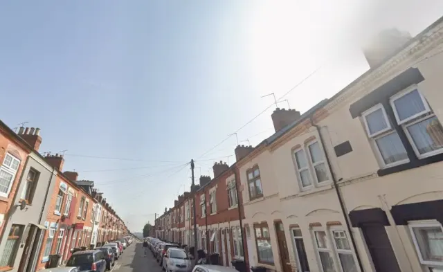
Charnwood is a strongly owner-occupied area. Across the council area 69.8% of homes are owned, 17.4% are privately rented and just 11.7% are social rented, split between council at 6.7% and housing association at 5%. That is well below the England average of 17.1%, so social homes here are a smaller share of the stock than in many places.
Charnwood Borough Council is by far the biggest social landlord with 5,418 homes, followed by EMH Housing and Regeneration with 976, Amplius Living with 690, Nottingham Community Housing Association with 687 and Platform Housing with 569.
Average weekly social rents in the council area for 2024/25 were £84 for a one bed, £103 for a two bed and £111 for a three bed. At 31 March 2025 the council's housing register held 1,143 households; 469 social homes were let through the council in 2024-25 and 15 council homes changed hands by mutual exchange. A register is not a simple queue, which is exactly why swapping is worth a look.
Council waiting list and lettings
Households on the register by the size of home they need.
That is roughly 2.4 households waiting for every social home let in a year. Mutual exchange doesn't use the waiting list: if you already have a council or housing association home, swapping with another tenant can be a quicker way to move to Loughborough.
A register counts households who have applied, so it isn't a simple queue: some are already social tenants hoping to transfer, and people can be on more than one council's list.
Typical weekly social rents in the Charnwood council area
| Size | Council | Housing association |
|---|---|---|
| Bedsit | £65 | £85 |
| 1 bed | £82 | £93 |
| 2 bed | £92 | £112 |
| 3 bed | £104 | £129 |
| 4 bed | £115 | £147 |
Social rent averages for 2024/25. Affordable rent homes cost more, typically 60 to 80% of market rent.
Biggest social landlords in the council area
- Charnwood Borough Council5,418 homes
- EMH Housing and Regeneration Limited976 homes
- Amplius Living690 homes
- Nottingham Community Housing Association Limited687 homes
- Platform Housing Limited569 homes
- The Riverside Group Limited430 homes
- Midland Heart Limited356 homes
- Stonewater Limited285 homes
What are the schools and family life like in Loughborough?
There is a good spread of primary schools close to the centre. Cobden Primary School is about 0.2 miles away, with St Mary's Catholic Primary School and Rendell Primary School both around 0.4 miles, Loughborough Church of England (Aided) Primary School at 0.5 miles and Mountfields Lodge School at 0.8 miles. Check current places and admission rules directly, as popular schools fill up.
For older children, Limehurst Academy is roughly 0.2 miles from the centre, with Loughborough High School, Denton House, Loughborough Learning Alliance and Woodbrook Vale all within about 1.6 miles.
Loughborough Library is a short walk away and has Family Hub support, which is useful if you are new to the area and need pointing towards local services. Queen's Park, Southfields Park, Radmoor Road Park and Sidings Park give you somewhere to take children without a long trip. Children under 16 make up 17.2% of the wider Charnwood population, a shade below the England figure of 18.6%.
Primary schools
- Cobden Primary Schoolnearby
- St Mary's Catholic Primary School0.4 mi
- Rendell Primary School0.4 mi
- Loughborough Church of England (Aided) Primary School0.5 mi
- Mountfields Lodge School0.8 mi
Secondary schools
- Limehurst Academynearby
- Loughborough High School0.4 mi
- Denton House0.6 mi
- Loughborough Learning Alliance1.4 mi
- Woodbrook Vale1.6 mi
Parks
- Queen's Parknearby
- Royal British Legion Memorialnearby
- Southfields Park0.3 mi
- Radmoor Road Park0.5 mi
- Sidings Park0.6 mi
Libraries
- Loughborough Library (with Family Hub support)nearby
- Pilkington Library1.4 mi
- Quorn Community Library2.6 mi
- Hathern Community Library2.7 mi
- Barrow Community Library2.8 mi
What shops and everyday essentials are in Loughborough?
Supermarkets
- Oriental Food Shop (OFS store)nearby
- Iceland Supermarket Loughboroughnearby
- M&S Foodhallnearby
- Home Bargainsnearby
- Tesco Superstorenearby
Pharmacies
- Boots Pharmacynearby
- HMS Pharmacynearby
- Superdrug Pharmacynearby
- Regent Health Pharmacynearby
- Tesco Pharmacynearby
Hospitals
- Boost Bariatric Surgery Weight Lossnearby
- Life Line Screeningnearby
- Rosebery Pharmacy0.6 mi
- Charnwood GP Network Ltd0.6 mi
- Loughborough Urgent Treatment Centre0.8 mi
Shopping centres
- The Rushes Shopping Centrenearby
- Euro marketnearby
- Regent Place Retail Park0.3 mi
- Silk weavers way0.6 mi
How do you get around Loughborough?
Loughborough station sits about 0.6 miles from the town centre, with Barrow-upon-Soar station around three miles away. That makes the town a realistic base if your work or family ties pull you towards other towns and cities on the line, without needing a car.
In the centre itself, buses are hard to miss. There are stands on High Street and at Baxter Gate right in the middle of town, so you are rarely far from a stop if you live in or near LE11. Services thin out in the evenings, as they do most places, so it is worth checking the routes you would actually use before you commit.
Walking is the quiet strength here. From a town-centre address the shops, pharmacies, library and nearest parks are all within half a mile. If you drive, parking in the centre takes planning, but the retail parks on the edge of the middle are easier. Taxis operate from the town centre too.
Train stations
- Loughborough0.6 mi
- Barrow-upon-Soar3 mi
Bus stations
- Loughborough High Street (Stand HC)nearby
- Baxter Gate (Stand BA)nearby
- Baxter Gate (Stand BB)nearby
- Loughborough High Street (Stand HB)nearby
- Loughborough High Street (Stand HA)nearby
What is there to do in Loughborough?
For a town this size, Loughborough is well served for a night out. ODEON Loughborough is in the centre, and there is a thick cluster of pubs and bars around the middle, including Bunk, the Loughborough Arms, Champs Sports Bar & Grill, The Bell Foundry and S.O.A.K Cocktail Co. Clubs such as Echo's and Fire-Fly keep the town lively late on, which is great if you want it and worth knowing if you do not.
Shopping is concentrated at The Rushes Shopping Centre and Regent Place Retail Park, with a Tesco Superstore, M&S Foodhall, Iceland and Home Bargains all within a short walk of the centre, plus smaller independents like the Oriental Food Shop.
If you like to train, there is no shortage of gyms within half a mile, from The Ivy Gym to Hybrid Fitness and Dynamite Gym. Queen's Park is the obvious place for a slower day out.
Gyms
- The Ivy Gymnearby
- Hybrid Fitness Loughboroughnearby
- Go Beyond Your Limits - The Bunkernearby
- Hybrid Educationnearby
- Dynamite Gym Ltdnearby
Cinemas
- 3rTECHnearby
- ODEON Loughboroughnearby
Pubs and bars
- Bunk Loughboroughnearby
- Loughborough Armsnearby
- Champs Sports Bar & Grillnearby
- The Bell Foundrynearby
- S.O.A.K Cocktail Conearby
Nightlife
- Echo's Night Clubnearby
- Fire-Fly Clubnearby
- Loughborough Taxis - Cabsnearby
- The Treehouse0.9 mi
- The Basement0.9 mi
Community centres
- Fearon Community Association Ltdnearby
- John Storer House0.3 mi
- The Marios Tinenti Centre0.3 mi
- Loughborough Muslim Centre0.3 mi
- Polish Community Centre0.4 mi
What is work and the local economy like in Loughborough?
In the wider Charnwood area, 55.4% of adults are in work, just under the England figure of 57.4%, and unemployment sits at 2.9% against 3.5% nationally. Benefit claims tied to unemployment were 2.5% of 16 to 64 year olds in August 2026, compared with 4% across England. On the numbers, this is a steady local labour market rather than a struggling one.
Much of the day-to-day work you can see in the town centre is retail, hospitality and services, which is typical of a university town with a busy shopping core and a large student population.
The railway station matters here too. If your trade or your shifts are elsewhere in the East Midlands, commuting by train or bus from Loughborough is a realistic option. Before swapping, it is worth timing your actual journey to work at the hour you would travel, not just looking at the map.
Figures are for the Charnwood council area, Census 2021 and ONS claimant count.
How safe is Loughborough?
Like every town centre, Loughborough has police incidents logged each month. In August 2026 there were 423 within about a mile of the centre, made up of:
- Anti-social behaviour reports59
- Vehicle crime11
- Bicycle theft5
- Shoplifting68
- Other theft24
- Theft from the person5
Source: data.police.uk street-level crime. Counts cover a fixed one-mile radius around the centre, so busy high streets and stations always record far more than the residential streets around them, and most incidents are minor. Compare like with like: a similar-sized town centre, not a village.
Is Loughborough a good place for council and housing association tenants?
Right now: 1 home to swap within 15 miles of Loughborough.
If Loughborough looks like the right fit, the practical next step is to put your own home on Mutual Home Exchange and set Loughborough or Charnwood as an area you want to move to. Swaps happen when two tenants each have something the other wants, so a clear, honest listing does most of the work.
Take decent photos in daylight, say plainly how many bedrooms you have, who your landlord is, what the rent and heating are like, and mention the good and the awkward bits. Tenants who are upfront tend to get taken seriously and waste less time.
Then be specific about what you are after here. Town centre and LE11 feels different from the quieter edges, so say whether you want the walkable middle, a garden, a ground floor flat or a school catchment. Set up alerts, message first rather than waiting, and remember any exchange needs both landlords' written permission before anyone moves. It can take a while, but a steady search beats sitting on a register and hoping.
It costs nothing to list and nothing to look.
Tell me when a home appears near Loughborough
One email, the first time a council or housing association home is listed within your chosen distance. No newsletter, no spam.
Live in Loughborough? Add a photo
Tenants' own photos help other people picture the place. Approved photos are credited to you. Submit a photo.
Nearby place guides
Thinking of moving a little further? Compare homes to swap, rents and local landlords in places near Loughborough.
All place guides in Leicestershire → · All place guides in the East Midlands → · All regions →