What it's like to live in Manningtree
Manningtree is a very small market town on the Stour estuary in Tendring, Essex, with a compact centre, a strong local feel and open water and farmland all around it. It suits people who want quiet, community-minded living rather than city bustle. Cattawade Nature Reserve and the Constable Country landscape around Flatford are both close by, which is a real plus.
"I'd move here" adds Manningtree to the areas on your listing, so homes here are matched to you first.

Manningtree sits on the edge of the Stour estuary in the Tendring district of Essex, and it is tiny. The town's own population was about 874 at the 2021 Census, which gives you an idea of the scale: a short high street, a handful of pubs, and water and fields never far away.
What it lacks in size it makes up for in connections. Two train stations, Manningtree and Mistley, sit within a mile, and bus stops on Oxford Road are a couple of minutes from the centre. There is a library in town, a Tesco Express, a Boots pharmacy and a Premier shop just up the road.
It is a place that suits people who like a quiet, walkable town with countryside and estuary on the doorstep, and who are happy to travel for bigger shops and services. If you want everything on one site, Manningtree will feel small. If you want to know your neighbours and step out into open air in five minutes, it is hard to beat in this corner of Essex.
Swapping to Manningtree: key facts
Can I swap my council or housing association home to Manningtree?
Yes, if you are already a council or housing association tenant. Mutual exchange means swapping homes with another social tenant, so it does not depend on the council waiting list: you need a tenant in or near Manningtree who wants your area, and both landlords must agree. Landlords have 42 days to decide and can only refuse on set legal grounds. In 2024 to 2025, 37 council homes in Tendring changed tenants by mutual exchange.
How long is the council housing waiting list in Manningtree?
1,857 households were on the Tendring housing register on 31 March 2025, down 18% on a year earlier. 367 social homes were let through the council in 2024 to 2025, roughly 5.1 households for every home let. Source: Local Authority Housing Statistics, Ministry of Housing, Communities and Local Government.
How much is social rent in Manningtree?
Average weekly social rents in the Tendring council area in 2025/26: 1 bed £95 council, £106 housing association; 2 bed £107 council, £120 housing association; 3 bed £118 council, £139 housing association. Affordable rent homes cost more, typically 60 to 80% of market rent. Source: Regulator of Social Housing.
How much social housing is there in Manningtree and who owns it?
8.2% of homes in the Tendring council area are social housing (council 4%, housing association 4.2%), against 17.1% across England, according to the 2021 Census. The biggest social landlords there are Tendring District Council (3,134 homes), Eastlight Community Homes Limited (859 homes) and Places for People Homes Limited (656 homes).
How much is Council Tax in Manningtree?
In 2026 to 2027, Council Tax in the Tendring council area is £1,513 a year for Band A, £1,765 for Band B, £2,017 for Band C and £2,270 for Band D, for two adults, including police, fire and the average parish charge. The England average for Band D is £2,392. Someone living alone gets 25% off. Source: Ministry of Housing, Communities and Local Government.
What is the average salary in Manningtree?
The typical (median) full-time salary for people living in the Tendring council area was £39,799 a year before tax in 2025, against £39,243 across England. For jobs based in the area, including people who travel in, it was £36,030. Source: Office for National Statistics, Annual Survey of Hours and Earnings.
Who is the MP for Manningtree?
Manningtree is split between more than one constituency. Sir Bernard Jenkin (Conservative) is the MP for Harwich and North Essex, which covers the centre; the area also includes South Suffolk. Correct on 11 November 2026. Source: UK Parliament.
How Busy Is The Swap Market In Manningtree?
Figures as of 15 November 2026, updated every night. The waiting list figure is from 2024 to 2025 government data.
Homes to swap near Manningtree
Homes are shown near their address, not on it. Contains OS data © Crown copyright and database right. Source: Office for National Statistics, Open Government Licence.
- 1-bed bungalow in Colchester £140 p/w Wants to move to Colchester or Highwoods
- 2-bed flat in Colchester £756 p/m Wants to move to Colchester
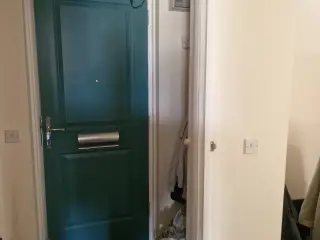 1-bed flat in Colchester £800 p/m Wants to move to Sudbury
No homes listed within 5 miles at the moment. New homes are listed every week: see homes across Essex, use the alert form below, or list your own home so tenants here can find you.
Housing in Manningtree
Tendring is dominated by home ownership: 71.5% of homes are owned and 19.8% are privately rented, leaving just 8.2% social rented, split roughly evenly between council and housing association. That is well below the England figure of 17.1%, so social homes here are a smaller slice of the market than in many places, and mutual exchange is a valuable route in.
Tendring District Council is the biggest social landlord with 3,078 homes, followed by Eastlight Community Homes (866), Places for People Homes (601), Delta Housing (424) and Anchor Hanover Group (356).
On cost, average weekly social rents across Tendring in 2024/25 were £94 for a one bed, £110 for a two bed and £123 for a three bed. In 2024-25 the council let 367 social homes and 37 council homes changed hands through mutual exchange, with 1,857 households on the housing register at 31 March 2025. A register is not a simple queue, which is one reason swapping appeals to so many tenants.
Who owns the homes
Share of homes in the Tendring council area, Census 2021.
Ages
Share of people in each age group, Census 2021.
Council waiting list and lettings
Households on the register by the size of home they need.
That is roughly 5.1 households waiting for every social home let in a year. Mutual exchange doesn't use the waiting list: if you already have a council or housing association home, swapping with another tenant can be a quicker way to move to Manningtree.
A register counts households who have applied, so it isn't a simple queue: some are already social tenants hoping to transfer, and people can be on more than one council's list.
Typical weekly social rents in the Tendring council area
Social rent averages for 2025/26. Affordable rent homes cost more, typically 60 to 80% of market rent.
Biggest social landlords in the council area
- Tendring District Council3,134 homes
- Eastlight Community Homes Limited859 homes
- Places for People Homes Limited656 homes
- Delta Housing Limited564 homes
- Anchor Hanover Group356 homes
- Flagship Housing Limited218 homes
- Home Group Limited206 homes
- Sanctuary Housing Association144 homes
Compare these landlords against every other on tenant satisfaction, repairs and complaints.
Living in Manningtree
Day to day life is low key. The centre has a Tesco Express, a Boots pharmacy and Manningtree Library, plus pubs including The Red Lion, The Crown and Skinners Arms and the Little Bear Bar. Foundry Court community centre is a few minutes away and the Venture Centre 2000 is about a mile off.
The wider Tendring area skews older than England as a whole: 29.6% of residents are 65 or over, against 18.4% nationally, and only 19.3% are aged 25 to 44. You will notice that in the pace of things. For some tenants that calm is exactly the appeal; if you want nightlife and crowds, be honest with yourself before you swap.
Schools in Manningtree
For a small town, schooling is well covered. Highfields Primary School is about 0.4 miles away, with Lawford C of E Primary at 0.9 miles, and Stourview CofE Primary Academy and Mistley Norman Church of England Primary both around 1.1 miles. Manningtree High School is only half a mile from the centre, and East Bergholt High School is 2.8 miles out. Always check current admissions and catchments with the council before you plan a move.
Outdoors, families are spoiled. Cattawade Nature Reserve is a short walk, Pattles Fen about 1.5 miles, and Flatford Field and the RSPB Flatford Wildlife Garden are roughly two miles away. River Reach Allotment Site is nearby if you fancy growing something.
The library in town is a useful free base for children, and Foundry Court and the Venture Centre 2000 host community activity. Across Tendring, 15.8% of residents are under 16, a little below the England figure of 18.6%, so it is not a child-heavy area.
Primary schools
- Highfields Primary School Outstanding 20220.4 mi
- Lawford Church of England Voluntary Aided Primary School Report card 20260.9 mi
- Stourview Church of England Primary Academy Requires improvement 20211.1 mi
- Brooklands Primary School Good 20221.2 mi
- Bradfield Primary School Good 20222.4 mi
Secondary schools
- Manningtree High School Inspected 20250.5 mi
- East Bergholt High School Good 20232.9 mi
Libraries
- Manningtree Librarynearby
Green good or better (on report cards, the expected standard or better), amber requires improvement or an area needs attention, red inadequate or an area needs urgent improvement, with the year of the inspection. Since September 2024 Ofsted no longer gives one overall grade, so newer results ("Report card", "Inspected") are coloured by their weakest area. Click a school for its full report. Ofsted data at 31 October 2026.
Shops in Manningtree
Supermarkets
- Tesco Expressnearby
- The Wholefood Storenearby
- East of England CO-OPnearby
- Coop Village Shop1.4 mi
Pharmacies
- Bootsnearby
- Day Lewis Pharmacy2.9 mi
Getting around Manningtree
Trains are Manningtree's strongest card. Manningtree station is about 0.8 miles from the centre, with Mistley station a similar distance the other way, so rail is a genuine option for work, college or days out without a car.
Buses run from stops on Oxford Road, a couple of minutes' walk from the shops, and from stops at and near the railway station. Services in a town this size will not be as frequent as in a city, so check timetables for the journeys you actually need to make before committing to a swap.
On foot, the town is easy: the shops, library, pharmacy and pubs sit within a few hundred metres of each other, and the walk out to Cattawade Nature Reserve is under a mile. Drivers get quick access to the wider Essex and Suffolk countryside, with East Bergholt and Bradfield a short drive away. Parking in the older streets can be tight, so ask about it.
Train stations
- Mistley0.8 mi
- Manningtree0.8 mi
Things to do in Manningtree
Life here is outdoors and sociable rather than commercial. The estuary, the nature reserve at Cattawade and the walks around Flatford are the main draw, and they change completely with the seasons and the tide. Bring boots.
In town, the pubs do a lot of the heavy lifting: the Estuary, The Red Lion, The Crown Pub and Hotel, Skinners Arms and the Little Bear Bar are all within a couple of hundred metres of each other. Manningtree Library is right in the centre for books, computers and quieter time.
For exercise there is Live Fit Gym half a mile away and Fitness@Summers Park at 0.7 miles, with Chris Tyrrell Fitness, Zacks boxing and East Bergholt Sports Centre a short drive out. Village halls at Bradfield and Stutton add to what is on locally. For big cinemas, shopping centres and chain restaurants you will be getting the train or driving, which is the honest trade-off for a town this small.
Gyms
- Fitness at Summer's Park0.7 mi
Pubs and bars
- Estuarynearby
- Winylnearby
- Skinners Armsnearby
- The Red Lionnearby
- The Crownnearby
Community centres
- The Hubnearby
- Foundry Courtnearby
- Honeycroft0.7 mi
- Mistley Village Hall1 mi
- Brantham Village Hall1 mi
Jobs in Manningtree
Manningtree itself is too small to be a jobs hub, so most working households here either commute by train, drive to nearby towns, or work from home. The two nearby stations make rail commuting realistic, which is a large part of the town's appeal.
The wider Tendring picture reflects the older age profile: 46.7% of adults are in work, compared with 57.4% across England, while unemployment at 3.1% is slightly below the England figure of 3.5%. Unemployment-related benefit claims stood at 4.1% of 16 to 64 year olds in August 2026, close to the England figure of 4%.
Locally, jobs tend to come from shops, pubs, care, schools and services rather than large employers. If your work is tied to a particular site or shift pattern, map out the journey properly before you swap, including evenings and weekends when bus and train services thin out.
Figures are for the Tendring council area, Census 2021 and ONS claimant count.
Typical Pay
Median yearly pay before tax for full-time workers, 2025. Half earn more than this and half earn less.
Where The Jobs Are
The five biggest industries by share of employee jobs, 2024. "Health" includes hospitals, GP surgeries and care homes.
Council tax & MP in Manningtree
Council Tax 2026 to 2027
Yearly bill for two adults, including police, fire and the average parish charge. Most council and housing association homes are in Bands A to C. Living alone takes 25% off, and you may get Council Tax Reduction on a low income.
Your MP
Manningtree has more than one MP. Sir Bernard Jenkin (Conservative) is the MP for Harwich and North Essex, which covers the centre; the area also includes South Suffolk. Find the MP for your postcode.
An MP can help with problems involving government departments and, sometimes, your landlord or council.
Broadband in Manningtree
Share of homes that can get each speed, Ofcom, January 2026. Check an address on Ofcom's broadband checker.
Deprivation in Manningtree
The Tendring council area ranks 25th of 296 council areas in England on the Index of Multiple Deprivation 2025, where 1st is the most deprived. 20.2% of its neighbourhoods are among the most deprived 10% in England.
The index combines seven measures, including income, work, health, education and housing. It describes areas, not the people who live in them.
Is Manningtree safe?
Like every town centre, Manningtree has police incidents logged each month. In July 2026 there were 32 within about a mile of the centre, made up of:
Source: data.police.uk street-level crime. Counts cover a fixed one-mile radius around the centre, so busy high streets and stations always record far more than the residential streets around them, and most incidents are minor. Compare like with like: a similar-sized town centre, not a village.
Swapping to Manningtree
If a small estuary town with good train links, decent schools within a mile and countryside on the doorstep sounds like your kind of life, Manningtree is worth putting on your list. Go and walk it first if you can: see the high street, the station walk and the reserve, and imagine a wet Tuesday in February as well as a sunny Saturday.
To get started, list your own home on Mutual Home Exchange with clear photos, the number of bedrooms, and an honest note about the garden, parking, heating and any steps. Then set Manningtree, and the CO11 area, as a desired area so tenants there can find you.
It is worth adding nearby options too, such as Mistley, Lawford, Bradfield or East Bergholt, since a slightly wider search often produces a match far quicker. Keep your listing up to date, reply promptly to messages, and check with your landlord about permission and the usual checks before you agree anything. Take your time and get the right match rather than the first one.
Home alerts for Manningtree
One email, the first time a council or housing association home is listed within your chosen distance. No newsletter, no spam.
Nearby place guides
Thinking of moving a little further? Compare homes to swap, rents and local landlords in places near Manningtree.
All place guides in Essex → · All place guides in the East of England → · All regions →
On X: Near Manningtree
Home to swap: 1-bed bungalow in Colchester. Looking to move to Colchester or Highwoods.
#Colchester #ColchesterCityCouncil