What it's like to live in Watford
What is it like to live in Watford? It is a busy, mixed Hertfordshire town with a big shopping centre at its heart and quiet residential streets a short walk behind it. It suits people who want town life, work and schools close together rather than somewhere sleepy. St Mary's open space and the Harlequin centre are both on the doorstep.
"I'd move here" adds Watford to the areas on your listing, so homes here are matched to you first.
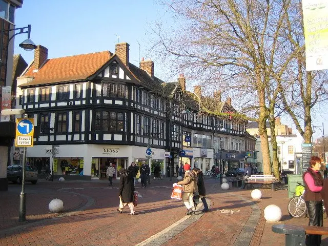
Watford sits in south-west Hertfordshire, close enough to London to feel connected and far enough out to have its own busy town centre. The town itself is home to around 90,000 people, and the wider council area about 102,000, so it has the shops, services and traffic of a proper town rather than a commuter village.
The centre is compact. From the WD17 postcode district you are within a few minutes' walk of the Harlequin shopping centre, Centre Court, a Marks & Spencer, a Tesco Express and a row of pharmacies including Boots and Superdrug. St Mary's open space is right on the doorstep.
It is a young, working town. A third of residents in the council area are aged 25 to 44 and just 12.6% are 65 or over, well below the England average of 18.4%. More than one in five is under 16. That shows in the number of families, the pace of the place and the demand for homes of every size.
Swapping to Watford: key facts
Can I swap my council or housing association home to Watford?
Yes, if you are already a council or housing association tenant. Mutual exchange means swapping homes with another social tenant, so it does not depend on the council waiting list: you need a tenant in or near Watford who wants your area, and both landlords must agree. Landlords have 42 days to decide and can only refuse on set legal grounds.
How long is the council housing waiting list in Watford?
1,232 households were on the Watford housing register on 31 March 2025, up 18% on a year earlier. 209 social homes were let through the council in 2024 to 2025, roughly 5.9 households for every home let. Source: Local Authority Housing Statistics, Ministry of Housing, Communities and Local Government.
How much is social rent in Watford?
Average weekly social rents in the Watford council area in 2025/26: 1 bed £0 council, £126 housing association; 2 bed £0 council, £142 housing association; 3 bed £0 council, £157 housing association. Affordable rent homes cost more, typically 60 to 80% of market rent. Source: Regulator of Social Housing.
How much social housing is there in Watford and who owns it?
15.6% of homes in the Watford council area are social housing (council 3.9%, housing association 11.7%), against 17.1% across England, according to the 2021 Census. The biggest social landlords there are Watford Community Housing Trust (4,927 homes), Origin Housing Limited (625 homes) and Hightown Housing Association Limited (402 homes).
How much is Council Tax in Watford?
In 2026 to 2027, Council Tax in the Watford council area is £1,631 a year for Band A, £1,903 for Band B, £2,175 for Band C and £2,447 for Band D, for two adults, including police, fire and the average parish charge. The England average for Band D is £2,392. Someone living alone gets 25% off. Source: Ministry of Housing, Communities and Local Government.
What is the average salary in Watford?
The typical (median) full-time salary for people living in the Watford council area was £43,219 a year before tax in 2025, against £39,243 across England. For jobs based in the area, including people who travel in, it was £38,746. Source: Office for National Statistics, Annual Survey of Hours and Earnings.
Who is the MP for Watford?
Matt Turmaine (Labour) is the MP for Watford, the constituency that covers Watford. Correct on 11 November 2026. Source: UK Parliament.
How Busy Is The Swap Market In Watford?
Figures as of 15 November 2026, updated every night. The waiting list figure is from 2024 to 2025 government data.
Homes to swap near Watford
Homes are shown near their address, not on it. Contains OS data © Crown copyright and database right. Source: Office for National Statistics, Open Government Licence.
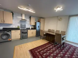 2-bed flat in Hendon £1,340 p/m Wants to move to Colindale
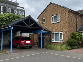 3-bed house in London £950 p/m Wants to move to W11 or Notting Hill +1 more
No homes listed within 5 miles at the moment. New homes are listed every week: see homes across Hertfordshire, use the alert form below, or list your own home so tenants here can find you.
Housing in Watford
Social renting is a smaller slice of Watford than the national picture: 15.6% of homes in the council area, against 17.1% across England. Most of that is housing association rather than council, with 11.7% association homes and only 3.9% council. Owner occupation is 55.1% and private renting is high at 28.2%.
The largest social landlord by far is Watford Community Housing Trust with 4,897 homes, followed by Origin Housing with 625, Hightown with 402, Paradigm with 313 and Thrive Homes with 278. If you swap here, there is a fair chance one of those becomes your landlord.
Average social rents in the council area for 2024/25 were about £122 a week for a one bed, £139 for a two bed and £153 for a three bed. For context on demand, 1,232 households were on the council's housing register at 31 March 2025 and 209 social homes were let through the council in 2024-25. A register is not a simple queue, which is why mutual exchange is worth pursuing alongside it.
Who owns the homes
Share of homes in the Watford council area, Census 2021.
Ages
Share of people in each age group, Census 2021.
Council waiting list and lettings
Households on the register by the size of home they need.
That is roughly 5.9 households waiting for every social home let in a year. Mutual exchange doesn't use the waiting list: if you already have a council or housing association home, swapping with another tenant can be a quicker way to move to Watford.
A register counts households who have applied, so it isn't a simple queue: some are already social tenants hoping to transfer, and people can be on more than one council's list.
Typical weekly social rents in the Watford council area
Social rent averages for 2025/26. Affordable rent homes cost more, typically 60 to 80% of market rent.
Biggest social landlords in the council area
- Watford Community Housing Trust4,927 homes
- Origin Housing Limited625 homes
- Hightown Housing Association Limited402 homes
- Paradigm Homes Charitable Housing Association Limited313 homes
- Thrive Homes Limited277 homes
- YMCA Chiltern Group253 homes
- Home Group Limited195 homes
- Peabody Trust173 homes
Compare these landlords against every other on tenant satisfaction, repairs and complaints.
Living in Watford
Day to day, central Watford is convenient in a way that costs nothing extra. Supermarkets, the main library, gyms and the bus stops are all within half a mile of WD17. If you currently drive to do everything, you may find you stop.
The trade-off is that the centre is loud and busy, especially at weekends and evenings. Parking is tight. Streets closer to parks like Nascot Grange Open Space or Waterfields Recreation Ground feel calmer. It is worth walking the exact street before you commit to a swap, because the character changes quickly from one road to the next.
Schools in Watford
There is a good cluster of primary schools close to the town centre. Central Primary School and Watford St John's Church of England Primary School are both about 0.2 miles away, with Chater Junior School and Field Junior School under half a mile. BeTa Primary Education Services is nearby too. For older children, Westfield Academy is roughly 1.1 miles, Queens' School 1.2 miles and Croxley Danes School 1.6 miles, with Chessbrook and Falconer School also within easy reach.
Always check current admissions and inspection reports yourself, as catchments and places change year to year.
For the rest of family life, there is more green space than the town centre suggests. St Mary's open space is right there, with Waterfields Recreation Ground, Estcourt Road Pocket Park, West Hertfordshire Sports Ground and Nascot Grange Open Space all within half a mile. Watford Library is about 0.5 miles away, and North Watford, Oxhey and Bushey libraries are all within three miles.
Primary schools
- Central Primary School Report card 2026nearby
- St John’s C of E Primary School Inspected 2025nearby
- Chater Junior School Inspected 20240.3 mi
- Watford Field School Infant & Nursery Report card 20260.3 mi
- Field Junior School0.4 mi
Secondary schools
- Watford Grammar School for Girls Outstanding 20240.3 mi
- Watford Grammar School for Boys Report card 20260.8 mi
- Chessbrook Education Support Centre Outstanding 20241 mi
- The Grange Academy Inspected 20241.1 mi
- Westfield Academy Inspected 20241.1 mi
Parks
- Waterfields Recreation Ground0.3 mi
- Radlett Road Playing fields0.5 mi
- Reeds Garden0.6 mi
- Old Fountain0.6 mi
- Oxhey Park0.7 mi
Libraries
- Watford Central Library0.5 mi
- North Watford Library1.7 mi
- Bushey Library2.2 mi
- Croxley Green Library2.2 mi
Green good or better (on report cards, the expected standard or better), amber requires improvement or an area needs attention, red inadequate or an area needs urgent improvement, with the year of the inspection. Since September 2024 Ofsted no longer gives one overall grade, so newer results ("Report card", "Inspected") are coloured by their weakest area. Click a school for its full report. Ofsted data at 31 October 2026.
Shops in Watford
Supermarkets
- M&S Simply Foodnearby
- Sainsbury's0.3 mi
- Tesco Extra0.4 mi
- Aldi0.5 mi
- Lidl0.5 mi
Pharmacies
- John Davis Pharmacynearby
- Hintons Pharmacy0.3 mi
- MD Pharmacy0.4 mi
- Abell Chemist1.1 mi
- Greenfield Pharmacy1.1 mi
Hospitals
- Watford General Hospital0.5 mi
- Spire Bushey Hospital3 mi
Shopping centres
- The Harlequinnearby
Getting around Watford
Watford is unusually well served by trains. Watford High Street station is about 0.2 miles from the centre and Watford Junction, the main line station, is around 0.6 miles. Bushey is 0.8 miles, Watford North 1.4 miles and Carpenders Park 1.9 miles, so several parts of town have a station within reasonable walking or cycling distance.
Buses run from a cluster of stops right in the middle of town: Market Street, Beechen Grove, Clarendon Road and Water Lane are all within a quarter of a mile of each other. That makes journeys across town and out to surrounding areas straightforward without a car.
Driving is fine for getting out of town, less fun inside it. The centre is one-way systems, bus lanes and paid parking, and traffic builds at school run times. Plenty of households here manage with one car or none. If you do drive, check what parking comes with the home you are swapping into, because it varies a lot.
Train stations
- Watford High Streetnearby
- Watford Junction0.6 mi
- Bushey0.8 mi
- Watford1 mi
- Cassiobury Park Station1.3 mi
Bus stations
- Watford Junction Railway Station (bus station)0.6 mi
Things to do in Watford
For a town of this size, Watford has a lot going on. Cineworld Watford is in the centre, with The Big Screen under half a mile away and Vue Cinema Watford and Woodside Leisure Park a little over two and a half miles out. Boom Battle Bar and a handful of late venues sit around the centre, so nights out do not involve a trip into London unless you want one.
Eating and drinking is mostly town-centre chains and bars: Las Iguanas, The Florist, Cassio Lounge and The Lounge are all within a few minutes' walk.
If you prefer daytime things, there are gyms almost on every corner of the centre, including JD Gyms, Charters Health Club, NRG Gym and the YMCA Chiltern Group. Community life runs through groups like Watford Community Trust, Watford Multi Cultural Community and the Watford Palace workshop. Between those, the parks and the libraries, it is not hard to find something to join.
Gyms
- Fullerlife Fitnessnearby
- PureGym0.3 mi
- Anytime Fitness Bushey0.8 mi
- The Gym1.1 mi
- RDX CageFit Gyms1.5 mi
Cinemas
- Cineworldnearby
- Vue2.6 mi
Pubs and bars
- The Floristnearby
- The Moon Under Waternearby
- The Market Tavernnearby
- Mad Squirrel Taproomnearby
- The Estcourt Tavernnearby
Nightlife
- Popworld0.3 mi
- Vinyl0.4 mi
Community centres
- Newton Price Centrenearby
- Watford Muslim Youth Centre0.9 mi
- Holyrood Social Centre1 mi
- Bushey Arena1.2 mi
- Holywell Community Centre1.3 mi
Jobs in Watford
Watford works. In the council area, 65.3% of adults are in employment, well above the England figure of 57.4%, and unemployment sits at 3.8% against 3.5% nationally. Benefit claims among 16 to 64 year olds were 4.6% in August 2026, slightly above the England rate of 4%.
Much of that employment is tied to the town centre itself: retail across the Harlequin, Centre Court and Waterfields Shopping Park, plus the offices along Clarendon Road and the services that keep a town of 90,000 running.
The other big factor is the trains. With Watford Junction and Watford High Street both close to the centre, London commuting is realistic, and plenty of households here do exactly that. If you are moving for work, it is worth pricing season tickets before you decide, because fares can eat a chunk of the money you save on rent compared with living in London.
Figures are for the Watford council area, Census 2021 and ONS claimant count.
Typical Pay
Median yearly pay before tax for full-time workers, 2025. Half earn more than this and half earn less.
Where The Jobs Are
The five biggest industries by share of employee jobs, 2024. "Health" includes hospitals, GP surgeries and care homes.
Jobcentres And Recruitment Agencies
- Jobcentre Plusnearby
From OpenStreetMap, which doesn't list every agency. Find more on Find a job (GOV.UK).
Council tax & MP in Watford
Council Tax 2026 to 2027
Yearly bill for two adults, including police, fire and the average parish charge. Most council and housing association homes are in Bands A to C. Living alone takes 25% off, and you may get Council Tax Reduction on a low income.
Your MP
Matt Turmaine (Labour) is the MP for Watford. Near the edges, find the MP for your postcode.
An MP can help with problems involving government departments and, sometimes, your landlord or council.
Broadband in Watford
Share of homes that can get each speed, Ofcom, January 2026. Check an address on Ofcom's broadband checker.
Deprivation in Watford
The Watford council area ranks 181st of 296 council areas in England on the Index of Multiple Deprivation 2025, where 1st is the most deprived. None of its neighbourhoods are among the most deprived 10% in England.
The index combines seven measures, including income, work, health, education and housing. It describes areas, not the people who live in them.
Is Watford safe?
Like every town centre, Watford has police incidents logged each month. In August 2026 there were 713 within about a mile of the centre, made up of:
Source: data.police.uk street-level crime. Counts cover a fixed one-mile radius around the centre, so busy high streets and stations always record far more than the residential streets around them, and most incidents are minor. Compare like with like: a similar-sized town centre, not a village.
Swapping to Watford
If Watford sounds like the right fit, the practical step is to list your own home on Mutual Home Exchange and set Watford as a desired area. Swaps only happen when tenants can find each other, and a clear, honest listing with decent photos does most of the work.
Be specific about what you have: number of bedrooms, floor level, garden or no garden, parking, heating and anything a family would want to know. Say what you are looking for too. Someone in Watford wanting to move to your area is the match you need, and the more detail you give, the faster that person spots you.
Then do the homework. Visit the street at different times, check school places and travel costs, and confirm with both landlords that the exchange can go ahead before anyone packs. Watford rewards people who want town life with trains, shops and parks close together. If that is you, start the conversation and see who comes back.
Home alerts for Watford
One email, the first time a council or housing association home is listed within your chosen distance. No newsletter, no spam.
Nearby place guides
Thinking of moving a little further? Compare homes to swap, rents and local landlords in places near Watford.
All place guides in Hertfordshire → · All place guides in the East of England → · All regions →