What it's like to live in Burnley
What is it like to live in Burnley? It is a former mill town in east Lancashire, compact and down to earth, with a proper town centre rather than a scattering of retail parks. It suits people who want everything close by and rents kept low. Charter Walk Shopping Centre and the town square, Place de Vitry sur Seine, are both minutes from the middle.
1 council and housing association home available to swap within 15 miles of Burnley.
"I'd move here" adds Burnley to the areas on your listing, so homes here are matched to you first.
Burnley sits in east Lancashire, a town of around 110,000 people built where the River Calder and River Brun meet. This guide covers the BB11 district, right at the heart of town.
If you are weighing up a mutual exchange here, the big draw is convenience. Shops, two cinemas, the bus station, three train stations, a leisure centre and the Central Library all sit within half a mile of the centre. Social rents in the council area are among the lower ones you will find anywhere in England.
Below we go through what living here feels like day to day, how you get about, schools, things to do, work and housing.
Which homes are available to swap near Burnley?
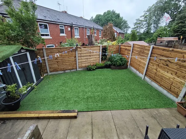
What is it like to live in Burnley?
What is it like to live in Burnley? It is a former mill town in east Lancashire, compact and down to earth, with a proper town centre rather than a scattering of retail parks. It suits people who want everything close by and rents kept low. Charter Walk Shopping Centre and the town square, Place de Vitry sur Seine, are both minutes from the middle.
Central BB11 is busy and built up. You are near supermarkets, pharmacies and health centres, but also near the pubs and clubs, so some streets are livelier at night than others.
About 701 incidents were recorded within a mile of the centre in July 2026, which is normal for a busy town centre and mostly minor matters like anti-social behaviour and shoplifting.
The age mix in the wider council area is close to the England average, with slightly more under-16s, so there are plenty of families around.
What are the schools and family life like in Burnley?
Families in central Burnley have a good choice of schools nearby. St Peter's Primary School, Holy Trinity Primary School and Springfield Community Primary School are all within half a mile. Check current Ofsted reports and admissions before you commit, as catchments change.
For older children there is real choice within a mile: Olive High, Coal Clough Academy, The Heights School Burnley, The Rose School and Unity College.
For free days out, Healey Heights, Sandygate Square and the riverside where the Calder and Brun meet are all close. The Central Library is a couple of minutes from the town square and Coal Clough Library is a little further out.
Burnley Play Association, theSWITCH and Burnley Wood Community Centre are handy for groups and activities.
Primary schools
- Positive Footprints Networknearby
- Moonline Uniforms Ltd0.3 mi
- St Peters's Primary School0.4 mi
- Holy Trinity Primary School0.5 mi
- Springfield Community Primary School0.5 mi
Secondary schools
- Olive High0.5 mi
- Coal Clough Academy0.6 mi
- The Heights School Burnley0.8 mi
- The Rose School0.9 mi
- Unity College0.9 mi
Parks
- Place de Vitry sur Seine (Town Square)nearby
- River Burnleynearby
- River Calder and River Brun confluence0.3 mi
- Sandygate Square0.3 mi
- Healey Heights0.5 mi
Libraries
- Central Librarynearby
- Coal Clough Library0.6 mi
- Burnley Little Free Library0.7 mi
- Burnley Campus1.3 mi
- Burnley Campus Library1.3 mi
What shops and everyday essentials are in Burnley?
Supermarkets
- Mega Bargain Storenearby
- Iceland Supermarket Burnleynearby
- Marks & Spencernearby
- Tesco Extranearby
- Tesco Petrol Stationnearby
Pharmacies
- Boots Pharmacynearby
- Tesco Pharmacynearby
- St Peters Pharmacy0.3 mi
- Boots Pharmacy0.4 mi
- Asda Burnley Superstore0.5 mi
Hospitals
- St Peter's Primary Health Care Centre0.3 mi
- My MSK Clinic Lancashire0.3 mi
- Burnley Wood Medical Centre0.4 mi
- Colne Road Surgery0.8 mi
- Life Line Screening1.2 mi
Shopping centres
- Charter Walk Shopping Centrenearby
- Burnley FC in the Community Kitchennearby
- Pioneer Place0.3 mi
- Briercliffe Shopping Centre1.4 mi
- Pendle Village Mill2.8 mi
How do you get around Burnley?
For a town this size, Burnley is unusually well served by rail. Burnley Manchester Road is about a third of a mile from the centre, with Burnley Central and Burnley Barracks also within walking distance and Rose Grove and Brierfield a short hop out.
Buses run from the St James Street stops and Burnley bus station, all clustered within a couple of hundred metres of the shops, which makes changing services simple.
On foot, the centre is flat and walkable, and most of what you need day to day is inside half a mile. If you drive, you have supermarket parking and a Tesco petrol station close in, though central streets can be tight and busy at peak times.
Train stations
- Burnley Manchester Road0.3 mi
- Burnley Central0.4 mi
- Burnley Barracks0.6 mi
- Rose Grove1.6 mi
- Brierfield2.5 mi
Bus stations
- St James Street (Stop 1)nearby
- Red Lion Street Schoolnearby
- St James Street (Stop 3)nearby
- St James Street (Stop 2)nearby
- Burnleynearby
What is there to do in Burnley?
For a town of this size, the centre is well stocked. Two cinemas, Vault Cinemas and REEL, sit within a third of a mile, and Charter Walk and Pioneer Place cover most of the shopping. Briercliffe Shopping Centre and Pendle Village Mill are a short trip out.
If you like keeping active, St Peter's Leisure Centre is close, along with smaller independent gyms and clubs like Dragons kickboxing and Legacy Fitness.
Nights out are easy to find. There is a cluster of pubs and bars around the centre, plus several clubs. Burnley FC in the Community Kitchen is part of the town centre mix too.
Green space is more about squares and riverside walks than big parkland, with Healey Heights the nearest higher ground.
Gyms
- 24 Fit Campnearby
- Dragons kickboxing clubnearby
- Legacy Fitnessnearby
- St Peter's Leisure Centre, Burnley Leisure & Culture0.3 mi
- shredzone0.4 mi
Cinemas
- Vault Cinemas Burnleynearby
- REEL Cinemas Burnley0.3 mi
Pubs and bars
- William's Lounge Barnearby
- Oskarsnearby
- Dublinernearby
- Bar Mojitos Burnleynearby
- Smackwater Jack’s Barnearby
Nightlife
- The New Mr Greensnearby
- Paparazzi Nightclubnearby
- OFF THE RECORDnearby
- RR Night Clubnearby
- Projektnearby
Community centres
- theSWITCH (Burnley)nearby
- Burnley Play Association0.3 mi
- Vanguard Community Centre0.3 mi
- Burnley Wood Community Centre0.4 mi
- Canalside Community Centre0.5 mi
What is work and the local economy like in Burnley?
Work is the honest weak spot. In the Burnley council area, 53.2% of adults are in work, below the England figure of 57.4%, and 5.6% of working-age people were claiming unemployment-related benefits in August 2026 against 4% for England. Unemployment itself, at 3.6%, is close to the national 3.5%.
In practice that means it is worth knowing where your work or training is coming from before you move. Retail, health and community services are visible in the town centre, and Burnley Campus is just over a mile away for courses.
The upside is the railway. Frequent trains from Burnley Manchester Road widen the area you can realistically commute to without needing a car.
Figures are for the Burnley council area, Census 2021 and ONS claimant count.
What is housing like in Burnley and who lives there?
Social rents in the Burnley council area are low: around £84 a week for a one bed, £98 for a two bed and £109 for a three bed in 2024/25. For many tenants that is the single biggest reason to look here.
Calico Homes is much the largest social landlord, with around 5,020 homes, followed by Accent Housing, Your Housing, Anchor Hanover and Places for People.
Social renting makes up 15.6% of homes in the council area, a little under the England share of 17.1%, with most of that housing association rather than council. Owner occupation is high at 59.8% and private renting accounts for 24.3%. Stock in central Burnley leans towards terraced streets.
Typical weekly social rents in the Burnley council area
| Size | Council | Housing association |
|---|---|---|
| Bedsit | £0 | £69 |
| 1 bed | £0 | £84 |
| 2 bed | £104 | £98 |
| 3 bed | £116 | £109 |
| 4 bed | £0 | £118 |
Social rent averages for 2024/25. Affordable rent homes cost more, typically 60 to 80% of market rent.
Biggest social landlords in the council area
- Calico Homes Limited5,020 homes
- Accent Housing Limited579 homes
- Your Housing Limited194 homes
- Anchor Hanover Group166 homes
- Places for People Homes Limited133 homes
- Great Places Housing Association121 homes
- Housing 21115 homes
- Muir Group Housing Association Limited99 homes
How safe is Burnley?
Like every town centre, Burnley has police incidents logged each month. In July 2026 there were 701 within about a mile of the centre, made up of:
- Anti-social behaviour reports145
- Vehicle crime26
- Bicycle theft4
- Shoplifting98
- Other theft27
- Theft from the person4
Source: data.police.uk street-level crime. Counts cover a fixed one-mile radius around the centre, so busy high streets and stations always record far more than the residential streets around them, and most incidents are minor. Compare like with like: a similar-sized town centre, not a village.
Is Burnley a good place for council and housing association tenants?
Right now there is very little listed nearby on Mutual Home Exchange: one two-bed house in Bury, about 12.8 miles away, whose tenant wants to upsize. That is a thin picture, but swap lists change week by week.
The way to get ahead of it is to list your own home properly, with clear photos and an honest description, and set Burnley as a desired area. Then you appear to tenants here who are looking to move out, and you get told when something new comes up.
It is free to list. Before you agree anything, visit the street, check the school run and get written permission from both landlords.
Tell me when a home appears near Burnley
One email, the first time a council or housing association home is listed within your chosen distance. No newsletter, no spam.
Live in Burnley? Add a photo
Tenants' own photos help other people picture the place. Approved photos are credited to you. Submit a photo.