What it's like to live in Portchester
Portchester is a settled harbourside suburb in Hampshire, sitting between Fareham and Portsmouth with around 17,800 people. It feels like a proper village centre wrapped in quiet residential streets, and it suits families and older households who want everyday things close by. Portchester Park and the library on the doorstep are a real plus.
"I'd move here" adds Portchester to the areas on your listing, so homes here are matched to you first.
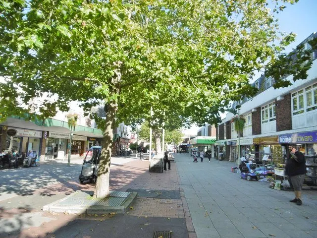
Portchester sits in the Borough of Fareham, on the northern shore of Portsmouth Harbour in Hampshire, in the South East. Fareham town centre is about two and a half miles west and Portsmouth lies to the east, with Cosham the nearest neighbourhood across the water's edge. The postcode district is PO16.
People move here for the position. You are between two decent-sized towns without living in either, with a train station in the village and major roads close at hand. That mix of a small-town centre and easy reach of bigger places is the main draw for tenants looking to swap in.
The wider Fareham council area has a population of around 114,500, and Portchester itself is home to roughly 17,800 people. It is a suburban area rather than a city neighbourhood, so expect a slower pace. For anyone working in Portsmouth or Fareham, or with family spread between the two, it is a sensible middle ground, and the harbour setting gives it a character that nearby estates further inland do not have.
Swapping to Portchester: key facts
Can I swap my council or housing association home to Portchester?
Yes, if you are already a council or housing association tenant. Mutual exchange means swapping homes with another social tenant, so it does not depend on the council waiting list: you need a tenant in or near Portchester who wants your area, and both landlords must agree. Landlords have 42 days to decide and can only refuse on set legal grounds. In 2024 to 2025, 11 council homes in Fareham changed tenants by mutual exchange.
How long is the council housing waiting list in Portchester?
293 households were on the Fareham housing register on 31 March 2025, down 50% on a year earlier. 300 social homes were let through the council in 2024 to 2025, roughly 1.0 households for every home let. Source: Local Authority Housing Statistics, Ministry of Housing, Communities and Local Government.
How much is social rent in Portchester?
Average weekly social rents in the Fareham council area in 2025/26: 1 bed £100 council, £113 housing association; 2 bed £113 council, £134 housing association; 3 bed £137 council, £157 housing association. Affordable rent homes cost more, typically 60 to 80% of market rent. Source: Regulator of Social Housing.
How much social housing is there in Portchester and who owns it?
8.1% of homes in the Fareham council area are social housing (council 4.6%, housing association 3.5%), against 17.1% across England, according to the 2021 Census. The biggest social landlords there are Fareham Borough Council (2,422 homes), Vivid Housing Limited (1,127 homes) and Hyde Housing Association Limited (356 homes).
How Busy Is The Swap Market In Portchester?
Figures as of 4 November 2026, updated every night. The waiting list figure is from 2024 to 2025 government data.
Which homes are available to swap near Portchester?
Homes are shown near their address, not on it. Contains OS data © Crown copyright and database right. Source: Office for National Statistics, Open Government Licence.
No homes listed within 5 miles at the moment. New homes are listed every week: see homes across Hampshire, use the alert form below, or list your own home so tenants here can find you.
What is housing like in Portchester and who lives there?
Portchester is mostly a home-owning area. Across the Fareham council area, 78.5% of homes are owned outright or with a mortgage, 12.6% are privately rented and just 8.1% are social rented, well below the England figure of 17.1%. Council homes make up 4.6% and housing association homes 3.5%, so social lets here are comparatively scarce and a mutual exchange is a genuinely useful route in.
Fareham Borough Council is the largest social landlord with 2,422 homes, followed by Vivid Housing with 1,127, Hyde Housing Association with 356, The Swaythling Housing Society with 283 and Abri Group with 135. The council's housing register held 293 households at 31 March 2025, with 300 social homes let in 2024-25 and 11 council homes swapped by mutual exchange. A register is not a simple queue.
Average weekly social rents in the borough for 2025/26 are £105 for a one bed, £124 for two beds and £145 for three beds. The population skews older than England as a whole: 28.3% are aged 45 to 64 and 24.5% are 65 or over, with 22.2% aged 25 to 44.
Who owns the homes
Share of homes in the Fareham council area, Census 2021.
Ages
Share of people in each age group, Census 2021.
Council waiting list and lettings
Households on the register by the size of home they need.
That is roughly 1.0 households waiting for every social home let in a year. Mutual exchange doesn't use the waiting list: if you already have a council or housing association home, swapping with another tenant can be a quicker way to move to Portchester.
A register counts households who have applied, so it isn't a simple queue: some are already social tenants hoping to transfer, and people can be on more than one council's list.
Typical weekly social rents in the Fareham council area
Social rent averages for 2025/26. Affordable rent homes cost more, typically 60 to 80% of market rent.
Biggest social landlords in the council area
- Fareham Borough Council2,422 homes
- Vivid Housing Limited1,127 homes
- Hyde Housing Association Limited356 homes
- The Swaythling Housing Society Limited283 homes
- Abri Group Limited135 homes
- The Guinness Partnership Limited88 homes
- Aster Communities76 homes
- Church of England Soldiers' Sailors' and Airmen's Housing Association Limited55 homes
Compare these landlords against every other on tenant satisfaction, repairs and complaints.
What is it like to live in Portchester?
Day to day, most of what you need is within a short walk or a quick drive. There is a Lidl a few minutes away and a Co-operative Food a little further on, with a Rowlands Pharmacy near the centre. The Boardwalk Shopping Centre is just over a mile off, and Fareham Shopping Centre and Market Quay sit about two and a half miles away.
Green space is well spread out. Portchester Park, High View Park and Northfield Park are all within a mile, with Alton Grove and Kenwood Road open spaces nearby too, so there is somewhere to walk the dog or let children run without crossing town. Portchester Community Centre is half a mile away and Portchester Library only a couple of hundred metres from the centre. Queen Alexandra Hospital is around two and a half miles away, which matters if you have regular appointments.
What are the schools and family life like in Portchester?
Families are well served for schools. Northern Junior School, Northern Infant School and Castle Primary School are all around 0.4 miles away, with Red Barn Community Primary School at 0.5 miles and Wicor Primary School under a mile. That is five primaries within easy reach, which gives you some choice rather than one obvious option.
For older children, Portchester Community School is 0.4 miles away and Castle View Academy 0.6 miles. Cams Hill School is about a mile and a half, with The Harbour School two miles and Trafalgar School around two and a half. Several are close enough for a secondary-age child to walk or take a short bus ride.
Beyond school, Portchester Park, High View Park and Northfield Park give children somewhere to play close to home, and Portchester Community Centre half a mile away is the focus for local groups and activities. The library is a couple of hundred metres from the centre, handy for homework and rainy afternoons. Across the Fareham council area, under-16s make up 16.4% of residents, slightly below the England figure of 18.6%, so it is a family area but not an especially young one.
Primary schools
- Northern Junior School0.4 mi
- Northern Infant School0.4 mi
- Castle Primary School0.4 mi
- Red Barn Community Primary School0.5 mi
- Wicor Primary School0.8 mi
Secondary schools
- Portchester Community School0.4 mi
- Castle View Academy0.6 mi
- Cams Hill School1.5 mi
- The Harbour School2 mi
- Trafalgar School2.6 mi
Parks
- Portchester Park0.4 mi
- High View Park0.5 mi
- Northfield Park0.7 mi
- Alton Grove Open Space0.7 mi
- Kenwood Road Open Space0.8 mi
Libraries
- Portchester Librarynearby
- Fareham Library2.4 mi
- Cosham Library2.5 mi
- Bridgemary Library2.8 mi
- North End Library2.9 mi
What shops and everyday essentials are in Portchester?
Supermarkets
- Lidl0.3 mi
- The Co-operative Food0.6 mi
- Aldi1.2 mi
- Tesco Extra1.3 mi
- Tesco2.2 mi
Pharmacies
- Rowlands Pharmacynearby
- Superdrug2.3 mi
- Boots2.4 mi
- Everetts Pharmacy2.5 mi
- Lalys Pharmacy2.5 mi
Hospitals
- Queen Alexandra Hospital2.4 mi
- Nelson House (Psychiatric Rehabilitation Facility)2.9 mi
Shopping centres
- The Boardwalk Shopping Centre1.3 mi
- Market Quay Shopping Centre2.4 mi
- Fareham Shopping Centre2.4 mi
How do you get around Portchester?
Portchester station is barely a tenth of a mile from the centre, which is unusually handy. Cosham station is about two and a half miles away and Fareham station around three miles, so you have options if a line is disrupted or you need a different direction.
For buses, local services run through the area and Fareham Bus Station, roughly two and a half miles away, is the main hub for longer routes. If you do not drive, the combination of a village-centre station and bus links into Fareham makes getting about workable, though you will want to check timetables for evenings and Sundays.
By car, you are well placed between Fareham and Portsmouth, with Queen Alexandra Hospital and the Boardwalk and Odeon area all a short drive. Parking on older residential streets can be tight in places. On foot, the centre, library, pharmacy and Lidl are all within a few minutes of many homes, and the parks link up residential pockets, so plenty of everyday trips can be done without a car at all.
Train stations
- Portchesternearby
- Cosham2.5 mi
- Fareham3 mi
Bus stations
- Fareham Bus Station2.4 mi
What is there to do in Portchester?
For a suburb, Portchester has a decent spread. The Red Lion and Al's are both within a couple of hundred metres of the centre, with The Seagull, The Wicor Mill and The Cormorant all under a mile, so you are not short of somewhere local for a drink or a meal.
Outdoors, Portchester Park is the main green space at 0.4 miles, backed up by High View Park, Northfield Park, Alton Grove Open Space and Kenwood Road Open Space, all within a mile. That makes walking, running and taking children out easy without needing to travel.
For bigger days out, the Odeon cinema is about 1.3 miles away, with the Reel cinema around 2.4 miles in Fareham. PureGym sits next to the Boardwalk Shopping Centre, with NoExcusess and Praetorian MMA a little further for anyone after something different. Shopping ranges from the Boardwalk at just over a mile to Fareham Shopping Centre and Market Quay at around two and a half miles. Portchester Library and the community centre round out the local options close to home.
Gyms
- PureGym1.3 mi
- NoExcusess1.9 mi
- Praetorian MMA2.7 mi
Cinemas
- Odeon1.3 mi
- Reel2.4 mi
Pubs and bars
- The Red Lionnearby
- Al'snearby
- The Seagull0.6 mi
- The Wicor Mill0.7 mi
- The Cormorant0.7 mi
Community centres
- Portchester Community Centre0.5 mi
- Wallington Village Hall2.2 mi
- Howard Road Community Centre2.5 mi
- Bridgemary Community Centre2.8 mi
What is work and the local economy like in Portchester?
Employment in the wider Fareham council area looks healthy. At the 2021 Census, 58.2% of adults were in work, a touch above the England figure of 57.4%, while unemployment was 2.2% against 3.5% nationally. More recent figures put unemployment-related benefit claimants at around 2% of 16 to 64 year olds in August 2026, half the England rate of 4%.
For jobseekers, Portchester's position between Fareham and Portsmouth matters more than the village itself. Queen Alexandra Hospital, two and a half miles away, is a major employer on your doorstep, and the shopping centres at the Boardwalk, Market Quay and Fareham bring retail and hospitality work within a short trip.
With the train station in the village and bus links into Fareham Bus Station, commuting further afield is realistic without a car. The age profile across the borough skews older, with 24.5% aged 65 and over, so care and health roles are likely to stay in demand. If your work is tied to Portsmouth or Southampton, check journey times before you commit to a swap.
Figures are for the Fareham council area, Census 2021 and ONS claimant count.
How safe is Portchester?
Like every town centre, Portchester has police incidents logged each month. In August 2026 there were 116 within about a mile of the centre, made up of:
Source: data.police.uk street-level crime. Counts cover a fixed one-mile radius around the centre, so busy high streets and stations always record far more than the residential streets around them, and most incidents are minor. Compare like with like: a similar-sized town centre, not a village.
Is Portchester a good place for social housing tenants?
If Portchester looks like the right fit, the practical step is to list your own home here and set Portchester, or the wider Fareham area, as a place you want to move to. Swaps only happen when both sides can see each other, so a clear listing with honest photos and a proper description of your home does most of the work.
Be specific about what you have and what you need: number of bedrooms, floor level, garden or no garden, parking, and whether stairs are an issue. Tenants searching this area are often weighing up schools, the station and how far they are from Fareham or Portsmouth, so say what your home offers on those fronts.
It is worth adding nearby areas as well as Portchester itself. Social housing is a smaller share of homes in this borough than nationally, so widening your search to Fareham, Cosham or neighbouring estates gives you more chances of a match. Check with your landlord about permission early, keep your listing up to date, and reply to enquiries quickly. Patience helps, but so does being easy to deal with.
Tell me when a home appears near Portchester
One email, the first time a council or housing association home is listed within your chosen distance. No newsletter, no spam.
Live in Portchester? Add a photo
Tenants' own photos help other people picture the place. Approved photos are credited to you. Submit a photo.
Nearby place guides
Thinking of moving a little further? Compare homes to swap, rents and local landlords in places near Portchester.
All place guides in Hampshire → · All place guides in the South East → · All regions →