What it's like to live in Wednesfield
Wednesfield is a busy suburban township on the eastern side of Wolverhampton, in the West Midlands. It has an old village heart with a high street, pubs and a park, wrapped in rows of post-war estates. It suits families and anyone who wants a proper local centre rather than a quiet backwater, with Wednesfield Park and Bentley Bridge close by.
"I'd move here" adds Wednesfield to the areas on your listing, so homes here are matched to you first.
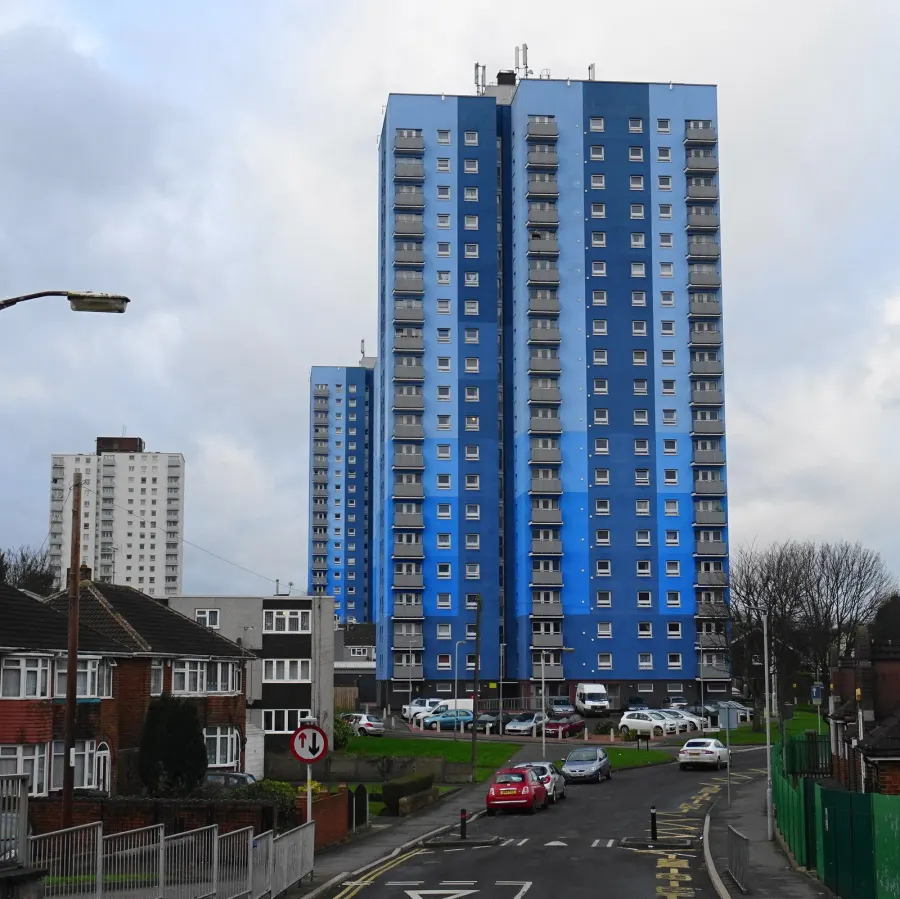
Wednesfield sits in the City of Wolverhampton, about two miles north-east of Wolverhampton city centre. Willenhall is just along the road to the east, with Bilston and Darlaston to the south-east, so you are well inside the Black Country but with open parkland never far off.
People move here for the balance. You get a recognisable local centre with its own shops, library and park, while the Mander Centre in Wolverhampton is only a couple of miles away for bigger shopping. The Bentley Bridge retail and leisure park, with its cinema, is a short hop from the centre.
For tenants thinking about a swap, the pull is usually practical: good access to New Cross Hospital, a choice of primary and secondary schools within walking or short bus distance, and main roads that make the rest of the West Midlands reachable. Wolverhampton has a large council housing stock, so the kind of homes that come up for exchange here cover everything from flats to family houses on the estates.
Swapping to Wednesfield: key facts
Can I swap my council or housing association home to Wednesfield?
Yes, if you are already a council or housing association tenant. Mutual exchange means swapping homes with another social tenant, so it does not depend on the council waiting list: you need a tenant in or near Wednesfield who wants your area, and both landlords must agree. Landlords have 42 days to decide and can only refuse on set legal grounds. In 2024 to 2025, 161 council homes in Wolverhampton changed tenants by mutual exchange.
How long is the council housing waiting list in Wednesfield?
8,260 households were on the Wolverhampton housing register on 31 March 2025, up 24% on a year earlier. 1,128 social homes were let through the council in 2024 to 2025, roughly 7.3 households for every home let. Source: Local Authority Housing Statistics, Ministry of Housing, Communities and Local Government.
How much is social rent in Wednesfield?
Average weekly social rents in the Wolverhampton council area in 2025/26: 1 bed £86 council, £99 housing association; 2 bed £96 council, £112 housing association; 3 bed £109 council, £124 housing association. Affordable rent homes cost more, typically 60 to 80% of market rent. Source: Regulator of Social Housing.
How much social housing is there in Wednesfield and who owns it?
25.2% of homes in the Wolverhampton council area are social housing (council 18.8%, housing association 6.4%), against 17.1% across England, according to the 2021 Census. The biggest social landlords there are City of Wolverhampton Council (21,174 homes), Midland Heart Limited (2,143 homes) and GreenSquareAccord Limited (1,623 homes).
How Busy Is The Swap Market In Wednesfield?
Figures as of 4 November 2026, updated every night. The waiting list figure is from 2024 to 2025 government data.
Which homes are available to swap near Wednesfield?
Homes are shown near their address, not on it. Contains OS data © Crown copyright and database right. Source: Office for National Statistics, Open Government Licence.
No homes listed within 5 miles at the moment. New homes are listed every week: see homes across the West Midlands, use the alert form below, or list your own home so tenants here can find you.
What is housing like in Wednesfield and who lives there?
Wolverhampton has a bigger share of social housing than most of England. Across the council area, 25.2% of homes are socially rented (18.8% council, 6.4% housing association), against 17.1% nationally. Around 55% are owner-occupied and 19% privately rented, so streets here tend to be a genuine mix of tenures rather than single-tenure estates.
City of Wolverhampton Council is by far the largest landlord with 21,174 homes, followed by Midland Heart (2,143), GreenSquareAccord (1,623), Bromford (1,498) and Walsall Housing Group (482). Average weekly social rents for 2025/26 in the council area are about £88 for one bed, £100 for two and £110 for three.
The age profile is slightly younger than England's: 20.9% are under 16 and 16.4% are 65 or over. In 2024-25 the council let 1,128 social homes and 161 council homes changed hands through mutual exchange, with 8,260 households on the housing register at the end of March 2025. A register is not a simple queue, which is one reason many tenants look at swapping instead.
Who owns the homes
Share of homes in the Wolverhampton council area, Census 2021.
Ages
Share of people in each age group, Census 2021.
Council waiting list and lettings
Households on the register by the size of home they need.
That is roughly 7.3 households waiting for every social home let in a year. Mutual exchange doesn't use the waiting list: if you already have a council or housing association home, swapping with another tenant can be a quicker way to move to Wednesfield.
A register counts households who have applied, so it isn't a simple queue: some are already social tenants hoping to transfer, and people can be on more than one council's list.
Typical weekly social rents in the Wolverhampton council area
Social rent averages for 2025/26. Affordable rent homes cost more, typically 60 to 80% of market rent.
Biggest social landlords in the council area
- City of Wolverhampton Council21,174 homes
- Midland Heart Limited2,143 homes
- GreenSquareAccord Limited1,623 homes
- Bromford Housing Association Limited1,498 homes
- Walsall Housing Group Limited482 homes
- Nehemiah United Churches Housing Association Limited399 homes
- Housing 21313 homes
- Anchor Hanover Group254 homes
Compare these landlords against every other on tenant satisfaction, repairs and complaints.
What is it like to live in Wednesfield?
Day to day, most of what you need sits within a short walk. There is a Sainsbury's and an Aldi within a few hundred metres, a Heron Foods on the doorstep, a Boots pharmacy nearby and Wednesfield Library right in the middle of things. Co-op Food and Asda are both about a mile out for bigger shops.
The streets mix older terraces and cottages near the centre with wider estate roads further out, so the feel changes street by street. Pubs like the Dog and Partridge, The Royal Tiger, The Angel and The Vine are all close to the centre, which keeps the place sociable. New Cross Hospital and the Gem Centre are both under a mile away, which matters more than people expect when you have children or regular appointments.
What are the schools and family life like in Wednesfield?
There is a good spread of primary schools close by. St Patrick's Catholic Primary Academy is right on the doorstep at 0.1 miles, with The Children Village at 0.2, Wodensfield Primary School at 0.5, St Thomas' Church of England Primary Academy at 0.6 and Wood End Primary School at 0.7 miles.
For older children, Wednesfield High School (upper) is 0.6 miles away and Heath Park 0.7. St Matthias School is under a mile, with Our Lady and St Chad Catholic Academy and Pool Hayes Academy both around 1.3 miles. That gives families a genuine choice, including faith schools, without long journeys. Always check current admission rules and catchments before you commit to a swap.
Outside school, Wednesfield Park is a minute from the centre and Heath Town Park, Perry Hall Park, Brickheath Park and Willenhall Memorial Park are all within a couple of miles. Wednesfield Library is close for story times and free indoor space, and Cineworld at Bentley Bridge is about half a mile away for rainy weekends.
Primary schools
- St Patrick's Catholic Primary Academynearby
- The Children Villagenearby
- Wodensfield Primary School0.5 mi
- St Thomas' Church of England Primary Academy0.6 mi
- Wood End Primary School0.7 mi
Secondary schools
- Wednesfield High School (upper)0.6 mi
- Heath Park0.7 mi
- St Matthias School0.9 mi
- Our Lady and St Chad Catholic Academy1.3 mi
- Pool Hayes Academy1.3 mi
Parks
- Wednesfield Parknearby
- Heath Town Park0.7 mi
- Perry Hall Park0.8 mi
- Brickheath Park1 mi
- Willenhall Memorial Park1.2 mi
Libraries
- Wednesfield Librarynearby
- East Park Library1.3 mi
- Low Hill Library1.6 mi
- Willenhall Library1.7 mi
- Wolverhampton Central Library2.1 mi
What shops and everyday essentials are in Wednesfield?
Supermarkets
- Heron Foodsnearby
- Sainsbury'snearby
- Aldi0.3 mi
- Co-op Food1 mi
- Asda1 mi
Pharmacies
- Boots0.3 mi
- Brooklands Pharmacy1.1 mi
- Mayfield1.2 mi
- Chemist Ltd1.5 mi
- Bushbury Lane Pharmacy1.9 mi
Hospitals
- The Gem Centre0.3 mi
- New Cross Hospital0.5 mi
- Ivydene0.8 mi
- West Park Hospital2.6 mi
Shopping centres
- Mander Centre2.1 mi
How do you get around Wednesfield?
Wednesfield has no station of its own. The nearest are Wolverhampton, about 1.7 miles away, and Willenhall, also around 1.7 miles. Wolverhampton gives you the main line services and sits next to Wolverhampton Interchange, the city's bus station, roughly 1.9 miles from Wednesfield. Bilston Bus Station is about 2.4 miles out and Darlaston about three.
Buses are the everyday option for most people here, linking the high street with Wolverhampton city centre and surrounding Black Country towns. If you do not drive, check the specific route from the street you are considering, as journey times vary across the estates.
By car you are close to the main routes across Wolverhampton and towards Willenhall and Walsall, though traffic around the hospital and Bentley Bridge builds at peak times. On foot, the centre is flat and compact, with the park, library, supermarkets and pharmacy all within about a third of a mile of each other. That makes a car useful rather than essential for day-to-day life.
Train stations
- Wolverhampton1.7 mi
- Willenhall1.7 mi
Bus stations
- Wolverhampton Interchange1.9 mi
- Bilston Bus Station2.4 mi
- Darlaston Bus Station3 mi
What is there to do in Wednesfield?
Green space is one of Wednesfield's strengths. Wednesfield Park is on the doorstep, and within about a mile and a half you also have Heath Town Park, Perry Hall Park, Brickheath Park and Willenhall Memorial Park, so there is somewhere different to walk the dog or take the kids most days.
For leisure, Cineworld at Bentley Bridge is around half a mile away and PureGym is just 0.3 miles. JD Gyms, TruGym and The Gym are all within three miles, along with Kaos Kickboxing. Libraries at Wednesfield, East Park, Low Hill, Willenhall and Wolverhampton Central cover reading, computers and community events.
The pubs give the centre its character, with the Dog and Partridge, The Royal Tiger, The Angel, The Vine and The Village Inn all within a short walk. For nights out, Wolverhampton's venues including Wulfrun Hall, Little Civic and Planet are under two and a half miles away, and the Mander Centre and Lighthouse Cinema add more to the mix.
Gyms
- PureGym0.3 mi
- JD Gyms1.8 mi
- TruGym2.2 mi
- The Gym2.5 mi
- Kaos Kickboxing2.9 mi
Cinemas
- Cineworld Bentley Bridge0.5 mi
- The Lighthouse Cinema1.9 mi
Pubs and bars
- Dog and Partridgenearby
- The Royal Tigernearby
- The Angelnearby
- The Vinenearby
- The Village Inn0.3 mi
Nightlife
- Planet1.9 mi
- Little Civic1.9 mi
- Jones Road WMC2 mi
- Wulfrun Hall2.2 mi
- Blossoms Jungle2.2 mi
Community centres
- Bushbury Triangle1.9 mi
- All Saints Action Network2 mi
- All Saints Community Centre2 mi
- Ettingshall Village Community Activities Partnership Centre2.1 mi
- Dunstall Community Centre2.1 mi
What is work and the local economy like in Wednesfield?
Work patterns here follow the wider Wolverhampton picture, and the figures below cover the whole council area rather than Wednesfield alone. At the 2021 Census, 53.4% of adults were in work, below the England average of 57.4%, and 5.6% were unemployed against 3.5% nationally. By August 2026, 6.7% of 16 to 64 year olds were claiming unemployment-related benefits, compared with 4% across England.
That tells you the local job market can be competitive, so it is worth looking at your own commute before moving. The upside is location: Wolverhampton city centre is under two miles away, and Willenhall, Bilston and Darlaston are all within easy reach by bus or car.
Locally, New Cross Hospital sits half a mile from Wednesfield centre and is one of the area's major employers, with the Gem Centre and other health sites nearby. Retail and leisure at Bentley Bridge, the high street shops, supermarkets and schools also provide work close to home, which helps if you need short hours or no commuting costs.
Figures are for the Wolverhampton council area, Census 2021 and ONS claimant count.
How safe is Wednesfield?
Like every town centre, Wednesfield has police incidents logged each month. In August 2026 there were 308 within about a mile of the centre, made up of:
Source: data.police.uk street-level crime. Counts cover a fixed one-mile radius around the centre, so busy high streets and stations always record far more than the residential streets around them, and most incidents are minor. Compare like with like: a similar-sized town centre, not a village.
Is Wednesfield a good place for social housing tenants?
If Wednesfield looks like the right fit, the practical next step is to put your own home on Mutual Home Exchange and add Wednesfield, or the WV11 postcode district, to your list of desired areas. Listing is free for council and housing association tenants, and it is what makes you visible to people already living here who want to move the other way.
Write your advert with the detail a swapper actually needs: number of bedrooms, floor level, garden or parking, heating, and whether the area is quiet or close to a main road. Clear photos help more than long descriptions. Be honest about anything that needs work, as it saves wasted viewings later.
Set your desired areas widely at first, including nearby Willenhall, Heath Town and Wolverhampton, then narrow down once you see what comes up. Any exchange still needs written permission from both landlords, so talk to yours early about what they check. Keep your listing updated and reply quickly, and you give yourself the best chance of a match.
Tell me when a home appears near Wednesfield
One email, the first time a council or housing association home is listed within your chosen distance. No newsletter, no spam.
Live in Wednesfield? Add a photo
Tenants' own photos help other people picture the place. Approved photos are credited to you. Submit a photo.
Nearby place guides
Thinking of moving a little further? Compare homes to swap, rents and local landlords in places near Wednesfield.